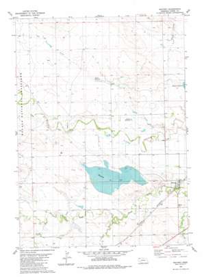
Whitney Topo Map Nebraska
To zoom in, hover over the map of Whitney
USGS Topo Quad 42103g3 - 1:24,000 scale
| Topo Map Name: | Whitney |
| USGS Topo Quad ID: | 42103g3 |
| Print Size: | ca. 21 1/4" wide x 27" high |
| Southeast Coordinates: | 42.75° N latitude / 103.25° W longitude |
| Map Center Coordinates: | 42.8125° N latitude / 103.3125° W longitude |
| U.S. State: | NE |
| Filename: | O42103G3.jpg |
| Download Map JPG Image: | Whitney topo map 1:24,000 scale |
| Map Type: | Topographic |
| Topo Series: | 7.5´ |
| Map Scale: | 1:24,000 |
| Source of Map Images: | United States Geological Survey (USGS) |
| Alternate Map Versions: |
Whitney NE 1980, updated 1981 Download PDF Buy paper map Whitney NE 2011 Download PDF Buy paper map Whitney NE 2014 Download PDF Buy paper map |
| FStopo: | US Forest Service topo Whitney is available: Download FStopo PDF Download FStopo TIF |
1:24,000 Topo Quads surrounding Whitney
> Back to 42103e1 at 1:100,000 scale
> Back to 42102a1 at 1:250,000 scale
> Back to U.S. Topo Maps home
Whitney topo map: Gazetteer
Whitney: Dams
Blust Dam elevation 1067m 3500′Pilster Dam elevation 1056m 3464′
Whitney Dam Number 1 elevation 1061m 3480′
Whitney: Lakes
Whitney Lake elevation 1062m 3484′Whitney: Populated Places
Whitney elevation 1040m 3412′Whitney: Post Offices
Whitney Post Office elevation 1040m 3412′Whitney: Reservoirs
Blust Reservoir elevation 1067m 3500′Pilster Reservoir elevation 1056m 3464′
Pilster Reservoir elevation 1055m 3461′
Stewart Reservoir elevation 1046m 3431′
Whitney Reservoir elevation 1061m 3480′
Whitney: Streams
Dry Creek elevation 1031m 3382′Little Cottonwood Creek elevation 1049m 3441′
Spring Creek elevation 1062m 3484′
Whitney digital topo map on disk
Buy this Whitney topo map showing relief, roads, GPS coordinates and other geographical features, as a high-resolution digital map file on DVD:
Eastern Wyoming & Western South Dakota
Buy digital topo maps: Eastern Wyoming & Western South Dakota


