Bohemian Creek Topo Map Nebraska
To zoom in, hover over the map of Bohemian Creek
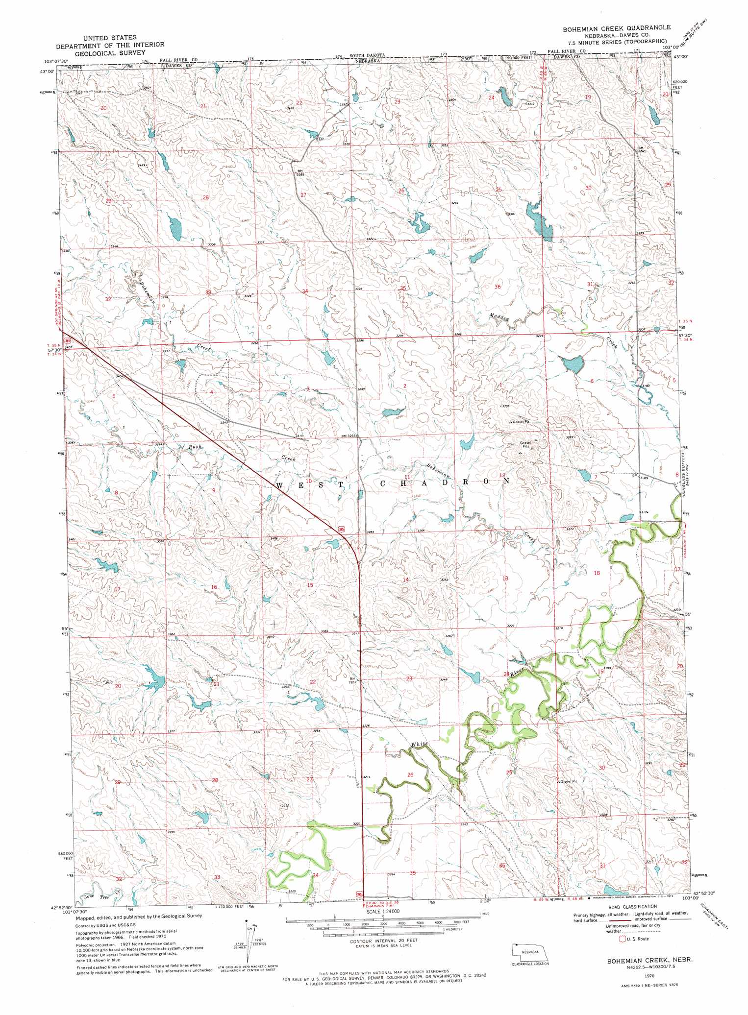
USGS Topo Quad 42103h1 - 1:24,000 scale
| Topo Map Name: | Bohemian Creek |
| USGS Topo Quad ID: | 42103h1 |
| Print Size: | ca. 21 1/4" wide x 27" high |
| Southeast Coordinates: | 42.875° N latitude / 103° W longitude |
| Map Center Coordinates: | 42.9375° N latitude / 103.0625° W longitude |
| U.S. State: | NE |
| Filename: | O42103H1.jpg |
| Download Map JPG Image: | Bohemian Creek topo map 1:24,000 scale |
| Map Type: | Topographic |
| Topo Series: | 7.5´ |
| Map Scale: | 1:24,000 |
| Source of Map Images: | United States Geological Survey (USGS) |
| Alternate Map Versions: |
Bohemian Creek NE 1970, updated 1972 Download PDF Buy paper map Bohemian Creek NE 2011 Download PDF Buy paper map Bohemian Creek NE 2014 Download PDF Buy paper map |
1:24,000 Topo Quads surrounding Bohemian Creek
Lone Well Creek East |
Oelrichs |
Oelrichs Ne |
Slim Butte Nw |
Slim Butte Ne |
Black Banks Creek East |
Oelrichs Sw |
Heinne Creek |
Slim Butte Sw |
Slim Butte |
Lone Tree Ranch |
Wayside |
Bohemian Creek |
Isinglass Buttes |
Chadron Ne |
Whitney |
Trunk Butte |
Chadron West |
Chadron East |
Bordeaux |
Crow Butte |
Chimney Butte |
Coffee Mill Butte |
Chadron 3 Nw |
Chadron 3 Ne |
> Back to 42103e1 at 1:100,000 scale
> Back to 42102a1 at 1:250,000 scale
> Back to U.S. Topo Maps home
Bohemian Creek topo map: Gazetteer
Bohemian Creek: Dams
Bartlet Dam elevation 1005m 3297′Gorr Dam Number 1 elevation 982m 3221′
Gorr Dam Number 2 elevation 997m 3270′
Gorr Dam Number 3 elevation 1005m 3297′
Morris Dam elevation 979m 3211′
Bohemian Creek: Reservoirs
Bartlet Reservoir elevation 1005m 3297′Gorr Reservoir Number 1 elevation 982m 3221′
Gorr Reservoir Number 2 elevation 997m 3270′
Gorr Reservoir Number 3 elevation 1005m 3297′
Morris Reservoir elevation 979m 3211′
Bohemian Creek: Streams
Bohemian Creek elevation 964m 3162′Rush Creek elevation 982m 3221′
Bohemian Creek digital topo map on disk
Buy this Bohemian Creek topo map showing relief, roads, GPS coordinates and other geographical features, as a high-resolution digital map file on DVD:
Eastern Wyoming & Western South Dakota
Buy digital topo maps: Eastern Wyoming & Western South Dakota