Wayside Topo Map Nebraska
To zoom in, hover over the map of Wayside
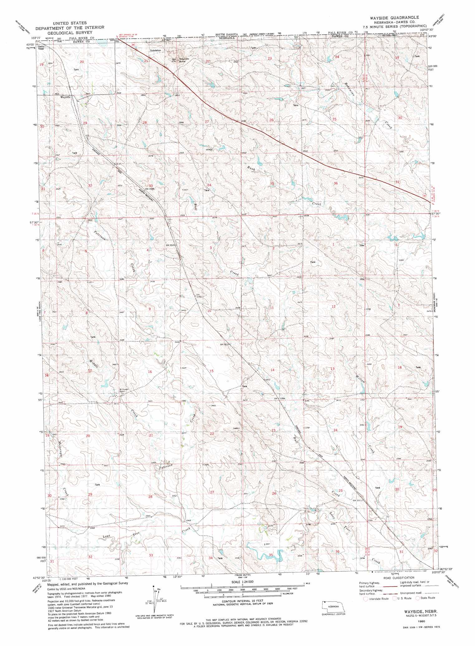
USGS Topo Quad 42103h2 - 1:24,000 scale
| Topo Map Name: | Wayside |
| USGS Topo Quad ID: | 42103h2 |
| Print Size: | ca. 21 1/4" wide x 27" high |
| Southeast Coordinates: | 42.875° N latitude / 103.125° W longitude |
| Map Center Coordinates: | 42.9375° N latitude / 103.1875° W longitude |
| U.S. State: | NE |
| Filename: | O42103H2.jpg |
| Download Map JPG Image: | Wayside topo map 1:24,000 scale |
| Map Type: | Topographic |
| Topo Series: | 7.5´ |
| Map Scale: | 1:24,000 |
| Source of Map Images: | United States Geological Survey (USGS) |
| Alternate Map Versions: |
Wayside NE 1980, updated 1981 Download PDF Buy paper map Wayside NE 2011 Download PDF Buy paper map Wayside NE 2014 Download PDF Buy paper map |
1:24,000 Topo Quads surrounding Wayside
Lone Well Creek West |
Lone Well Creek East |
Oelrichs |
Oelrichs Ne |
Slim Butte Nw |
Black Banks Creek West |
Black Banks Creek East |
Oelrichs Sw |
Heinne Creek |
Slim Butte Sw |
Wolf Butte |
Lone Tree Ranch |
Wayside |
Bohemian Creek |
Isinglass Buttes |
Horn |
Whitney |
Trunk Butte |
Chadron West |
Chadron East |
Crawford |
Crow Butte |
Chimney Butte |
Coffee Mill Butte |
Chadron 3 Nw |
> Back to 42103e1 at 1:100,000 scale
> Back to 42102a1 at 1:250,000 scale
> Back to U.S. Topo Maps home
Wayside topo map: Gazetteer
Wayside: Post Offices
Wayside Post Office (historical) elevation 1112m 3648′Wayside: Streams
Messenger Creek elevation 1025m 3362′Middle Creek elevation 1021m 3349′
Peterson Creek elevation 1016m 3333′
Willow Creek elevation 1003m 3290′
Wayside: Summits
Wayside Butte elevation 1145m 3756′Wayside digital topo map on disk
Buy this Wayside topo map showing relief, roads, GPS coordinates and other geographical features, as a high-resolution digital map file on DVD:
Eastern Wyoming & Western South Dakota
Buy digital topo maps: Eastern Wyoming & Western South Dakota