Story Topo Map Nebraska
To zoom in, hover over the map of Story
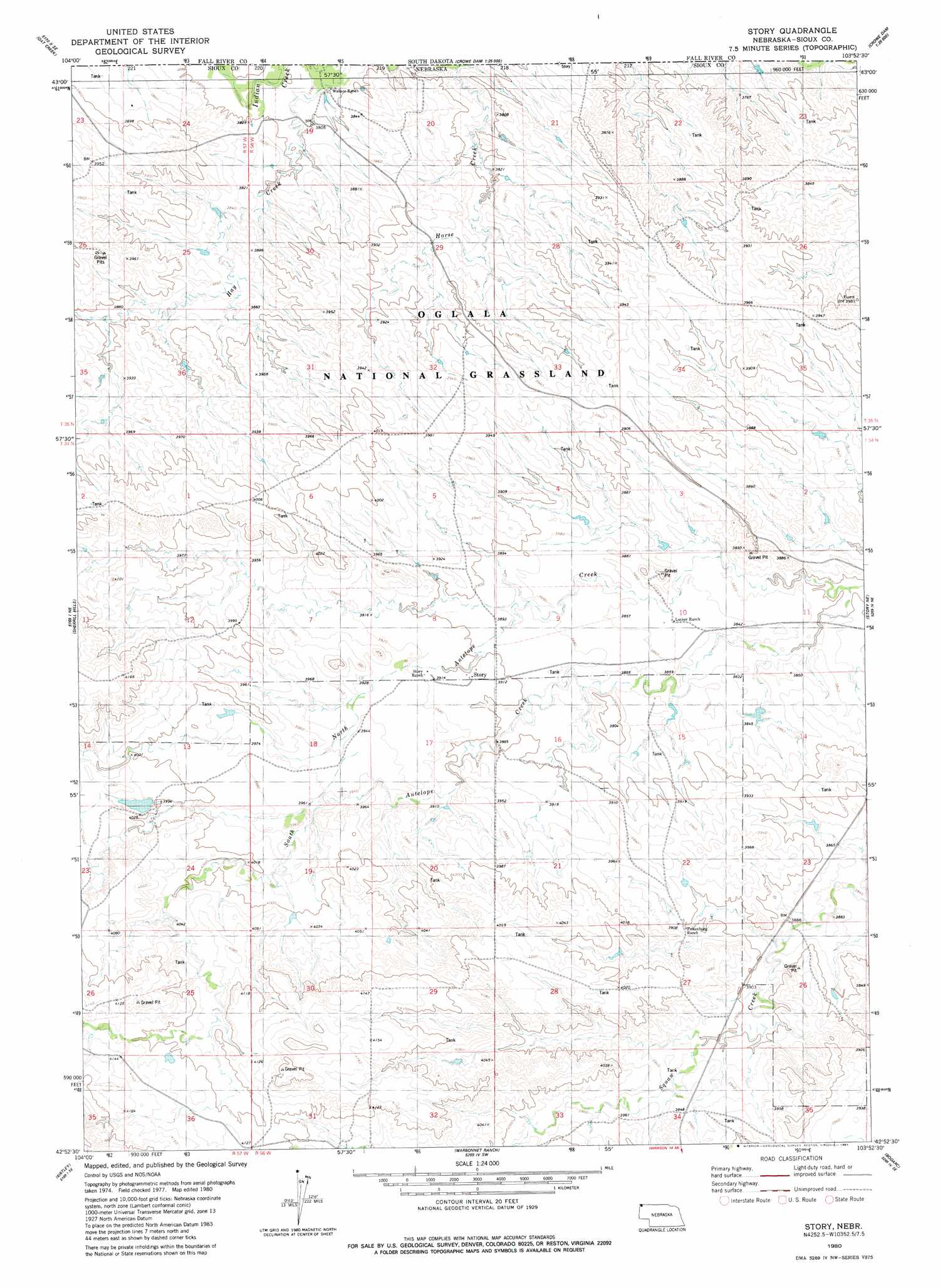
USGS Topo Quad 42103h8 - 1:24,000 scale
| Topo Map Name: | Story |
| USGS Topo Quad ID: | 42103h8 |
| Print Size: | ca. 21 1/4" wide x 27" high |
| Southeast Coordinates: | 42.875° N latitude / 103.875° W longitude |
| Map Center Coordinates: | 42.9375° N latitude / 103.9375° W longitude |
| U.S. State: | NE |
| Filename: | O42103H8.jpg |
| Download Map JPG Image: | Story topo map 1:24,000 scale |
| Map Type: | Topographic |
| Topo Series: | 7.5´ |
| Map Scale: | 1:24,000 |
| Source of Map Images: | United States Geological Survey (USGS) |
| Alternate Map Versions: |
Story NE 1980, updated 1981 Download PDF Buy paper map Story NE 2011 Download PDF Buy paper map Story NE 2014 Download PDF Buy paper map |
| FStopo: | US Forest Service topo Story is available: Download FStopo PDF Download FStopo TIF |
1:24,000 Topo Quads surrounding Story
Oat Creek Nw |
Coffee Flats |
Phister Ranch |
Provo |
Rumford |
South Oat Creek |
Oat Creek |
Wallace Ranch |
Crowe Dam |
Ardmore |
Shepherds Point |
Sherrill Hills |
Story |
Story Ne |
Montrose |
Kirtley Sw |
Kirtley |
Warbonnet Ranch |
Bodarc |
Five Points |
Mcmaster Reservoir |
Van Tassell |
Harrison West |
Harrison East |
Andrews |
> Back to 42103e1 at 1:100,000 scale
> Back to 42102a1 at 1:250,000 scale
> Back to U.S. Topo Maps home
Story topo map: Gazetteer
Story: Dams
Anderson Dam Number 1 elevation 1171m 3841′Hay Creek Wallace Dam elevation 1153m 3782′
Schnurr Dam Number 2 elevation 1224m 4015′
Wallace Dam Number 1 elevation 1176m 3858′
Story: Populated Places
Story elevation 1190m 3904′Story: Post Offices
Story Post Office (historical) elevation 1190m 3904′Story: Reservoirs
Anderson Reservoir elevation 1171m 3841′Hay Creek Wallace Reservoir elevation 1153m 3782′
Schnurr Reservoir Number 2 elevation 1224m 4015′
Wallace Reservoir elevation 1176m 3858′
Story: Streams
North Antelope Creek elevation 1158m 3799′South Antelope Creek elevation 1158m 3799′
Story: Valleys
Gandma Davis Draw elevation 1204m 3950′Grandma Davis Draw elevation 1214m 3982′
Story digital topo map on disk
Buy this Story topo map showing relief, roads, GPS coordinates and other geographical features, as a high-resolution digital map file on DVD:
Eastern Wyoming & Western South Dakota
Buy digital topo maps: Eastern Wyoming & Western South Dakota