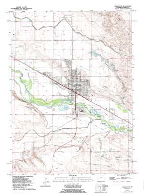
Torrington Topo Map Wyoming
To zoom in, hover over the map of Torrington
USGS Topo Quad 42104a2 - 1:24,000 scale
| Topo Map Name: | Torrington |
| USGS Topo Quad ID: | 42104a2 |
| Print Size: | ca. 21 1/4" wide x 27" high |
| Southeast Coordinates: | 42° N latitude / 104.125° W longitude |
| Map Center Coordinates: | 42.0625° N latitude / 104.1875° W longitude |
| U.S. State: | WY |
| Filename: | o42104a2.jpg |
| Download Map JPG Image: | Torrington topo map 1:24,000 scale |
| Map Type: | Topographic |
| Topo Series: | 7.5´ |
| Map Scale: | 1:24,000 |
| Source of Map Images: | United States Geological Survey (USGS) |
| Alternate Map Versions: |
Torrington WY 1963, updated 1965 Download PDF Buy paper map Torrington WY 1963, updated 1979 Download PDF Buy paper map Torrington WY 1990, updated 1995 Download PDF Buy paper map Torrington WY 2012 Download PDF Buy paper map Torrington WY 2015 Download PDF Buy paper map |
1:24,000 Topo Quads surrounding Torrington
> Back to 42104a1 at 1:100,000 scale
> Back to 42104a1 at 1:250,000 scale
> Back to U.S. Topo Maps home
Torrington topo map: Gazetteer
Torrington: Airports
Community Hospital Heliport elevation 1243m 4078′Torrington Municipal Airport elevation 1280m 4199′
Torrington: Canals
Arnold Drainage Ditch elevation 1261m 4137′Cherry Creek Wasteway elevation 1254m 4114′
North Platte Ditch elevation 1255m 4117′
Torrington: Cliffs
The Narrows elevation 1276m 4186′Torrington: Dams
Arnold Dam elevation 1272m 4173′Torrington: Flats
Jirdon Park elevation 1251m 4104′Pioneer Park elevation 1248m 4094′
Torrington: Populated Places
South Torrington elevation 1244m 4081′Torrington elevation 1251m 4104′
Torrington: Reservoirs
Arnold Reservoir elevation 1272m 4173′Torrington: Streams
Cold Springs Branch elevation 1240m 4068′Torrington digital topo map on disk
Buy this Torrington topo map showing relief, roads, GPS coordinates and other geographical features, as a high-resolution digital map file on DVD:
Eastern Wyoming & Western South Dakota
Buy digital topo maps: Eastern Wyoming & Western South Dakota


