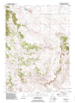
Casebier Hill Topo Map Wyoming
To zoom in, hover over the map of Casebier Hill
USGS Topo Quad 42104c5 - 1:24,000 scale
| Topo Map Name: | Casebier Hill |
| USGS Topo Quad ID: | 42104c5 |
| Print Size: | ca. 21 1/4" wide x 27" high |
| Southeast Coordinates: | 42.25° N latitude / 104.5° W longitude |
| Map Center Coordinates: | 42.3125° N latitude / 104.5625° W longitude |
| U.S. State: | WY |
| Filename: | o42104c5.jpg |
| Download Map JPG Image: | Casebier Hill topo map 1:24,000 scale |
| Map Type: | Topographic |
| Topo Series: | 7.5´ |
| Map Scale: | 1:24,000 |
| Source of Map Images: | United States Geological Survey (USGS) |
| Alternate Map Versions: |
Casebier Hill WY 1950, updated 1952 Download PDF Buy paper map Casebier Hill WY 1950, updated 1952 Download PDF Buy paper map Casebier Hill WY 1990, updated 1995 Download PDF Buy paper map Casebier Hill WY 2012 Download PDF Buy paper map Casebier Hill WY 2015 Download PDF Buy paper map |
1:24,000 Topo Quads surrounding Casebier Hill
> Back to 42104a1 at 1:100,000 scale
> Back to 42104a1 at 1:250,000 scale
> Back to U.S. Topo Maps home
Casebier Hill topo map: Gazetteer
Casebier Hill: Dams
Walsh Dam elevation 1346m 4416′Casebier Hill: Mines
Chicago Prospect elevation 1489m 4885′Haystack Number One Claim elevation 1429m 4688′
Haystack Number Two Claim elevation 1429m 4688′
Minnie Claims elevation 1460m 4790′
Casebier Hill: Reservoirs
Walsh Reservoir elevation 1346m 4416′Casebier Hill: Springs
Woodworth Spring elevation 1409m 4622′Casebier Hill: Summits
Casebier Hill elevation 1543m 5062′Casebier Hill: Valleys
Britain Draw elevation 1350m 4429′Divinie Draw elevation 1369m 4491′
Casebier Hill digital topo map on disk
Buy this Casebier Hill topo map showing relief, roads, GPS coordinates and other geographical features, as a high-resolution digital map file on DVD:
Eastern Wyoming & Western South Dakota
Buy digital topo maps: Eastern Wyoming & Western South Dakota


