Jay Em Nw Topo Map Wyoming
To zoom in, hover over the map of Jay Em Nw
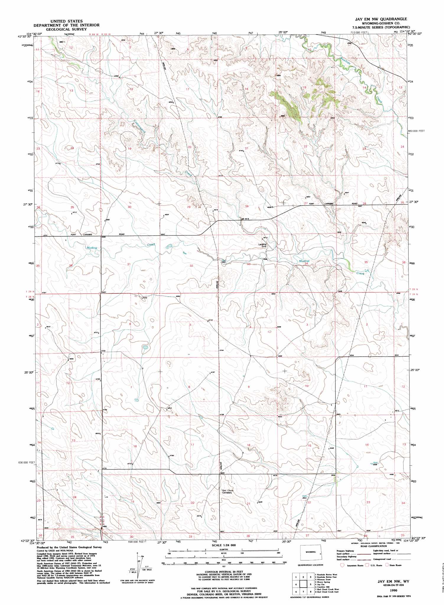
USGS Topo Quad 42104d4 - 1:24,000 scale
| Topo Map Name: | Jay Em Nw |
| USGS Topo Quad ID: | 42104d4 |
| Print Size: | ca. 21 1/4" wide x 27" high |
| Southeast Coordinates: | 42.375° N latitude / 104.375° W longitude |
| Map Center Coordinates: | 42.4375° N latitude / 104.4375° W longitude |
| U.S. State: | WY |
| Filename: | o42104d4.jpg |
| Download Map JPG Image: | Jay Em Nw topo map 1:24,000 scale |
| Map Type: | Topographic |
| Topo Series: | 7.5´ |
| Map Scale: | 1:24,000 |
| Source of Map Images: | United States Geological Survey (USGS) |
| Alternate Map Versions: |
Jay Em NW WY 1974, updated 1978 Download PDF Buy paper map Jay Em NW WY 1974, updated 1993 Download PDF Buy paper map Jay Em NW WY 1990, updated 1995 Download PDF Buy paper map Jay Em NW WY 2012 Download PDF Buy paper map Jay Em NW WY 2015 Download PDF Buy paper map |
1:24,000 Topo Quads surrounding Jay Em Nw
Lone Tree Hill |
Silver Springs |
Reynolds Spring |
Node |
Mcmaster Reservoir |
Meadowdale |
Rawhide Butte West |
Rawhide Buttes East |
Hileman Draw |
Prairie Center |
Hell Gap |
Moore Spring |
Jay Em Nw |
Jay Em |
Spoon Butte Nw |
Guernsey |
Casebier Hill |
Red Cloud Creek West |
Red Cloud Creek East |
Spoon Butte Sw |
Register Cliff |
Fort Laramie |
Barnes |
Lingle |
Teakettle Rock |
> Back to 42104a1 at 1:100,000 scale
> Back to 42104a1 at 1:250,000 scale
> Back to U.S. Topo Maps home
Jay Em Nw topo map: Gazetteer
Jay Em Nw: Dams
John B Carl Dam elevation 1379m 4524′Jay Em Nw: Reservoirs
John B Carl Reservoir elevation 1379m 4524′Jay Em Nw digital topo map on disk
Buy this Jay Em Nw topo map showing relief, roads, GPS coordinates and other geographical features, as a high-resolution digital map file on DVD:
Eastern Wyoming & Western South Dakota
Buy digital topo maps: Eastern Wyoming & Western South Dakota