Haushar Ranch Topo Map Wyoming
To zoom in, hover over the map of Haushar Ranch
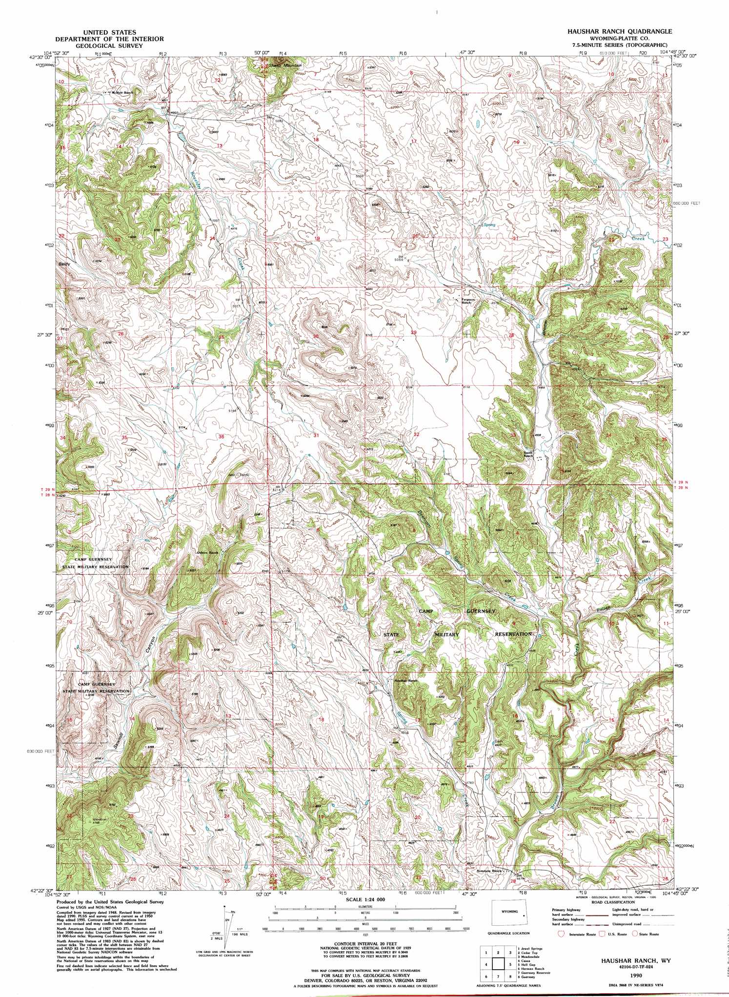
USGS Topo Quad 42104d7 - 1:24,000 scale
| Topo Map Name: | Haushar Ranch |
| USGS Topo Quad ID: | 42104d7 |
| Print Size: | ca. 21 1/4" wide x 27" high |
| Southeast Coordinates: | 42.375° N latitude / 104.75° W longitude |
| Map Center Coordinates: | 42.4375° N latitude / 104.8125° W longitude |
| U.S. State: | WY |
| Filename: | o42104d7.jpg |
| Download Map JPG Image: | Haushar Ranch topo map 1:24,000 scale |
| Map Type: | Topographic |
| Topo Series: | 7.5´ |
| Map Scale: | 1:24,000 |
| Source of Map Images: | United States Geological Survey (USGS) |
| Alternate Map Versions: |
Haushar Ranch WY 1950, updated 1976 Download PDF Buy paper map Haushar Ranch WY 1950, updated 1980 Download PDF Buy paper map Haushar Ranch WY 1951 Download PDF Buy paper map Haushar Ranch WY 1990, updated 1995 Download PDF Buy paper map Haushar Ranch WY 2012 Download PDF Buy paper map Haushar Ranch WY 2015 Download PDF Buy paper map |
1:24,000 Topo Quads surrounding Haushar Ranch
Shawnee |
Amend Ranch |
Prairie View School |
Lone Tree Hill |
Silver Springs |
Glendo |
Jewel Springs |
Cedar Top |
Meadowdale |
Rawhide Butte West |
Sibley Peak |
Cassa |
Haushar Ranch |
Hell Gap |
Moore Spring |
Coleman Butte |
Herman Ranch |
Guernsey Reservoir |
Guernsey |
Casebier Hill |
Lewis Flat |
Dwyer |
Wheatland Ne |
Register Cliff |
Fort Laramie |
> Back to 42104a1 at 1:100,000 scale
> Back to 42104a1 at 1:250,000 scale
> Back to U.S. Topo Maps home
Haushar Ranch topo map: Gazetteer
Haushar Ranch: Streams
Dearcorn Draw elevation 1476m 4842′Patten Creek elevation 1476m 4842′
Haushar Ranch digital topo map on disk
Buy this Haushar Ranch topo map showing relief, roads, GPS coordinates and other geographical features, as a high-resolution digital map file on DVD:
Eastern Wyoming & Western South Dakota
Buy digital topo maps: Eastern Wyoming & Western South Dakota