Rawhide Buttes East Topo Map Wyoming
To zoom in, hover over the map of Rawhide Buttes East
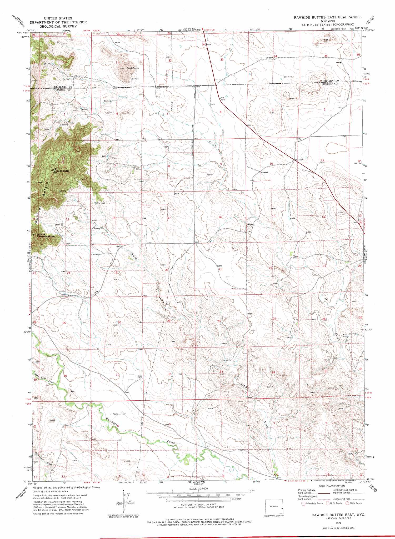
USGS Topo Quad 42104e4 - 1:24,000 scale
| Topo Map Name: | Rawhide Buttes East |
| USGS Topo Quad ID: | 42104e4 |
| Print Size: | ca. 21 1/4" wide x 27" high |
| Southeast Coordinates: | 42.5° N latitude / 104.375° W longitude |
| Map Center Coordinates: | 42.5625° N latitude / 104.4375° W longitude |
| U.S. State: | WY |
| Filename: | o42104e4.jpg |
| Download Map JPG Image: | Rawhide Buttes East topo map 1:24,000 scale |
| Map Type: | Topographic |
| Topo Series: | 7.5´ |
| Map Scale: | 1:24,000 |
| Source of Map Images: | United States Geological Survey (USGS) |
| Alternate Map Versions: |
Rawhide Buttes East WY 1974, updated 1978 Download PDF Buy paper map Rawhide Buttes East WY 2012 Download PDF Buy paper map Rawhide Buttes East WY 2015 Download PDF Buy paper map |
1:24,000 Topo Quads surrounding Rawhide Buttes East
Bills Creek |
Manville |
Lusk |
Signature Rock |
Kirtley Sw |
Lone Tree Hill |
Silver Springs |
Reynolds Spring |
Node |
Mcmaster Reservoir |
Meadowdale |
Rawhide Butte West |
Rawhide Buttes East |
Hileman Draw |
Prairie Center |
Hell Gap |
Moore Spring |
Jay Em Nw |
Jay Em |
Spoon Butte Nw |
Guernsey |
Casebier Hill |
Red Cloud Creek West |
Red Cloud Creek East |
Spoon Butte Sw |
> Back to 42104e1 at 1:100,000 scale
> Back to 42104a1 at 1:250,000 scale
> Back to U.S. Topo Maps home
Rawhide Buttes East topo map: Gazetteer
Rawhide Buttes East: Ranges
Rawhide Buttes elevation 1600m 5249′Rawhide Buttes East: Springs
Wolf Spring elevation 1576m 5170′Rawhide Buttes East: Streams
Negro Baby Creek elevation 1487m 4878′Rawhide Buttes East: Summits
Bald Butte elevation 1651m 5416′Big Rawhide Butte elevation 1845m 6053′
Middle Rawhide Butte elevation 1727m 5666′
Rawhide Buttes East: Valleys
Sand Draw elevation 1437m 4714′Rawhide Buttes East digital topo map on disk
Buy this Rawhide Buttes East topo map showing relief, roads, GPS coordinates and other geographical features, as a high-resolution digital map file on DVD:
Eastern Wyoming & Western South Dakota
Buy digital topo maps: Eastern Wyoming & Western South Dakota