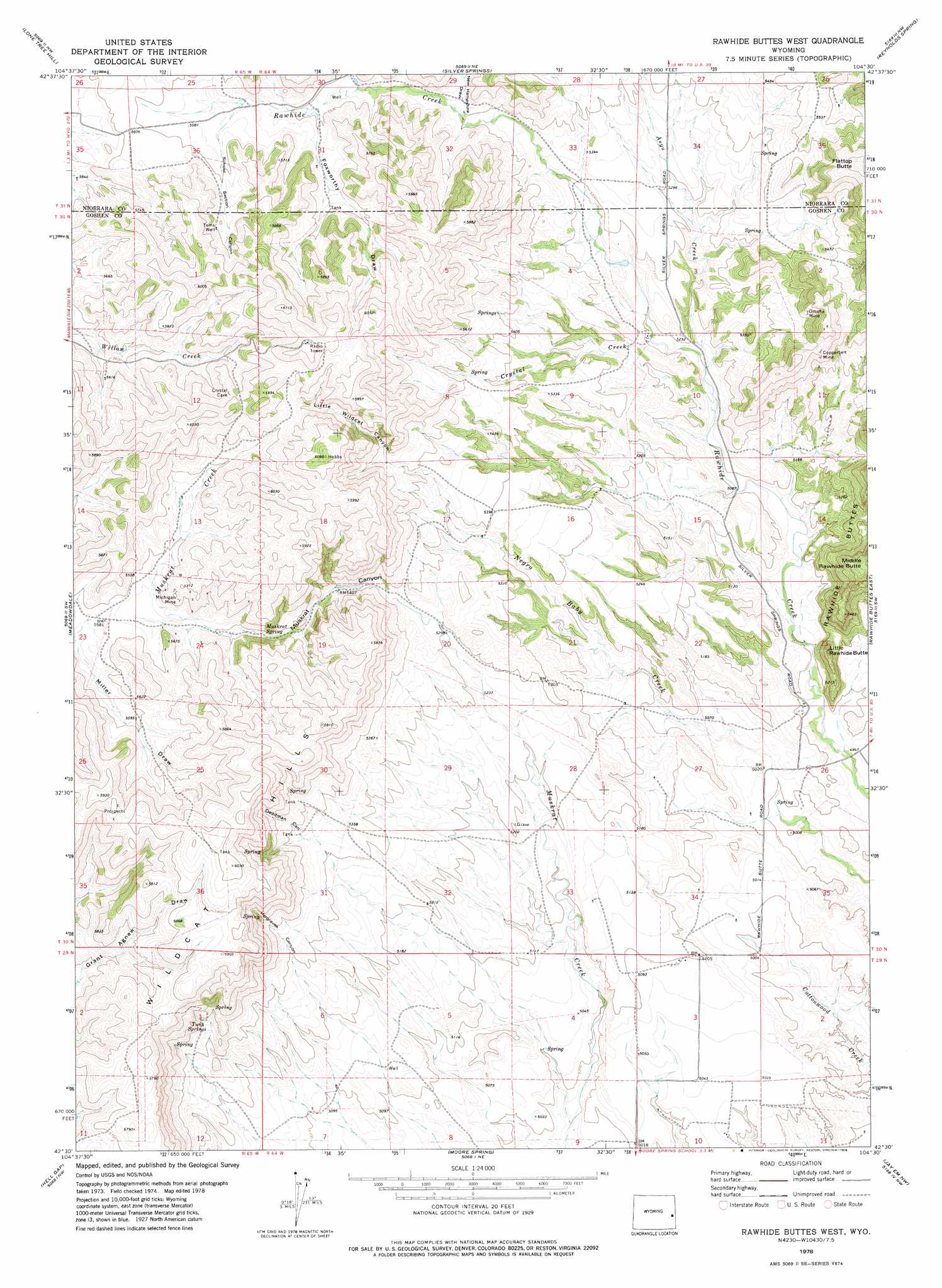
Rawhide Butte West Topo Map Wyoming
To zoom in, hover over the map of Rawhide Butte West
USGS Topo Quad 42104e5 - 1:24,000 scale
| Topo Map Name: | Rawhide Butte West |
| USGS Topo Quad ID: | 42104e5 |
| Print Size: | ca. 21 1/4" wide x 27" high |
| Southeast Coordinates: | 42.5° N latitude / 104.5° W longitude |
| Map Center Coordinates: | 42.5625° N latitude / 104.5625° W longitude |
| U.S. State: | WY |
| Filename: | o42104e5.jpg |
| Download Map JPG Image: | Rawhide Butte West topo map 1:24,000 scale |
| Map Type: | Topographic |
| Topo Series: | 7.5´ |
| Map Scale: | 1:24,000 |
| Source of Map Images: | United States Geological Survey (USGS) |
| Alternate Map Versions: |
Rawhide Buttes West WY 1978, updated 1978 Download PDF Buy paper map Rawhide Buttes West WY 2012 Download PDF Buy paper map Rawhide Buttes West WY 2015 Download PDF Buy paper map |
1:24,000 Topo Quads surrounding Rawhide Butte West
Keeline |
Bills Creek |
Manville |
Lusk |
Signature Rock |
Prairie View School |
Lone Tree Hill |
Silver Springs |
Reynolds Spring |
Node |
Cedar Top |
Meadowdale |
Rawhide Butte West |
Rawhide Buttes East |
Hileman Draw |
Haushar Ranch |
Hell Gap |
Moore Spring |
Jay Em Nw |
Jay Em |
Guernsey Reservoir |
Guernsey |
Casebier Hill |
Red Cloud Creek West |
Red Cloud Creek East |
> Back to 42104e1 at 1:100,000 scale
> Back to 42104a1 at 1:250,000 scale
> Back to U.S. Topo Maps home
Rawhide Butte West topo map: Gazetteer
Rawhide Butte West: Mines
Copperbelt Mine elevation 1687m 5534′Michigan Mine elevation 1725m 5659′
Omaha Mine elevation 1662m 5452′
Rawhide Butte West: Springs
Muskrat Spring elevation 1667m 5469′Twin Springs elevation 1626m 5334′
Rawhide Butte West: Streams
Aego Creek elevation 1571m 5154′Crystal Creek elevation 1561m 5121′
Rawhide Butte West: Summits
Flattop Butte elevation 1788m 5866′Little Rawhide Butte elevation 1597m 5239′
Rawhide Butte West: Valleys
Deadman Canyon elevation 1636m 5367′Foxworthy Draw elevation 1677m 5501′
Hargraves Canyon elevation 1610m 5282′
Lamb Draw elevation 1668m 5472′
Little Wildcat Canyon elevation 1687m 5534′
Muskrat Canyon elevation 1630m 5347′
School Section Canyon elevation 1696m 5564′
Rawhide Butte West: Wells
Toms Well elevation 1738m 5702′Rawhide Butte West digital topo map on disk
Buy this Rawhide Butte West topo map showing relief, roads, GPS coordinates and other geographical features, as a high-resolution digital map file on DVD:
Eastern Wyoming & Western South Dakota
Buy digital topo maps: Eastern Wyoming & Western South Dakota