Cooley Draw Topo Map Wyoming
To zoom in, hover over the map of Cooley Draw
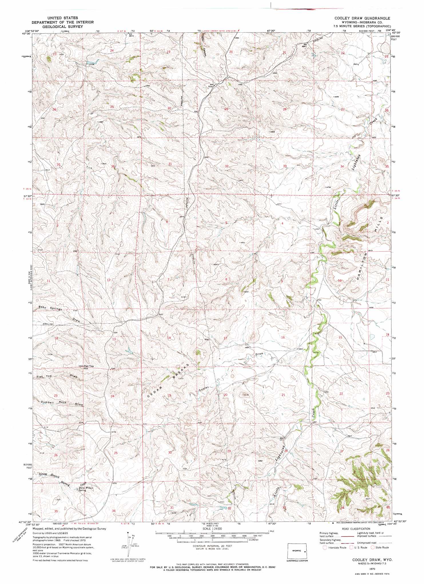
USGS Topo Quad 42104h7 - 1:24,000 scale
| Topo Map Name: | Cooley Draw |
| USGS Topo Quad ID: | 42104h7 |
| Print Size: | ca. 21 1/4" wide x 27" high |
| Southeast Coordinates: | 42.875° N latitude / 104.75° W longitude |
| Map Center Coordinates: | 42.9375° N latitude / 104.8125° W longitude |
| U.S. State: | WY |
| Filename: | o42104h7.jpg |
| Download Map JPG Image: | Cooley Draw topo map 1:24,000 scale |
| Map Type: | Topographic |
| Topo Series: | 7.5´ |
| Map Scale: | 1:24,000 |
| Source of Map Images: | United States Geological Survey (USGS) |
| Alternate Map Versions: |
Cooley Draw WY 1970, updated 1973 Download PDF Buy paper map Cooley Draw WY 2012 Download PDF Buy paper map Cooley Draw WY 2015 Download PDF Buy paper map |
1:24,000 Topo Quads surrounding Cooley Draw
Bill 4 Ne |
Split Hill |
Mercer Draw |
Lance Creek Nw |
Funny Rock |
Bill 4 Se |
Split Hill Sw |
Mikes Draw |
Lance Creek |
Rabbit Mountains |
Walker Creek School |
Lost Springs Nw |
Cooley Draw |
Flat Top |
Manville Ne |
The Park |
Lost Springs |
Keeline |
Bills Creek |
Manville |
Shawnee |
Amend Ranch |
Prairie View School |
Lone Tree Hill |
Silver Springs |
> Back to 42104e1 at 1:100,000 scale
> Back to 42104a1 at 1:250,000 scale
> Back to U.S. Topo Maps home
Cooley Draw topo map: Gazetteer
Cooley Draw: Mines
McCullaugh Mine elevation 1613m 5291′Cooley Draw: Ranges
Hamilton Hills elevation 1498m 4914′Cooley Draw: Ridges
Cedar Breaks elevation 1572m 5157′Cooley Draw: Springs
Three Willow Spring elevation 1568m 5144′Cooley Draw: Summits
Flat Top Hill elevation 1614m 5295′Cooley Draw: Valleys
Cooley Draw elevation 1470m 4822′Cooley Draw digital topo map on disk
Buy this Cooley Draw topo map showing relief, roads, GPS coordinates and other geographical features, as a high-resolution digital map file on DVD:
Eastern Wyoming & Western South Dakota
Buy digital topo maps: Eastern Wyoming & Western South Dakota