Lost Springs Nw Topo Map Wyoming
To zoom in, hover over the map of Lost Springs Nw
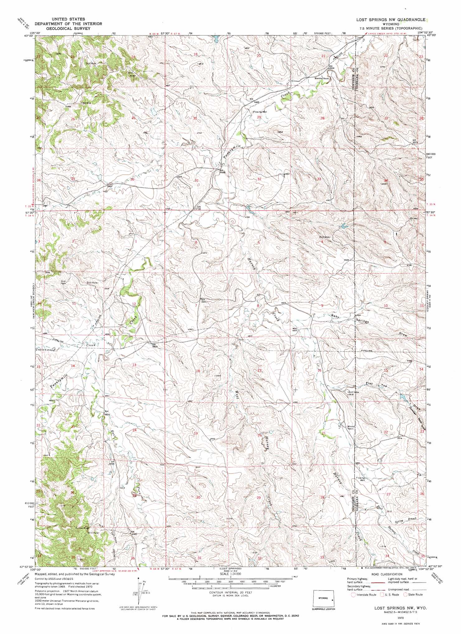
USGS Topo Quad 42104h8 - 1:24,000 scale
| Topo Map Name: | Lost Springs Nw |
| USGS Topo Quad ID: | 42104h8 |
| Print Size: | ca. 21 1/4" wide x 27" high |
| Southeast Coordinates: | 42.875° N latitude / 104.875° W longitude |
| Map Center Coordinates: | 42.9375° N latitude / 104.9375° W longitude |
| U.S. State: | WY |
| Filename: | o42104h8.jpg |
| Download Map JPG Image: | Lost Springs Nw topo map 1:24,000 scale |
| Map Type: | Topographic |
| Topo Series: | 7.5´ |
| Map Scale: | 1:24,000 |
| Source of Map Images: | United States Geological Survey (USGS) |
| Alternate Map Versions: |
Lost Springs NW WY 1970, updated 1973 Download PDF Buy paper map Lost Springs NW WY 2012 Download PDF Buy paper map Lost Springs NW WY 2015 Download PDF Buy paper map |
1:24,000 Topo Quads surrounding Lost Springs Nw
Bill 4 Nw |
Bill 4 Ne |
Split Hill |
Mercer Draw |
Lance Creek Nw |
Bill 4 Sw |
Bill 4 Se |
Split Hill Sw |
Mikes Draw |
Lance Creek |
Simpson Draw Nw |
Walker Creek School |
Lost Springs Nw |
Cooley Draw |
Flat Top |
Simpson Draw |
The Park |
Lost Springs |
Keeline |
Bills Creek |
Orin |
Shawnee |
Amend Ranch |
Prairie View School |
Lone Tree Hill |
> Back to 42104e1 at 1:100,000 scale
> Back to 42104a1 at 1:250,000 scale
> Back to U.S. Topo Maps home
Lost Springs Nw topo map: Gazetteer
Lost Springs Nw: Mines
Harney Creek Mine elevation 1515m 4970′Sunset Mine elevation 1527m 5009′
Lost Springs Nw: Streams
Cottonwood Creek elevation 1464m 4803′East Fork Twentymile Creek elevation 1469m 4819′
East Harney Creek elevation 1519m 4983′
Harney Creek elevation 1434m 4704′
Spring Branch Harney Creek elevation 1528m 5013′
West Harney Creek elevation 1458m 4783′
Lost Springs Nw: Valleys
Baby Springs Draw elevation 1473m 4832′Dumbell Rock Draw elevation 1518m 4980′
Flat Top Draw elevation 1486m 4875′
Lost Springs Nw digital topo map on disk
Buy this Lost Springs Nw topo map showing relief, roads, GPS coordinates and other geographical features, as a high-resolution digital map file on DVD:
Eastern Wyoming & Western South Dakota
Buy digital topo maps: Eastern Wyoming & Western South Dakota