Hightower Topo Map Wyoming
To zoom in, hover over the map of Hightower
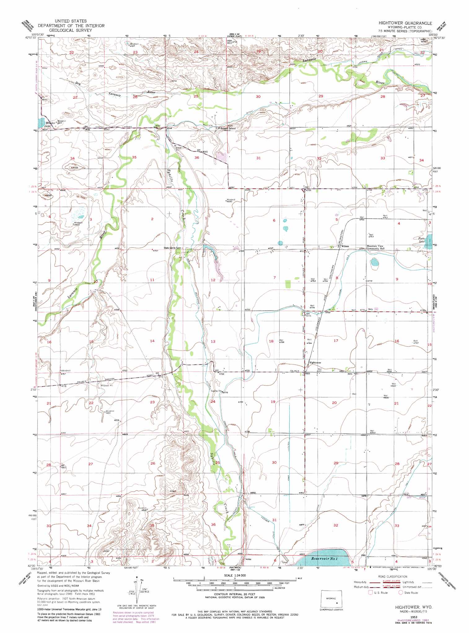
USGS Topo Quad 42105a1 - 1:24,000 scale
| Topo Map Name: | Hightower |
| USGS Topo Quad ID: | 42105a1 |
| Print Size: | ca. 21 1/4" wide x 27" high |
| Southeast Coordinates: | 42° N latitude / 105° W longitude |
| Map Center Coordinates: | 42.0625° N latitude / 105.0625° W longitude |
| U.S. State: | WY |
| Filename: | o42105a1.jpg |
| Download Map JPG Image: | Hightower topo map 1:24,000 scale |
| Map Type: | Topographic |
| Topo Series: | 7.5´ |
| Map Scale: | 1:24,000 |
| Source of Map Images: | United States Geological Survey (USGS) |
| Alternate Map Versions: |
Hightower WY 1953, updated 1954 Download PDF Buy paper map Hightower WY 1953, updated 1982 Download PDF Buy paper map Hightower WY 2012 Download PDF Buy paper map Hightower WY 2015 Download PDF Buy paper map |
1:24,000 Topo Quads surrounding Hightower
Harris Park |
Cottonwood Falls |
Coleman Butte |
Herman Ranch |
Guernsey Reservoir |
Fletcher Park |
Johnson Mountain |
Lewis Flat |
Dwyer |
Wheatland Ne |
Reese Mountain |
Hightower Sw |
Hightower |
Wheatland |
Antelope Gap |
Moonshine Peak |
Squaw Rock |
Natwick |
Ferguson Corner |
Bordeaux |
Poe Mountain |
Natwick Sw |
Richeau Hills |
Double L Ranch |
Chugwater |
> Back to 42105a1 at 1:100,000 scale
> Back to 42104a1 at 1:250,000 scale
> Back to U.S. Topo Maps home
Hightower topo map: Gazetteer
Hightower: Canals
Feeder Ditch Number 2 elevation 1487m 4878′Iowa Lateral elevation 1479m 4852′
Mullen Ditch elevation 1399m 4589′
Old Muleshoe Drain Ditch elevation 1430m 4691′
Hightower: Dams
O Bar O Number 3 Dam elevation 1434m 4704′Utter Dam elevation 1440m 4724′
Hightower: Populated Places
Westview Circle elevation 1443m 4734′Hightower: Reservoirs
O Bar O Number 3 Reservoir elevation 1434m 4704′Reservoir Number 1 elevation 1506m 4940′
Utter Reservoir elevation 1440m 4724′
Hightower: Streams
Dry Laramie River elevation 1397m 4583′Sybille Creek elevation 1400m 4593′
Hightower digital topo map on disk
Buy this Hightower topo map showing relief, roads, GPS coordinates and other geographical features, as a high-resolution digital map file on DVD:
Eastern Wyoming & Western South Dakota
Buy digital topo maps: Eastern Wyoming & Western South Dakota