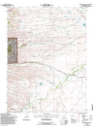
Hightower Sw Topo Map Wyoming
To zoom in, hover over the map of Hightower Sw
USGS Topo Quad 42105a2 - 1:24,000 scale
| Topo Map Name: | Hightower Sw |
| USGS Topo Quad ID: | 42105a2 |
| Print Size: | ca. 21 1/4" wide x 27" high |
| Southeast Coordinates: | 42° N latitude / 105.125° W longitude |
| Map Center Coordinates: | 42.0625° N latitude / 105.1875° W longitude |
| U.S. State: | WY |
| Filename: | o42105a2.jpg |
| Download Map JPG Image: | Hightower Sw topo map 1:24,000 scale |
| Map Type: | Topographic |
| Topo Series: | 7.5´ |
| Map Scale: | 1:24,000 |
| Source of Map Images: | United States Geological Survey (USGS) |
| Alternate Map Versions: |
Hightower SW WY 1953, updated 1954 Download PDF Buy paper map Hightower SW WY 1953, updated 1972 Download PDF Buy paper map Hightower SW WY 1953, updated 1979 Download PDF Buy paper map Hightower SW WY 1953, updated 1982 Download PDF Buy paper map Hightower SW WY 1953, updated 1985 Download PDF Buy paper map Hightower SW WY 1992, updated 1996 Download PDF Buy paper map Hightower SW WY 2012 Download PDF Buy paper map Hightower SW WY 2015 Download PDF Buy paper map |
| FStopo: | US Forest Service topo Hightower SW is available: Download FStopo PDF Download FStopo TIF |
1:24,000 Topo Quads surrounding Hightower Sw
> Back to 42105a1 at 1:100,000 scale
> Back to 42104a1 at 1:250,000 scale
> Back to U.S. Topo Maps home
Hightower Sw topo map: Gazetteer
Hightower Sw: Canals
Cramer Ditch elevation 1502m 4927′Mertz Ditch elevation 1486m 4875′
Pine Ditch elevation 1464m 4803′
Hightower Sw: Dams
Bohnke Dam elevation 1561m 5121′J N Mertz Dam elevation 1485m 4872′
Mertz Number 2 Dam elevation 1477m 4845′
Naffziger Dam elevation 1464m 4803′
Hightower Sw: Lakes
Wheeler Lake elevation 1419m 4655′Hightower Sw: Mines
Lucky Gus Prospect elevation 1646m 5400′May Number One Quarry elevation 1583m 5193′
Hightower Sw: Reservoirs
Attebury Reservoir elevation 1429m 4688′Bohke Reservoir elevation 1561m 5121′
J N Metz Reservoir elevation 1485m 4872′
Mertz Reservoir elevation 1485m 4872′
Mertz Reservoir Number 2 elevation 1477m 4845′
Naffziger Reservoir elevation 1464m 4803′
Reservoir Number 1 elevation 1450m 4757′
Hightower Sw: Streams
Collins Cutoff Creek elevation 1425m 4675′Dugout Creek elevation 1491m 4891′
Hobbs Creek elevation 1511m 4957′
Luman Creek elevation 1446m 4744′
Marble Quarry Creek elevation 1446m 4744′
Paradise Creek elevation 1489m 4885′
Rabbit Creek elevation 1472m 4829′
Slate Creek elevation 1484m 4868′
Wagonhound Creek elevation 1418m 4652′
Hightower Sw: Valleys
Palmer Canyon elevation 1491m 4891′Shapley Draw elevation 1474m 4835′
Hightower Sw digital topo map on disk
Buy this Hightower Sw topo map showing relief, roads, GPS coordinates and other geographical features, as a high-resolution digital map file on DVD:
Eastern Wyoming & Western South Dakota
Buy digital topo maps: Eastern Wyoming & Western South Dakota


