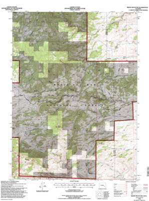
Reese Mountain Topo Map Wyoming
To zoom in, hover over the map of Reese Mountain
USGS Topo Quad 42105a3 - 1:24,000 scale
| Topo Map Name: | Reese Mountain |
| USGS Topo Quad ID: | 42105a3 |
| Print Size: | ca. 21 1/4" wide x 27" high |
| Southeast Coordinates: | 42° N latitude / 105.25° W longitude |
| Map Center Coordinates: | 42.0625° N latitude / 105.3125° W longitude |
| U.S. State: | WY |
| Filename: | o42105a3.jpg |
| Download Map JPG Image: | Reese Mountain topo map 1:24,000 scale |
| Map Type: | Topographic |
| Topo Series: | 7.5´ |
| Map Scale: | 1:24,000 |
| Source of Map Images: | United States Geological Survey (USGS) |
| Alternate Map Versions: |
Reese Mountain WY 1968, updated 1972 Download PDF Buy paper map Reese Mountain WY 1968, updated 1985 Download PDF Buy paper map Reese Mountain WY 1992, updated 1996 Download PDF Buy paper map Reese Mountain WY 1992, updated 1996 Download PDF Buy paper map Reese Mountain WY 2012 Download PDF Buy paper map Reese Mountain WY 2015 Download PDF Buy paper map |
| FStopo: | US Forest Service topo Reese Mountain is available: Download FStopo PDF Download FStopo TIF |
1:24,000 Topo Quads surrounding Reese Mountain
> Back to 42105a1 at 1:100,000 scale
> Back to 42104a1 at 1:250,000 scale
> Back to U.S. Topo Maps home
Reese Mountain topo map: Gazetteer
Reese Mountain: Mines
Grizzly Creek Prospect elevation 1893m 6210′Long Jack Claim elevation 1852m 6076′
May Deposit elevation 1965m 6446′
Palmer Canyon Mine elevation 1969m 6459′
Roff Deposit elevation 1753m 5751′
Reese Mountain: Springs
Government Spring elevation 1842m 6043′Reese Mountain: Streams
Bear Track Creek elevation 1660m 5446′Cherry Creek elevation 1654m 5426′
Collins Creek elevation 1743m 5718′
Grizzly Creek elevation 1654m 5426′
Lefthand Luman Creek elevation 1812m 5944′
North Fork Luman Creek elevation 2097m 6879′
Sheep Camp Creek elevation 1556m 5104′
Trail Creek elevation 1749m 5738′
Reese Mountain: Summits
Bills Mountain elevation 1981m 6499′Collins Peak elevation 2371m 7778′
Green Mountain elevation 2350m 7709′
Menter Hill elevation 1989m 6525′
Resse Mountain elevation 2477m 8126′
Three Sisters elevation 2200m 7217′
Reese Mountain: Valleys
Bear Canyon elevation 1978m 6489′Mart Miller Draw elevation 1887m 6190′
Paradise Canyon elevation 1868m 6128′
Ringrose Draw elevation 1900m 6233′
Stovepipe Canyon elevation 2009m 6591′
Tall Timber Draw elevation 1733m 5685′
Willow Draw elevation 1675m 5495′
Reese Mountain digital topo map on disk
Buy this Reese Mountain topo map showing relief, roads, GPS coordinates and other geographical features, as a high-resolution digital map file on DVD:
Eastern Wyoming & Western South Dakota
Buy digital topo maps: Eastern Wyoming & Western South Dakota


