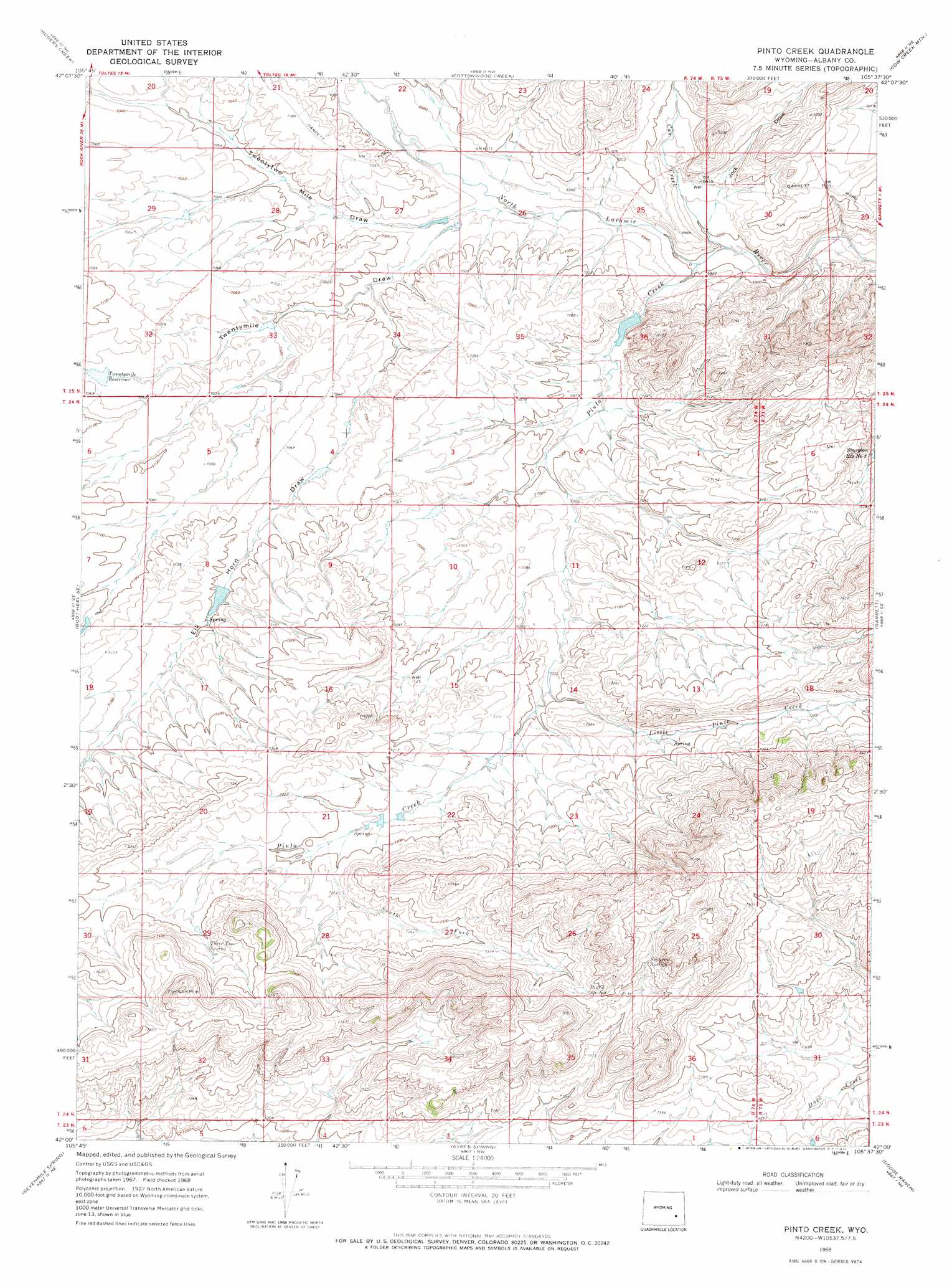
Pinto Creek Topo Map Wyoming
To zoom in, hover over the map of Pinto Creek
USGS Topo Quad 42105a6 - 1:24,000 scale
| Topo Map Name: | Pinto Creek |
| USGS Topo Quad ID: | 42105a6 |
| Print Size: | ca. 21 1/4" wide x 27" high |
| Southeast Coordinates: | 42° N latitude / 105.625° W longitude |
| Map Center Coordinates: | 42.0625° N latitude / 105.6875° W longitude |
| U.S. State: | WY |
| Filename: | o42105a6.jpg |
| Download Map JPG Image: | Pinto Creek topo map 1:24,000 scale |
| Map Type: | Topographic |
| Topo Series: | 7.5´ |
| Map Scale: | 1:24,000 |
| Source of Map Images: | United States Geological Survey (USGS) |
| Alternate Map Versions: |
Pinto Creek WY 1968, updated 1972 Download PDF Buy paper map Pinto Creek WY 2012 Download PDF Buy paper map Pinto Creek WY 2015 Download PDF Buy paper map |
1:24,000 Topo Quads surrounding Pinto Creek
Pass Creek |
Marshall |
Toltec |
Windy Peak |
Laramie Peak |
Boot Heel |
Rogers Creek |
Cottonwood Creek |
Cow Creek Mountain |
South Mountain |
Greasewood Knoll |
Boot Heel Se |
Pinto Creek |
Garrett |
Davidson Flats |
Pine Tree Ridge |
Sevenmile Spring |
Ayres Spring |
Dodge Ranch |
Bull Camp Peak |
Wilcox |
Cannonball Cut |
Mcgill Lakes |
Bluegrass Wells |
Guide Rock |
> Back to 42105a1 at 1:100,000 scale
> Back to 42104a1 at 1:250,000 scale
> Back to U.S. Topo Maps home
Pinto Creek topo map: Gazetteer
Pinto Creek: Dams
Pinto Dam elevation 2131m 6991′Twenty Mile Number 1 Dam elevation 2141m 7024′
Pinto Creek: Reservoirs
Pinto Reservoir elevation 2131m 6991′Sturgeon Reservoir Number 3 elevation 2164m 7099′
Twenty Mile Number 1 Reservoir elevation 2141m 7024′
Twentymile Reservoir elevation 2151m 7057′
Pinto Creek: Springs
Pinto Spring elevation 2274m 7460′Solomon Springs elevation 2286m 7500′
Three Tree Spring elevation 2232m 7322′
Pinto Creek: Streams
Cow Creek elevation 2099m 6886′Little Pinto Creek elevation 2161m 7089′
Pinto Creek elevation 2100m 6889′
South Fork Pinto Creek elevation 2190m 7185′
Pinto Creek: Valleys
Elk Horn Draw elevation 2131m 6991′Jock Draw elevation 2111m 6925′
Twentymile Draw elevation 2123m 6965′
Twentytwo Mile Draw elevation 2120m 6955′
Pinto Creek digital topo map on disk
Buy this Pinto Creek topo map showing relief, roads, GPS coordinates and other geographical features, as a high-resolution digital map file on DVD:
Eastern Wyoming & Western South Dakota
Buy digital topo maps: Eastern Wyoming & Western South Dakota