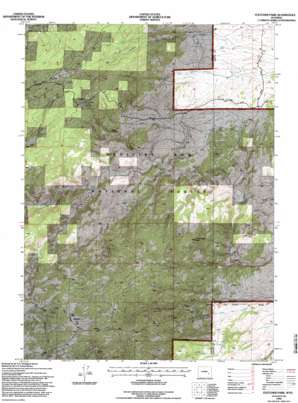
Fletcher Park Topo Map Wyoming
To zoom in, hover over the map of Fletcher Park
USGS Topo Quad 42105b3 - 1:24,000 scale
| Topo Map Name: | Fletcher Park |
| USGS Topo Quad ID: | 42105b3 |
| Print Size: | ca. 21 1/4" wide x 27" high |
| Southeast Coordinates: | 42.125° N latitude / 105.25° W longitude |
| Map Center Coordinates: | 42.1875° N latitude / 105.3125° W longitude |
| U.S. State: | WY |
| Filename: | o42105b3.jpg |
| Download Map JPG Image: | Fletcher Park topo map 1:24,000 scale |
| Map Type: | Topographic |
| Topo Series: | 7.5´ |
| Map Scale: | 1:24,000 |
| Source of Map Images: | United States Geological Survey (USGS) |
| Alternate Map Versions: |
Fletcher Park WY 1968, updated 1972 Download PDF Buy paper map Fletcher Park WY 1968, updated 1981 Download PDF Buy paper map Fletcher Park WY 1968, updated 1985 Download PDF Buy paper map Fletcher Park WY 1992, updated 1996 Download PDF Buy paper map Fletcher Park WY 2012 Download PDF Buy paper map Fletcher Park WY 2015 Download PDF Buy paper map |
| FStopo: | US Forest Service topo Fletcher Park is available: Download FStopo PDF Download FStopo TIF |
1:24,000 Topo Quads surrounding Fletcher Park
> Back to 42105a1 at 1:100,000 scale
> Back to 42104a1 at 1:250,000 scale
> Back to U.S. Topo Maps home
Fletcher Park topo map: Gazetteer
Fletcher Park: Flats
Wheeler Flat elevation 2109m 6919′Fletcher Park: Mines
Big Chief Mica Mine elevation 2134m 7001′Dixie Queen Claim elevation 1710m 5610′
Owen Creek Area Mine elevation 2075m 6807′
Fletcher Park: Parks
Elk Park elevation 2168m 7112′Fletcher Park: Streams
Brandel Creek elevation 1729m 5672′Claude Irvine Creek elevation 1722m 5649′
Owen Creek elevation 1814m 5951′
Robinson Creek elevation 2008m 6587′
South Creek elevation 1788m 5866′
Fletcher Park: Summits
Chimney Rock elevation 1817m 5961′Indian Head Rock elevation 1991m 6532′
Van Ortwick Hill elevation 1967m 6453′
Fletcher Park: Valleys
Deep Gulch elevation 1736m 5695′Fletcher Park digital topo map on disk
Buy this Fletcher Park topo map showing relief, roads, GPS coordinates and other geographical features, as a high-resolution digital map file on DVD:
Eastern Wyoming & Western South Dakota
Buy digital topo maps: Eastern Wyoming & Western South Dakota


