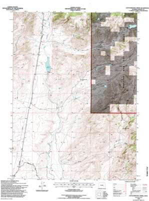
Cottonwood Creek Topo Map Wyoming
To zoom in, hover over the map of Cottonwood Creek
USGS Topo Quad 42105b6 - 1:24,000 scale
| Topo Map Name: | Cottonwood Creek |
| USGS Topo Quad ID: | 42105b6 |
| Print Size: | ca. 21 1/4" wide x 27" high |
| Southeast Coordinates: | 42.125° N latitude / 105.625° W longitude |
| Map Center Coordinates: | 42.1875° N latitude / 105.6875° W longitude |
| U.S. State: | WY |
| Filename: | o42105b6.jpg |
| Download Map JPG Image: | Cottonwood Creek topo map 1:24,000 scale |
| Map Type: | Topographic |
| Topo Series: | 7.5´ |
| Map Scale: | 1:24,000 |
| Source of Map Images: | United States Geological Survey (USGS) |
| Alternate Map Versions: |
Cottonwood Creek WY 1968, updated 1972 Download PDF Buy paper map Cottonwood Creek WY 1968, updated 1985 Download PDF Buy paper map Cottonwood Creek WY 1992, updated 1996 Download PDF Buy paper map Cottonwood Creek WY 2012 Download PDF Buy paper map Cottonwood Creek WY 2015 Download PDF Buy paper map |
| FStopo: | US Forest Service topo Cottonwood Creek is available: Download FStopo PDF Download FStopo TIF |
1:24,000 Topo Quads surrounding Cottonwood Creek
> Back to 42105a1 at 1:100,000 scale
> Back to 42104a1 at 1:250,000 scale
> Back to U.S. Topo Maps home
Cottonwood Creek topo map: Gazetteer
Cottonwood Creek: Canals
Joe Ditch elevation 2255m 7398′Cottonwood Creek: Dams
Bar M Number 1 Dam elevation 2420m 7939′Bar M Number 3 Dam elevation 2454m 8051′
Newell Dam elevation 2265m 7431′
Cottonwood Creek: Reservoirs
Bar M Number 1 Reservoir elevation 2420m 7939′Bar M Number 3 Reservoir elevation 2454m 8051′
Newell Reservoir elevation 2265m 7431′
Cottonwood Creek: Streams
Antelope Creek elevation 2196m 7204′Bar M Creek elevation 2246m 7368′
Cottonwood Creek elevation 2161m 7089′
Negro Creek elevation 2134m 7001′
Cottonwood Creek: Summits
Indian Head Rock elevation 2265m 7431′Cottonwood Creek: Valleys
Buckland Draw elevation 2208m 7244′Harvey Trail Draw elevation 2241m 7352′
Hay Draw elevation 2246m 7368′
Cottonwood Creek digital topo map on disk
Buy this Cottonwood Creek topo map showing relief, roads, GPS coordinates and other geographical features, as a high-resolution digital map file on DVD:
Eastern Wyoming & Western South Dakota
Buy digital topo maps: Eastern Wyoming & Western South Dakota


