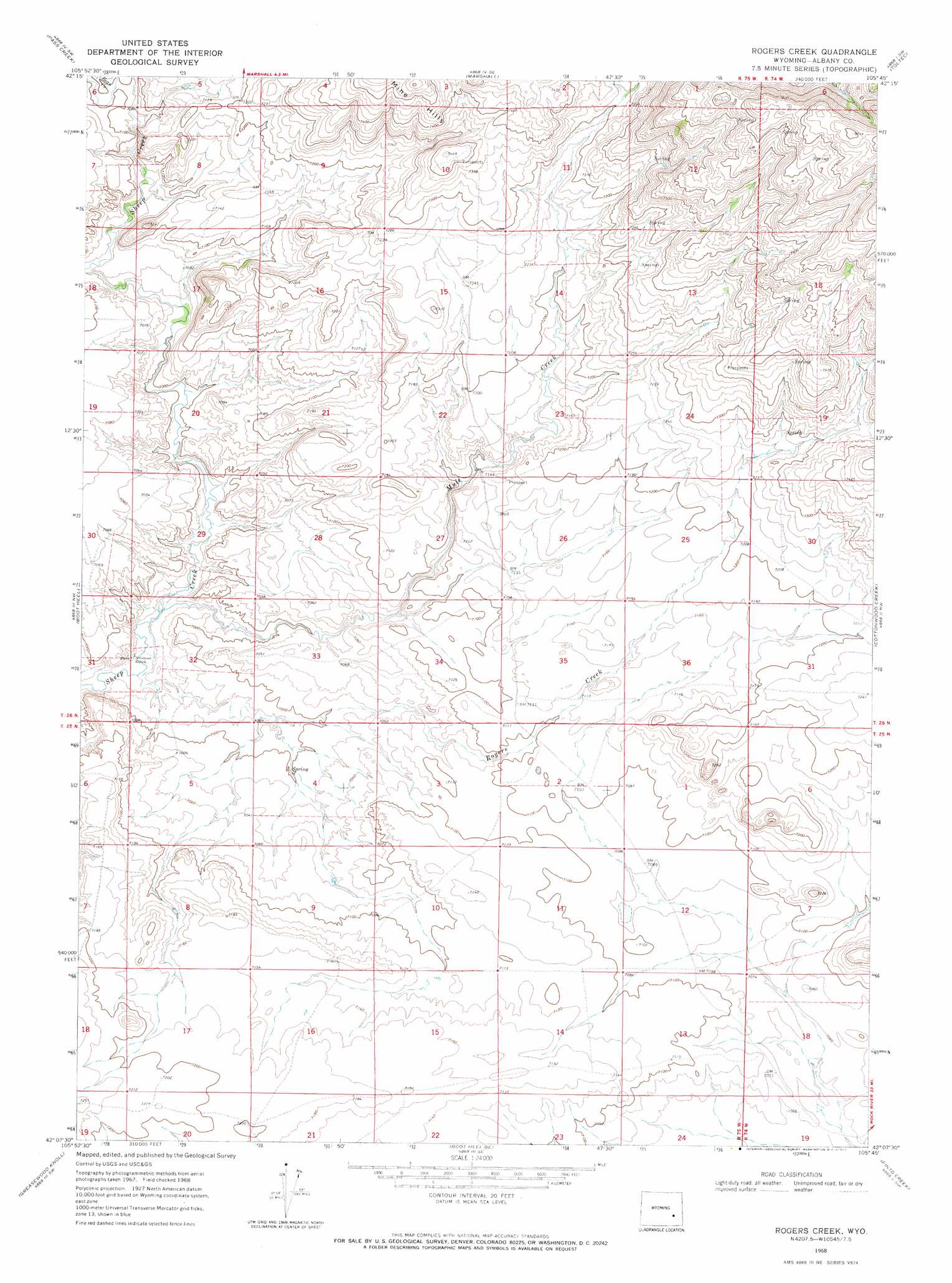
Rogers Creek Topo Map Wyoming
To zoom in, hover over the map of Rogers Creek
USGS Topo Quad 42105b7 - 1:24,000 scale
| Topo Map Name: | Rogers Creek |
| USGS Topo Quad ID: | 42105b7 |
| Print Size: | ca. 21 1/4" wide x 27" high |
| Southeast Coordinates: | 42.125° N latitude / 105.75° W longitude |
| Map Center Coordinates: | 42.1875° N latitude / 105.8125° W longitude |
| U.S. State: | WY |
| Filename: | o42105b7.jpg |
| Download Map JPG Image: | Rogers Creek topo map 1:24,000 scale |
| Map Type: | Topographic |
| Topo Series: | 7.5´ |
| Map Scale: | 1:24,000 |
| Source of Map Images: | United States Geological Survey (USGS) |
| Alternate Map Versions: |
Rogers Creek WY 1968, updated 1972 Download PDF Buy paper map Rogers Creek WY 2012 Download PDF Buy paper map Rogers Creek WY 2015 Download PDF Buy paper map |
1:24,000 Topo Quads surrounding Rogers Creek
Squaw Spring |
Rock Creek |
Warbonnett Peak |
School Section Mountain |
Saddleback Mountain |
Chalk Hills |
Pass Creek |
Marshall |
Toltec |
Windy Peak |
Big Charlie Lakes |
Boot Heel |
Rogers Creek |
Cottonwood Creek |
Cow Creek Mountain |
Walker Draw Se |
Greasewood Knoll |
Boot Heel Se |
Pinto Creek |
Garrett |
Aurora Lake |
Pine Tree Ridge |
Sevenmile Spring |
Ayres Spring |
Dodge Ranch |
> Back to 42105a1 at 1:100,000 scale
> Back to 42104a1 at 1:250,000 scale
> Back to U.S. Topo Maps home
Rogers Creek topo map: Gazetteer
Rogers Creek: Dams
Grazing Number 1 Stock Dam elevation 2163m 7096′Wellbaum Dam elevation 2165m 7103′
Rogers Creek: Mines
Sheep Creek Mine elevation 2125m 6971′Sheep Creek Mine elevation 2214m 7263′
Rogers Creek: Reservoirs
Grazing Number 1 Stock Reservoir elevation 2163m 7096′Wellbaum Reservoir elevation 2165m 7103′
Rogers Creek: Streams
Bean Creek elevation 2165m 7103′Mule Creek elevation 2116m 6942′
Rogers Creek elevation 2115m 6938′
Whistler Creek elevation 2228m 7309′
Rogers Creek digital topo map on disk
Buy this Rogers Creek topo map showing relief, roads, GPS coordinates and other geographical features, as a high-resolution digital map file on DVD:
Eastern Wyoming & Western South Dakota
Buy digital topo maps: Eastern Wyoming & Western South Dakota