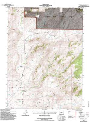
Marshall Topo Map Wyoming
To zoom in, hover over the map of Marshall
USGS Topo Quad 42105c7 - 1:24,000 scale
| Topo Map Name: | Marshall |
| USGS Topo Quad ID: | 42105c7 |
| Print Size: | ca. 21 1/4" wide x 27" high |
| Southeast Coordinates: | 42.25° N latitude / 105.75° W longitude |
| Map Center Coordinates: | 42.3125° N latitude / 105.8125° W longitude |
| U.S. State: | WY |
| Filename: | o42105c7.jpg |
| Download Map JPG Image: | Marshall topo map 1:24,000 scale |
| Map Type: | Topographic |
| Topo Series: | 7.5´ |
| Map Scale: | 1:24,000 |
| Source of Map Images: | United States Geological Survey (USGS) |
| Alternate Map Versions: |
Marshall WY 1964, updated 1968 Download PDF Buy paper map Marshall WY 1964, updated 1985 Download PDF Buy paper map Marshall WY 1992, updated 1996 Download PDF Buy paper map Marshall WY 2012 Download PDF Buy paper map Marshall WY 2015 Download PDF Buy paper map |
| FStopo: | US Forest Service topo Marshall is available: Download FStopo PDF Download FStopo TIF |
1:24,000 Topo Quads surrounding Marshall
> Back to 42105a1 at 1:100,000 scale
> Back to 42104a1 at 1:250,000 scale
> Back to U.S. Topo Maps home
Marshall topo map: Gazetteer
Marshall: Airports
Robbins Airport elevation 2202m 7224′Marshall: Dams
Mule Creek Dam elevation 2490m 8169′Marshall: Gaps
Cameron Pass elevation 2378m 7801′Marshall: Mines
Marshall Area Mine elevation 2237m 7339′Marshall: Ranges
Mine Hills elevation 2350m 7709′Marshall: Reservoirs
Mule Creek Reservoir elevation 2490m 8169′Marshall: Streams
Badger Creek elevation 2354m 7723′Bishop Creek elevation 2325m 7627′
Boulder Creek elevation 2319m 7608′
Cottonwood Creek elevation 2171m 7122′
East Fork Cottonwood Creek elevation 2364m 7755′
Green Creek elevation 2233m 7326′
Manse Creek elevation 2292m 7519′
Middle Fork Cottonwood Creek elevation 2364m 7755′
North Fork Cottonwood Creek elevation 2324m 7624′
Marshall: Summits
Crystal Hill elevation 2336m 7664′Mule Creek Mountain elevation 2567m 8421′
Marshall: Valleys
Curry Draw elevation 2333m 7654′Frenchy Draw elevation 2263m 7424′
Long Draw elevation 2264m 7427′
Parsons Canyon elevation 2357m 7732′
Post Draw elevation 2246m 7368′
Sheep Draw elevation 2194m 7198′
Marshall digital topo map on disk
Buy this Marshall topo map showing relief, roads, GPS coordinates and other geographical features, as a high-resolution digital map file on DVD:
Eastern Wyoming & Western South Dakota
Buy digital topo maps: Eastern Wyoming & Western South Dakota


