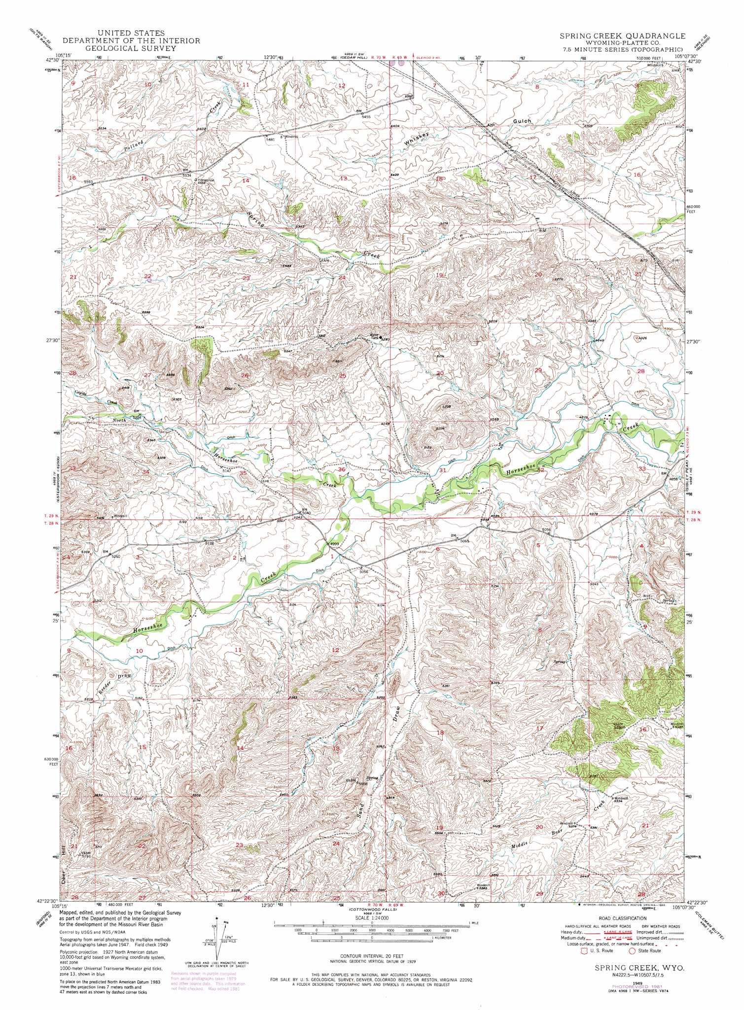
Spring Creek Topo Map Wyoming
To zoom in, hover over the map of Spring Creek
USGS Topo Quad 42105d2 - 1:24,000 scale
| Topo Map Name: | Spring Creek |
| USGS Topo Quad ID: | 42105d2 |
| Print Size: | ca. 21 1/4" wide x 27" high |
| Southeast Coordinates: | 42.375° N latitude / 105.125° W longitude |
| Map Center Coordinates: | 42.4375° N latitude / 105.1875° W longitude |
| U.S. State: | WY |
| Filename: | o42105d2.jpg |
| Download Map JPG Image: | Spring Creek topo map 1:24,000 scale |
| Map Type: | Topographic |
| Topo Series: | 7.5´ |
| Map Scale: | 1:24,000 |
| Source of Map Images: | United States Geological Survey (USGS) |
| Alternate Map Versions: |
Spring Creek WY 1949, updated 1970 Download PDF Buy paper map Spring Creek WY 1949, updated 1982 Download PDF Buy paper map Spring Creek WY 1950 Download PDF Buy paper map Spring Creek WY 2012 Download PDF Buy paper map Spring Creek WY 2015 Download PDF Buy paper map |
1:24,000 Topo Quads surrounding Spring Creek
Chalk Buttes |
Irvine |
Orin |
Shawnee |
Amend Ranch |
Poison Lake |
Dilts Ranch |
Cedar Hill |
Glendo |
Jewel Springs |
Braae |
Esterbrook |
Spring Creek |
Sibley Peak |
Cassa |
Laramie Peak |
Harris Park |
Cottonwood Falls |
Coleman Butte |
Herman Ranch |
South Mountain |
Fletcher Park |
Johnson Mountain |
Lewis Flat |
Dwyer |
> Back to 42105a1 at 1:100,000 scale
> Back to 42104a1 at 1:250,000 scale
> Back to U.S. Topo Maps home
Spring Creek topo map: Gazetteer
Spring Creek: Mines
Cassa Area Mine elevation 1493m 4898′Spring Creek: Streams
Coyote Creek elevation 1594m 5229′North Horseshoe Creek elevation 1521m 4990′
Spring Creek: Summits
Deer Hill elevation 1776m 5826′Spring Creek: Valleys
Reeder Draw elevation 1565m 5134′Sand Draw elevation 1526m 5006′
Spring Creek digital topo map on disk
Buy this Spring Creek topo map showing relief, roads, GPS coordinates and other geographical features, as a high-resolution digital map file on DVD:
Eastern Wyoming & Western South Dakota
Buy digital topo maps: Eastern Wyoming & Western South Dakota