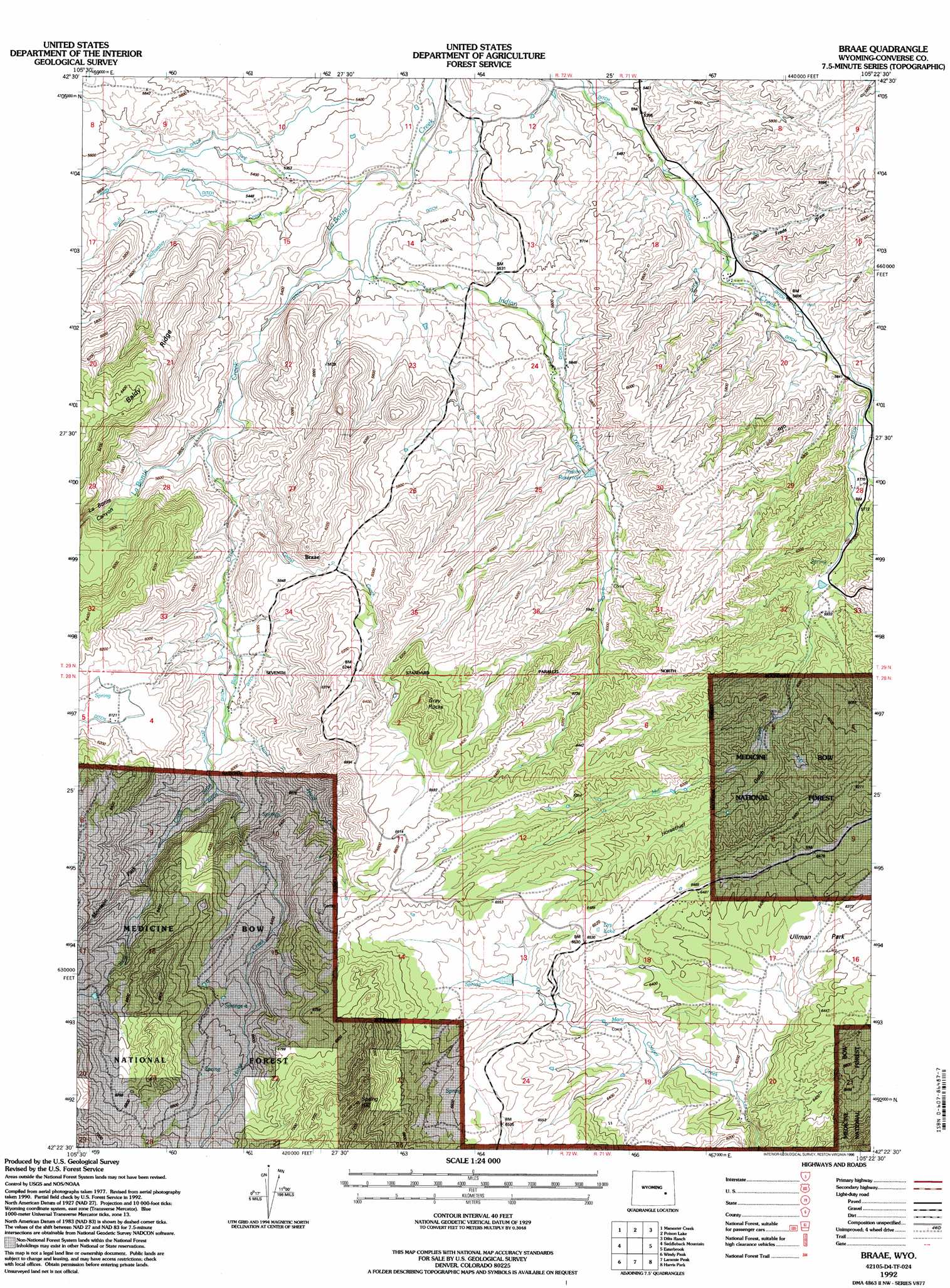
Braae Topo Map Wyoming
To zoom in, hover over the map of Braae
USGS Topo Quad 42105d4 - 1:24,000 scale
| Topo Map Name: | Braae |
| USGS Topo Quad ID: | 42105d4 |
| Print Size: | ca. 21 1/4" wide x 27" high |
| Southeast Coordinates: | 42.375° N latitude / 105.375° W longitude |
| Map Center Coordinates: | 42.4375° N latitude / 105.4375° W longitude |
| U.S. State: | WY |
| Filename: | o42105d4.jpg |
| Download Map JPG Image: | Braae topo map 1:24,000 scale |
| Map Type: | Topographic |
| Topo Series: | 7.5´ |
| Map Scale: | 1:24,000 |
| Source of Map Images: | United States Geological Survey (USGS) |
| Alternate Map Versions: |
Braae WY 1985, updated 1985 Download PDF Buy paper map Braae WY 1992, updated 1996 Download PDF Buy paper map Braae WY 2012 Download PDF Buy paper map Braae WY 2015 Download PDF Buy paper map |
| FStopo: | US Forest Service topo Braae is available: Download FStopo PDF Download FStopo TIF |
1:24,000 Topo Quads surrounding Braae
Hermit Rock |
La Prele Reservoir |
Chalk Buttes |
Irvine |
Orin |
Blue Nose Creek |
Maneater Creek |
Poison Lake |
Dilts Ranch |
Cedar Hill |
School Section Mountain |
Saddleback Mountain |
Braae |
Esterbrook |
Spring Creek |
Toltec |
Windy Peak |
Laramie Peak |
Harris Park |
Cottonwood Falls |
Cottonwood Creek |
Cow Creek Mountain |
South Mountain |
Fletcher Park |
Johnson Mountain |
> Back to 42105a1 at 1:100,000 scale
> Back to 42104a1 at 1:250,000 scale
> Back to U.S. Topo Maps home
Braae topo map: Gazetteer
Braae: Dams
Indian Number 1 Dam elevation 1757m 5764′Pexton Number 1 Dam elevation 2004m 6574′
Braae: Flats
Ullman Park elevation 1956m 6417′Braae: Pillars
Gray Rocks elevation 2046m 6712′Braae: Reservoirs
Indian Reservoir Number 1 elevation 1757m 5764′Pexton Reservoir Number 1 elevation 2004m 6574′
Braae: Streams
Bull Creek elevation 1667m 5469′Ghost Creek elevation 1703m 5587′
Hand in Hand Creek elevation 1783m 5849′
Horse Creek elevation 1799m 5902′
Indian Creek elevation 1626m 5334′
Owl Creek elevation 1605m 5265′
Reid Creek elevation 1677m 5501′
Rutherford Creek elevation 1688m 5538′
Softwater Creek elevation 1622m 5321′
Braae: Valleys
Freds Draw elevation 1694m 5557′Horsethief Gulch elevation 1867m 6125′
La Bonte Canyon elevation 1626m 5334′
Braae digital topo map on disk
Buy this Braae topo map showing relief, roads, GPS coordinates and other geographical features, as a high-resolution digital map file on DVD:
Eastern Wyoming & Western South Dakota
Buy digital topo maps: Eastern Wyoming & Western South Dakota