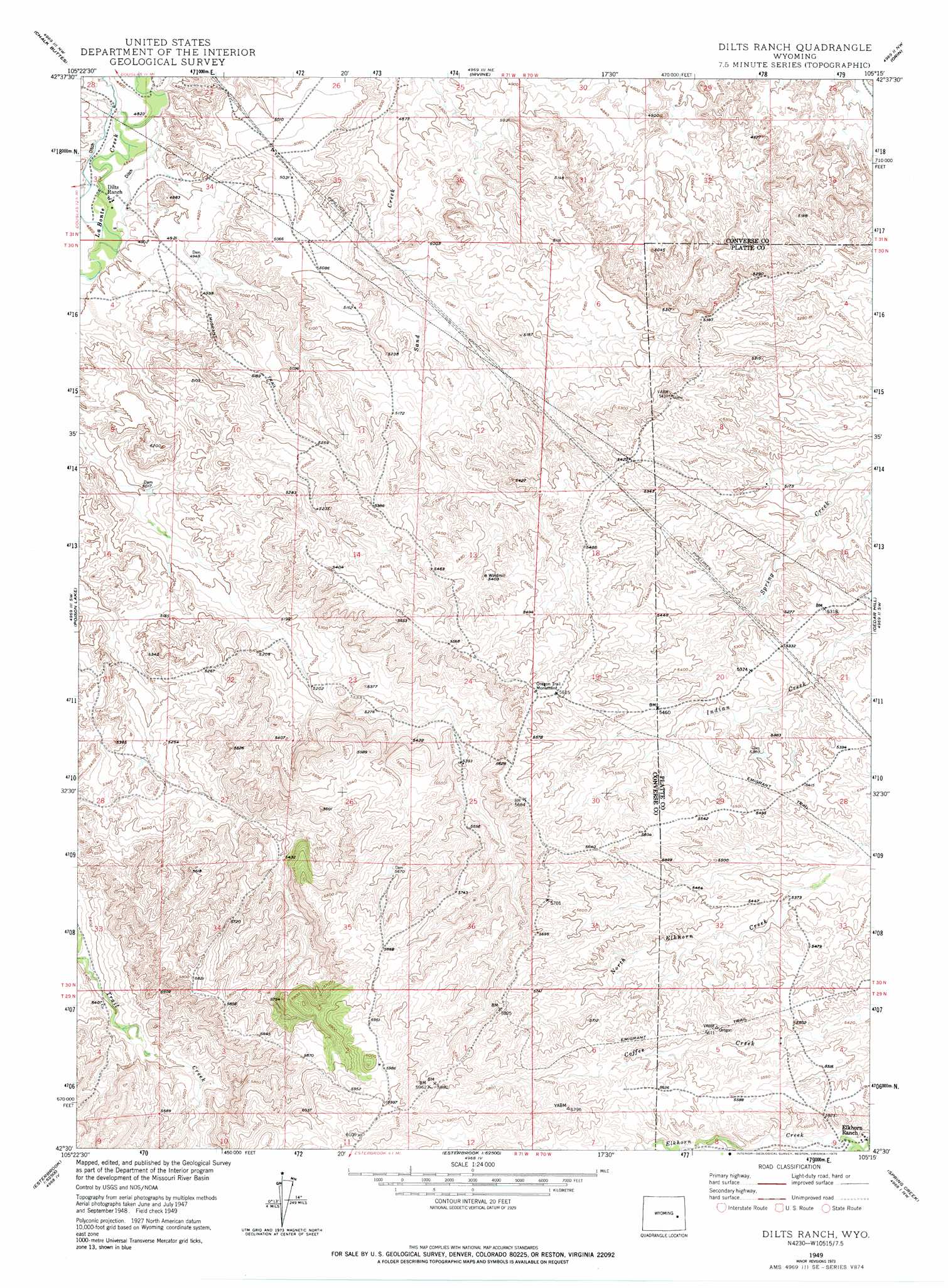
Dilts Ranch Topo Map Wyoming
To zoom in, hover over the map of Dilts Ranch
USGS Topo Quad 42105e3 - 1:24,000 scale
| Topo Map Name: | Dilts Ranch |
| USGS Topo Quad ID: | 42105e3 |
| Print Size: | ca. 21 1/4" wide x 27" high |
| Southeast Coordinates: | 42.5° N latitude / 105.25° W longitude |
| Map Center Coordinates: | 42.5625° N latitude / 105.3125° W longitude |
| U.S. State: | WY |
| Filename: | o42105e3.jpg |
| Download Map JPG Image: | Dilts Ranch topo map 1:24,000 scale |
| Map Type: | Topographic |
| Topo Series: | 7.5´ |
| Map Scale: | 1:24,000 |
| Source of Map Images: | United States Geological Survey (USGS) |
| Alternate Map Versions: |
Dilts Ranch WY 1949, updated 1975 Download PDF Buy paper map Dilts Ranch WY 1950 Download PDF Buy paper map Dilts Ranch WY 2012 Download PDF Buy paper map Dilts Ranch WY 2015 Download PDF Buy paper map |
1:24,000 Topo Quads surrounding Dilts Ranch
Orpha |
Douglas |
Antelope Creek |
Simpson Draw |
The Park |
La Prele Reservoir |
Chalk Buttes |
Irvine |
Orin |
Shawnee |
Maneater Creek |
Poison Lake |
Dilts Ranch |
Cedar Hill |
Glendo |
Saddleback Mountain |
Braae |
Esterbrook |
Spring Creek |
Sibley Peak |
Windy Peak |
Laramie Peak |
Harris Park |
Cottonwood Falls |
Coleman Butte |
> Back to 42105e1 at 1:100,000 scale
> Back to 42104a1 at 1:250,000 scale
> Back to U.S. Topo Maps home
Dilts Ranch digital topo map on disk
Buy this Dilts Ranch topo map showing relief, roads, GPS coordinates and other geographical features, as a high-resolution digital map file on DVD:
Eastern Wyoming & Western South Dakota
Buy digital topo maps: Eastern Wyoming & Western South Dakota