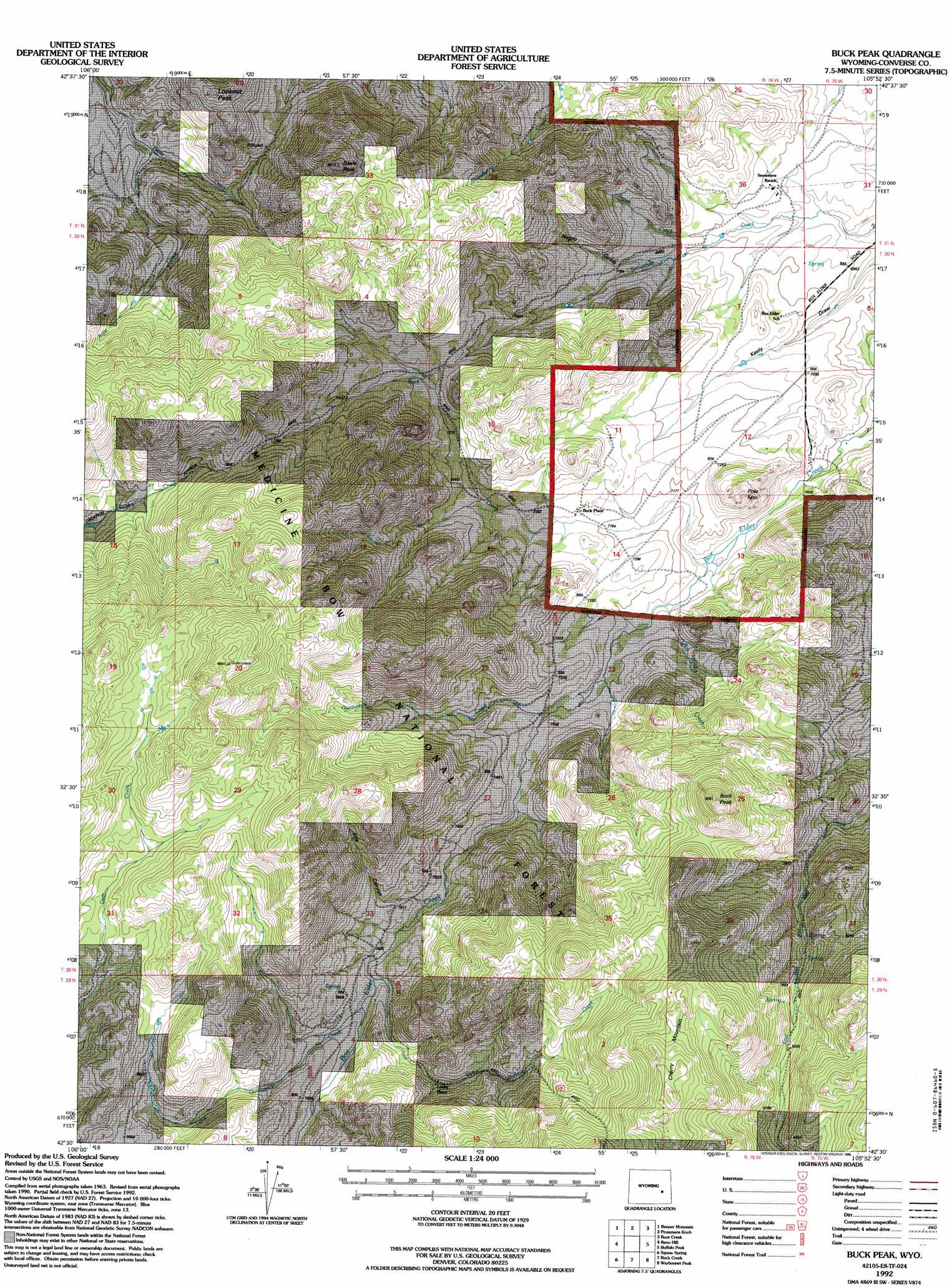
Buck Peak Topo Map Wyoming
To zoom in, hover over the map of Buck Peak
USGS Topo Quad 42105e8 - 1:24,000 scale
| Topo Map Name: | Buck Peak |
| USGS Topo Quad ID: | 42105e8 |
| Print Size: | ca. 21 1/4" wide x 27" high |
| Southeast Coordinates: | 42.5° N latitude / 105.875° W longitude |
| Map Center Coordinates: | 42.5625° N latitude / 105.9375° W longitude |
| U.S. State: | WY |
| Filename: | o42105e8.jpg |
| Download Map JPG Image: | Buck Peak topo map 1:24,000 scale |
| Map Type: | Topographic |
| Topo Series: | 7.5´ |
| Map Scale: | 1:24,000 |
| Source of Map Images: | United States Geological Survey (USGS) |
| Alternate Map Versions: |
Buck Peak WY 1964, updated 1967 Download PDF Buy paper map Buck Peak WY 1964, updated 1980 Download PDF Buy paper map Buck Peak WY 1964, updated 1985 Download PDF Buy paper map Buck Peak WY 1992, updated 1996 Download PDF Buy paper map Buck Peak WY 2012 Download PDF Buy paper map Buck Peak WY 2015 Download PDF Buy paper map |
| FStopo: | US Forest Service topo Buck Peak is available: Download FStopo PDF Download FStopo TIF |
1:24,000 Topo Quads surrounding Buck Peak
Brookhurst |
Lockett |
Parkerton |
Glenrock |
Careyhurst |
Otter Creek |
Banner Mountain |
Protsmans Knob |
Root Creek |
Hermit Rock |
Ice Cave Mountain |
Reno Hill |
Buck Peak |
Buffalo Peak |
Blue Nose Creek |
Bates Creek Reservoir |
Squaw Spring |
Rock Creek |
Warbonnett Peak |
School Section Mountain |
Moss Agate Reservoir |
Chalk Hills |
Pass Creek |
Marshall |
Toltec |
> Back to 42105e1 at 1:100,000 scale
> Back to 42104a1 at 1:250,000 scale
> Back to U.S. Topo Maps home
Buck Peak topo map: Gazetteer
Buck Peak: Populated Places
Buck Place elevation 2207m 7240′Leahy Place elevation 2352m 7716′
Buck Peak: Streams
Aspen Creek elevation 2125m 6971′Aunt Ag Creek elevation 2172m 7125′
Bill Young Creek elevation 2170m 7119′
Buck Creek elevation 2156m 7073′
Elk Run Creek elevation 2213m 7260′
Gunnysack Creek elevation 2204m 7230′
Little Gunnysack Creek elevation 2289m 7509′
Van Wormer Creek elevation 2284m 7493′
Buck Peak: Summits
Buck Peak elevation 2743m 8999′Cherry Mountain elevation 2786m 9140′
Davis Peak elevation 2557m 8389′
Lookout Peak elevation 2429m 7969′
Pole Mountain elevation 2352m 7716′
Twin Peak elevation 2410m 7906′
Buck Peak: Valleys
Fire Canyon elevation 2266m 7434′Negro Gulch elevation 2148m 7047′
Buck Peak digital topo map on disk
Buy this Buck Peak topo map showing relief, roads, GPS coordinates and other geographical features, as a high-resolution digital map file on DVD:
Eastern Wyoming & Western South Dakota
Buy digital topo maps: Eastern Wyoming & Western South Dakota