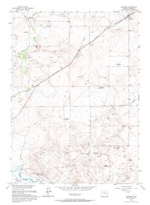
Shawnee Topo Map Wyoming
To zoom in, hover over the map of Shawnee
USGS Topo Quad 42105f1 - 1:24,000 scale
| Topo Map Name: | Shawnee |
| USGS Topo Quad ID: | 42105f1 |
| Print Size: | ca. 21 1/4" wide x 27" high |
| Southeast Coordinates: | 42.625° N latitude / 105° W longitude |
| Map Center Coordinates: | 42.6875° N latitude / 105.0625° W longitude |
| U.S. State: | WY |
| Filename: | o42105f1.jpg |
| Download Map JPG Image: | Shawnee topo map 1:24,000 scale |
| Map Type: | Topographic |
| Topo Series: | 7.5´ |
| Map Scale: | 1:24,000 |
| Source of Map Images: | United States Geological Survey (USGS) |
| Alternate Map Versions: |
Shawnee WY 1949, updated 1958 Download PDF Buy paper map Shawnee WY 1950 Download PDF Buy paper map Shawnee WY 1961, updated 1965 Download PDF Buy paper map Shawnee WY 2012 Download PDF Buy paper map Shawnee WY 2015 Download PDF Buy paper map |
1:24,000 Topo Quads surrounding Shawnee
> Back to 42105e1 at 1:100,000 scale
> Back to 42104a1 at 1:250,000 scale
> Back to U.S. Topo Maps home
Shawnee topo map: Gazetteer
Shawnee: Crossings
XH Crossing elevation 1482m 4862′Shawnee: Mines
Faith Number Two and Three Mine elevation 1519m 4983′Fox Numbers Eight and Ten Mine elevation 1482m 4862′
Mickey One Mine elevation 1484m 4868′
Shawnee: Populated Places
Deadmans Corner elevation 1428m 4685′Shawnee elevation 1542m 5059′
Shawnee: Streams
East Fork Shawnee Creek elevation 1482m 4862′West Fork Shawnee Creek elevation 1482m 4862′
Shawnee: Summits
Bobcat Hill elevation 1547m 5075′Grey Hills elevation 1506m 4940′
Twin Buttes elevation 1533m 5029′
White Hills elevation 1512m 4960′
Shawnee: Valleys
Cedar Draw elevation 1469m 4819′Fero Draw elevation 1457m 4780′
Shawnee digital topo map on disk
Buy this Shawnee topo map showing relief, roads, GPS coordinates and other geographical features, as a high-resolution digital map file on DVD:
Eastern Wyoming & Western South Dakota
Buy digital topo maps: Eastern Wyoming & Western South Dakota


