Orin Topo Map Wyoming
To zoom in, hover over the map of Orin
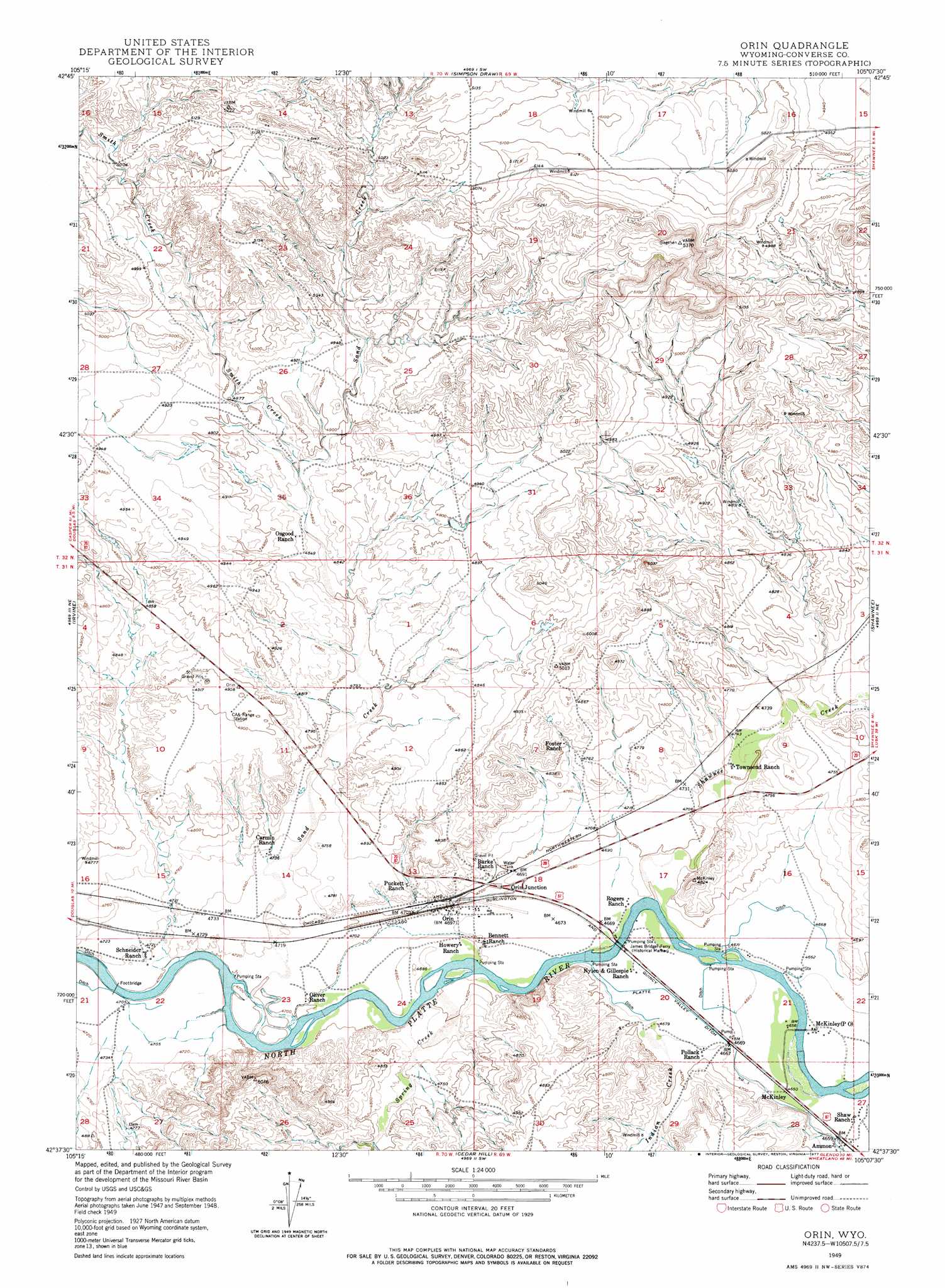
USGS Topo Quad 42105f2 - 1:24,000 scale
| Topo Map Name: | Orin |
| USGS Topo Quad ID: | 42105f2 |
| Print Size: | ca. 21 1/4" wide x 27" high |
| Southeast Coordinates: | 42.625° N latitude / 105.125° W longitude |
| Map Center Coordinates: | 42.6875° N latitude / 105.1875° W longitude |
| U.S. State: | WY |
| Filename: | o42105f2.jpg |
| Download Map JPG Image: | Orin topo map 1:24,000 scale |
| Map Type: | Topographic |
| Topo Series: | 7.5´ |
| Map Scale: | 1:24,000 |
| Source of Map Images: | United States Geological Survey (USGS) |
| Alternate Map Versions: |
Orin WY 1949, updated 1977 Download PDF Buy paper map Orin WY 1950 Download PDF Buy paper map Orin WY 2012 Download PDF Buy paper map Orin WY 2015 Download PDF Buy paper map |
1:24,000 Topo Quads surrounding Orin
Sundquist Ranch |
Clausen Ranch |
Simpson Draw Nw |
Walker Creek School |
Lost Springs Nw |
Douglas |
Antelope Creek |
Simpson Draw |
The Park |
Lost Springs |
Chalk Buttes |
Irvine |
Orin |
Shawnee |
Amend Ranch |
Poison Lake |
Dilts Ranch |
Cedar Hill |
Glendo |
Jewel Springs |
Braae |
Esterbrook |
Spring Creek |
Sibley Peak |
Cassa |
> Back to 42105e1 at 1:100,000 scale
> Back to 42104a1 at 1:250,000 scale
> Back to U.S. Topo Maps home
Orin topo map: Gazetteer
Orin: Bridges
James Bridger Ferry elevation 1422m 4665′Orin: Mines
Barkdoll Pit Number One elevation 1426m 4678′Cactus Four Claim elevation 1512m 4960′
Orin Junction Pit elevation 1433m 4701′
Sand Creek Mine elevation 1584m 5196′
Shawnee Creek Area Mine elevation 1494m 4901′
Orin: Populated Places
Ammon elevation 1420m 4658′Orin elevation 1434m 4704′
Orin Junction elevation 1433m 4701′
Orin: Post Offices
McKinley Post Office elevation 1418m 4652′Orin: Streams
Indian Creek elevation 1430m 4691′Sand Creek elevation 1434m 4704′
Shawnee Creek elevation 1418m 4652′
Smith Creek elevation 1477m 4845′
Spring Creek elevation 1428m 4685′
Orin digital topo map on disk
Buy this Orin topo map showing relief, roads, GPS coordinates and other geographical features, as a high-resolution digital map file on DVD:
Eastern Wyoming & Western South Dakota
Buy digital topo maps: Eastern Wyoming & Western South Dakota