Windy Hill Topo Map Wyoming
To zoom in, hover over the map of Windy Hill
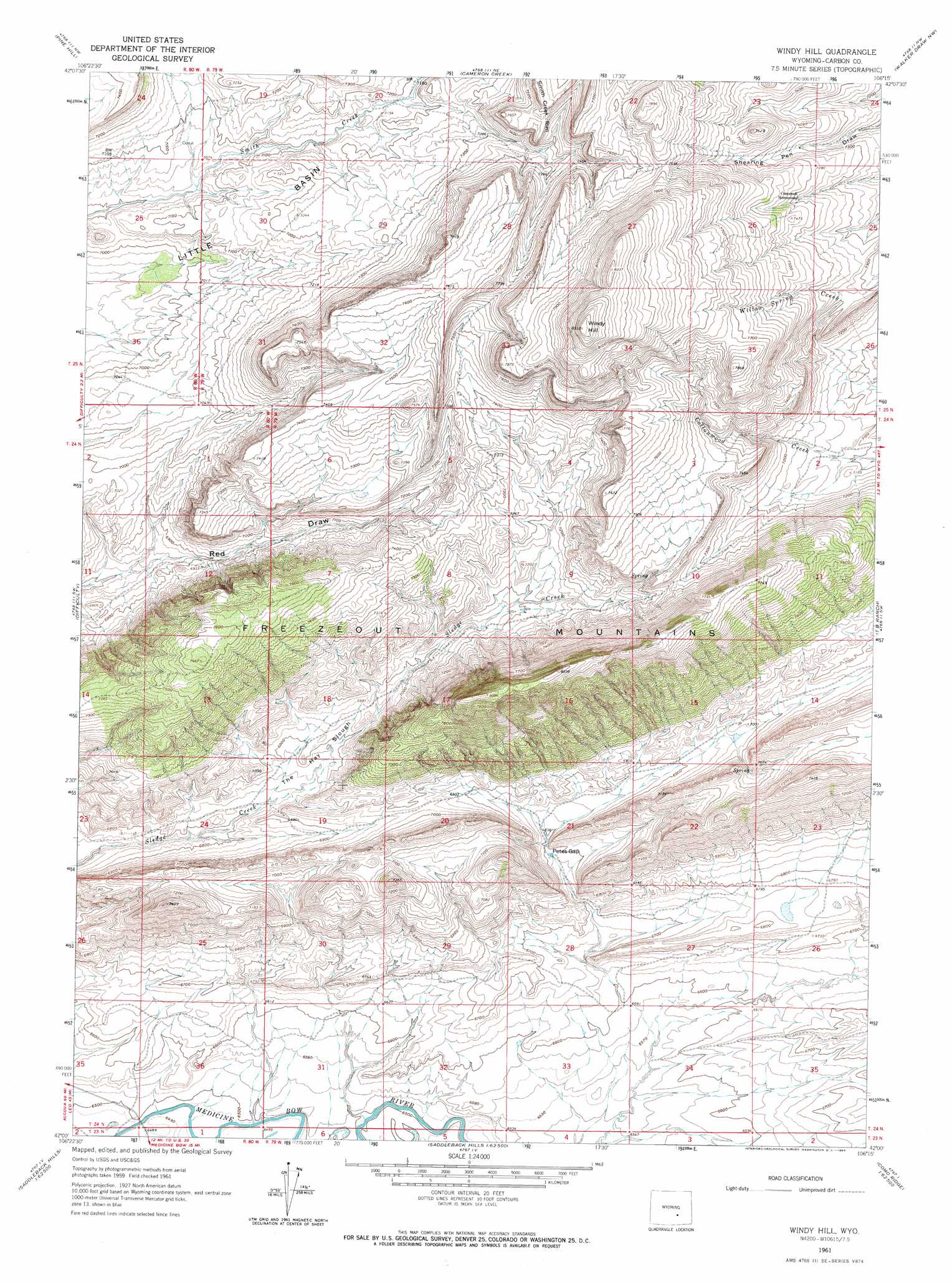
USGS Topo Quad 42106a3 - 1:24,000 scale
| Topo Map Name: | Windy Hill |
| USGS Topo Quad ID: | 42106a3 |
| Print Size: | ca. 21 1/4" wide x 27" high |
| Southeast Coordinates: | 42° N latitude / 106.25° W longitude |
| Map Center Coordinates: | 42.0625° N latitude / 106.3125° W longitude |
| U.S. State: | WY |
| Filename: | o42106a3.jpg |
| Download Map JPG Image: | Windy Hill topo map 1:24,000 scale |
| Map Type: | Topographic |
| Topo Series: | 7.5´ |
| Map Scale: | 1:24,000 |
| Source of Map Images: | United States Geological Survey (USGS) |
| Alternate Map Versions: |
Windy Hill WY 1961, updated 1964 Download PDF Buy paper map Windy Hill WY 2012 Download PDF Buy paper map Windy Hill WY 2015 Download PDF Buy paper map |
1:24,000 Topo Quads surrounding Windy Hill
Fourmile Point |
Wild Irish Reservoir |
Measel Spring Reservoir |
Moss Agate Reservoir |
Chalk Hills |
The Q Ranch |
Pine Hill |
Cameron Creek |
Walker Draw Nw |
Big Charlie Lakes |
T E Ranch |
Difficulty |
Windy Hill |
T B Ranch |
Walker Draw Se |
Elmo |
Como West |
Como East |
Medicine Bow |
Aurora Lake |
Hanna |
Carbon |
Halfway Hill |
Pine Ridge |
Foote Creek Lake |
> Back to 42106a1 at 1:100,000 scale
> Back to 42106a1 at 1:250,000 scale
> Back to U.S. Topo Maps home
Windy Hill topo map: Gazetteer
Windy Hill: Basins
The Hay Slough elevation 2094m 6870′Windy Hill: Gaps
Petes Gap elevation 2071m 6794′Windy Hill: Mines
Freezeout-Seminoe Area Mine elevation 2287m 7503′Freezeout-Seminoe Area Three Mine elevation 2287m 7503′
Freezeout-Seminoe Area Two Mine elevation 2149m 7050′
Windy Hill: Summits
Windy Hill elevation 2533m 8310′Windy Hill digital topo map on disk
Buy this Windy Hill topo map showing relief, roads, GPS coordinates and other geographical features, as a high-resolution digital map file on DVD:
Eastern Wyoming & Western South Dakota
Buy digital topo maps: Eastern Wyoming & Western South Dakota