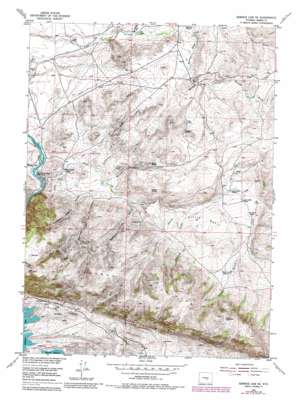
Seminoe Dam Ne Topo Map Wyoming
To zoom in, hover over the map of Seminoe Dam Ne
USGS Topo Quad 42106b7 - 1:24,000 scale
| Topo Map Name: | Seminoe Dam Ne |
| USGS Topo Quad ID: | 42106b7 |
| Print Size: | ca. 21 1/4" wide x 27" high |
| Southeast Coordinates: | 42.125° N latitude / 106.75° W longitude |
| Map Center Coordinates: | 42.1875° N latitude / 106.8125° W longitude |
| U.S. State: | WY |
| Filename: | o42106b7.jpg |
| Download Map JPG Image: | Seminoe Dam Ne topo map 1:24,000 scale |
| Map Type: | Topographic |
| Topo Series: | 7.5´ |
| Map Scale: | 1:24,000 |
| Source of Map Images: | United States Geological Survey (USGS) |
| Alternate Map Versions: |
Seminoe Dam NE WY 1953, updated 1955 Download PDF Buy paper map Seminoe Dam NE WY 1953, updated 1969 Download PDF Buy paper map Seminoe Dam NE WY 1953, updated 1983 Download PDF Buy paper map Seminoe Dam NE WY 2012 Download PDF Buy paper map Seminoe Dam NE WY 2015 Download PDF Buy paper map |
1:24,000 Topo Quads surrounding Seminoe Dam Ne
> Back to 42106a1 at 1:100,000 scale
> Back to 42106a1 at 1:250,000 scale
> Back to U.S. Topo Maps home
Seminoe Dam Ne topo map: Gazetteer
Seminoe Dam Ne: Lakes
Dry Lake elevation 2232m 7322′Seminoe Dam Ne: Mines
Shirley Mountains Area Mine elevation 2152m 7060′Seminoe Dam Ne: Ranges
Seminoe Mountains elevation 2265m 7431′Seminoe Dam Ne: Reservoirs
House Gulch Reservoir elevation 2156m 7073′Seminoe Dam Ne: Springs
Indian Spring elevation 2007m 6584′Red Spring elevation 1970m 6463′
Sips Spring elevation 2062m 6765′
Threemile Spring elevation 2020m 6627′
Wildcat Springs elevation 2009m 6591′
Willow Springs elevation 2012m 6601′
Seminoe Dam Ne: Streams
Cottonwood Creek elevation 1872m 6141′Hamilton Creek elevation 1798m 5898′
Iron Springs Creek elevation 1836m 6023′
Lost Creek elevation 1806m 5925′
Willow Springs Creek elevation 1895m 6217′
Seminoe Dam Ne: Summits
Bunker Hill elevation 1942m 6371′Seminoe Dam Ne: Valleys
Big Draw elevation 2043m 6702′Cow Canyon elevation 1838m 6030′
Deadman Canyon elevation 1898m 6227′
House Gulch elevation 2104m 6902′
Hurt Gulch elevation 1981m 6499′
Hurt Gulch elevation 1940m 6364′
Number One Gulch elevation 1910m 6266′
Number Three Gulch elevation 1932m 6338′
Number Two Gulch elevation 1919m 6295′
Red Spring Draw elevation 1939m 6361′
Seminoe Canyon elevation 1805m 5921′
Spencer Draw elevation 2012m 6601′
Seminoe Dam Ne digital topo map on disk
Buy this Seminoe Dam Ne topo map showing relief, roads, GPS coordinates and other geographical features, as a high-resolution digital map file on DVD:
Eastern Wyoming & Western South Dakota
Buy digital topo maps: Eastern Wyoming & Western South Dakota


