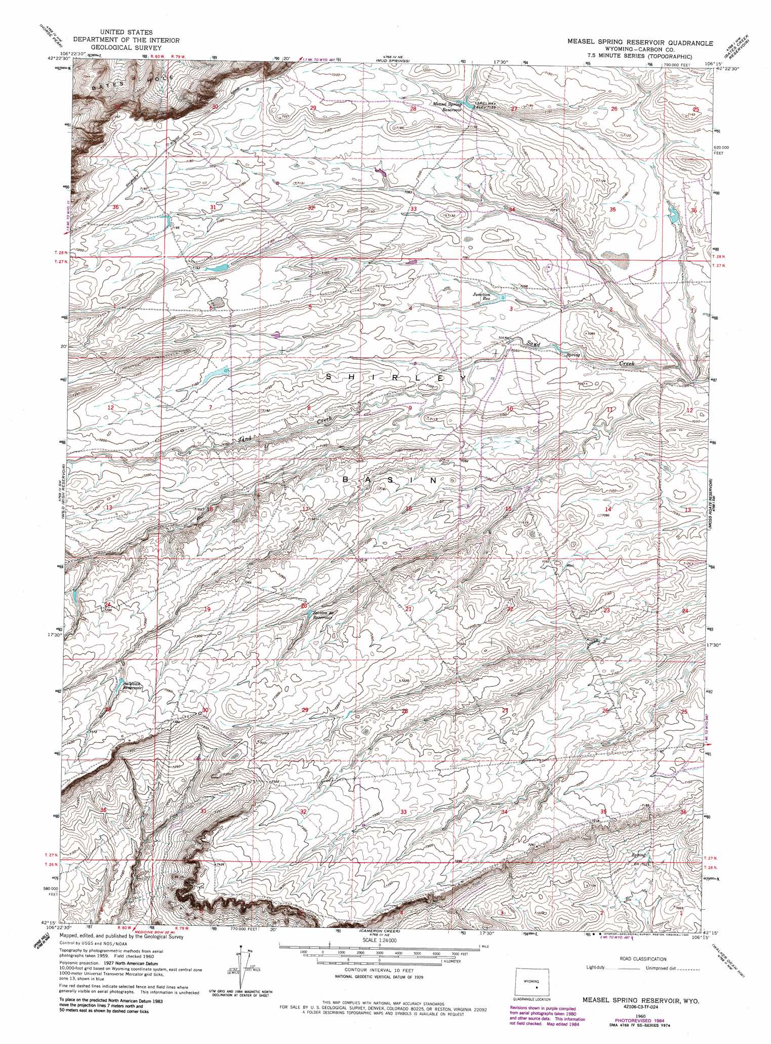
Measel Spring Reservoir Topo Map Wyoming
To zoom in, hover over the map of Measel Spring Reservoir
USGS Topo Quad 42106c3 - 1:24,000 scale
| Topo Map Name: | Measel Spring Reservoir |
| USGS Topo Quad ID: | 42106c3 |
| Print Size: | ca. 21 1/4" wide x 27" high |
| Southeast Coordinates: | 42.25° N latitude / 106.25° W longitude |
| Map Center Coordinates: | 42.3125° N latitude / 106.3125° W longitude |
| U.S. State: | WY |
| Filename: | o42106c3.jpg |
| Download Map JPG Image: | Measel Spring Reservoir topo map 1:24,000 scale |
| Map Type: | Topographic |
| Topo Series: | 7.5´ |
| Map Scale: | 1:24,000 |
| Source of Map Images: | United States Geological Survey (USGS) |
| Alternate Map Versions: |
Measel Spring Reservoir WY 1960, updated 1964 Download PDF Buy paper map Measel Spring Reservoir WY 1960, updated 1985 Download PDF Buy paper map Measel Spring Reservoir WY 2012 Download PDF Buy paper map Measel Spring Reservoir WY 2015 Download PDF Buy paper map |
1:24,000 Topo Quads surrounding Measel Spring Reservoir
Alcova Se |
Twin Buttes |
Sheep Creek |
Ice Cave Mountain |
Reno Hill |
Bear Mountain |
Horse Peak |
Mud Springs |
Bates Creek Reservoir |
Squaw Spring |
Fourmile Point |
Wild Irish Reservoir |
Measel Spring Reservoir |
Moss Agate Reservoir |
Chalk Hills |
The Q Ranch |
Pine Hill |
Cameron Creek |
Walker Draw Nw |
Big Charlie Lakes |
T E Ranch |
Difficulty |
Windy Hill |
T B Ranch |
Walker Draw Se |
> Back to 42106a1 at 1:100,000 scale
> Back to 42106a1 at 1:250,000 scale
> Back to U.S. Topo Maps home
Measel Spring Reservoir topo map: Gazetteer
Measel Spring Reservoir: Basins
Shirley Basin elevation 2162m 7093′Measel Spring Reservoir: Reservoirs
Junction Reservoir elevation 2151m 7057′Measel Spring Reservoir elevation 2176m 7139′
Section 20 Reservoir elevation 2203m 7227′
Sullivan Reservoir elevation 2236m 7335′
Measel Spring Reservoir digital topo map on disk
Buy this Measel Spring Reservoir topo map showing relief, roads, GPS coordinates and other geographical features, as a high-resolution digital map file on DVD:
Eastern Wyoming & Western South Dakota
Buy digital topo maps: Eastern Wyoming & Western South Dakota