Squaw Spring Topo Map Wyoming
To zoom in, hover over the map of Squaw Spring
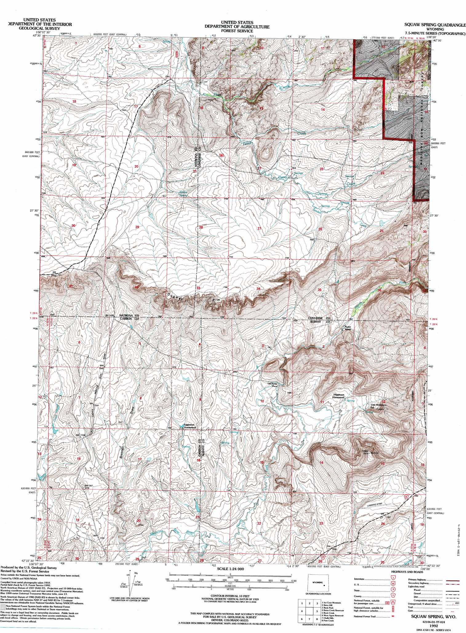
USGS Topo Quad 42106d1 - 1:24,000 scale
| Topo Map Name: | Squaw Spring |
| USGS Topo Quad ID: | 42106d1 |
| Print Size: | ca. 21 1/4" wide x 27" high |
| Southeast Coordinates: | 42.375° N latitude / 106° W longitude |
| Map Center Coordinates: | 42.4375° N latitude / 106.0625° W longitude |
| U.S. State: | WY |
| Filename: | o42106d1.jpg |
| Download Map JPG Image: | Squaw Spring topo map 1:24,000 scale |
| Map Type: | Topographic |
| Topo Series: | 7.5´ |
| Map Scale: | 1:24,000 |
| Source of Map Images: | United States Geological Survey (USGS) |
| Alternate Map Versions: |
Squaw Spring WY 1959, updated 1962 Download PDF Buy paper map Squaw Spring WY 1959, updated 1985 Download PDF Buy paper map Squaw Spring WY 1992, updated 1996 Download PDF Buy paper map Squaw Spring WY 2012 Download PDF Buy paper map Squaw Spring WY 2015 Download PDF Buy paper map |
| FStopo: | US Forest Service topo Squaw Spring is available: Download FStopo PDF Download FStopo TIF |
1:24,000 Topo Quads surrounding Squaw Spring
Crimson Dawn |
Otter Creek |
Banner Mountain |
Protsmans Knob |
Root Creek |
Sheep Creek |
Ice Cave Mountain |
Reno Hill |
Buck Peak |
Buffalo Peak |
Mud Springs |
Bates Creek Reservoir |
Squaw Spring |
Rock Creek |
Warbonnett Peak |
Measel Spring Reservoir |
Moss Agate Reservoir |
Chalk Hills |
Pass Creek |
Marshall |
Cameron Creek |
Walker Draw Nw |
Big Charlie Lakes |
Boot Heel |
Rogers Creek |
> Back to 42106a1 at 1:100,000 scale
> Back to 42106a1 at 1:250,000 scale
> Back to U.S. Topo Maps home
Squaw Spring topo map: Gazetteer
Squaw Spring: Cliffs
Dugway Rim elevation 2362m 7749′Squaw Spring: Springs
Squaw Spring elevation 2320m 7611′Squaw Spring: Streams
Curry Creek elevation 2306m 7565′North Fork Little Medicine Bow River elevation 2156m 7073′
Sandell Creek elevation 2320m 7611′
South Fork Little Medicine Bow River elevation 2156m 7073′
Texas Creek elevation 2289m 7509′
Squaw Spring: Valleys
Brennan Draw elevation 2158m 7080′Squaw Spring digital topo map on disk
Buy this Squaw Spring topo map showing relief, roads, GPS coordinates and other geographical features, as a high-resolution digital map file on DVD:
Eastern Wyoming & Western South Dakota
Buy digital topo maps: Eastern Wyoming & Western South Dakota