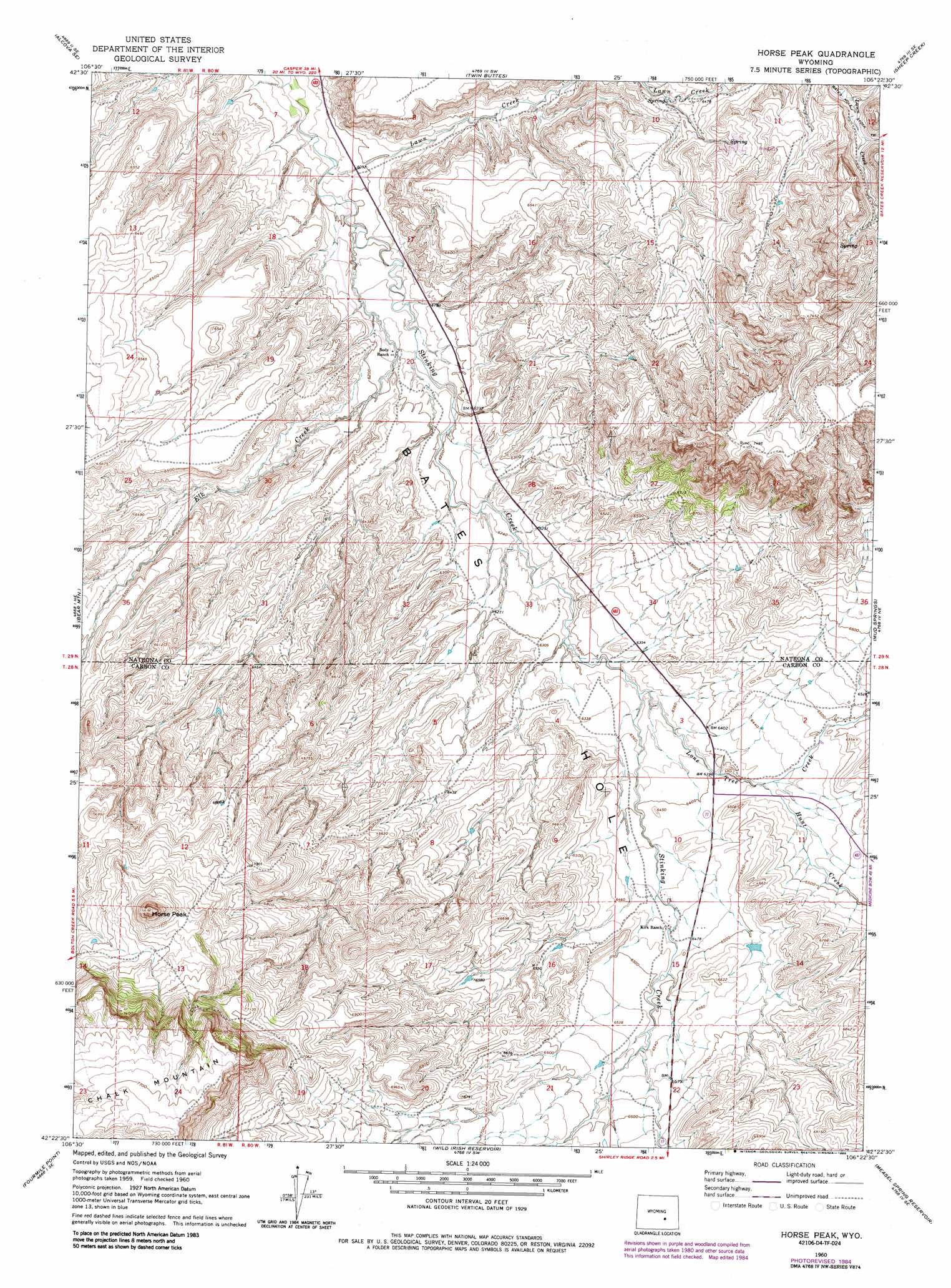
Horse Peak Topo Map Wyoming
To zoom in, hover over the map of Horse Peak
USGS Topo Quad 42106d4 - 1:24,000 scale
| Topo Map Name: | Horse Peak |
| USGS Topo Quad ID: | 42106d4 |
| Print Size: | ca. 21 1/4" wide x 27" high |
| Southeast Coordinates: | 42.375° N latitude / 106.375° W longitude |
| Map Center Coordinates: | 42.4375° N latitude / 106.4375° W longitude |
| U.S. State: | WY |
| Filename: | o42106d4.jpg |
| Download Map JPG Image: | Horse Peak topo map 1:24,000 scale |
| Map Type: | Topographic |
| Topo Series: | 7.5´ |
| Map Scale: | 1:24,000 |
| Source of Map Images: | United States Geological Survey (USGS) |
| Alternate Map Versions: |
Horse Peak WY 1960, updated 1964 Download PDF Buy paper map Horse Peak WY 1960, updated 1985 Download PDF Buy paper map Horse Peak WY 2012 Download PDF Buy paper map Horse Peak WY 2015 Download PDF Buy paper map |
1:24,000 Topo Quads surrounding Horse Peak
Clarkson Hill |
Bessemer Mountain |
Freeland |
Crimson Dawn |
Otter Creek |
Alcova |
Alcova Se |
Twin Buttes |
Sheep Creek |
Ice Cave Mountain |
Bear Spring |
Bear Mountain |
Horse Peak |
Mud Springs |
Bates Creek Reservoir |
Fourmile Ridge |
Fourmile Point |
Wild Irish Reservoir |
Measel Spring Reservoir |
Moss Agate Reservoir |
Beaver Creek |
The Q Ranch |
Pine Hill |
Cameron Creek |
Walker Draw Nw |
> Back to 42106a1 at 1:100,000 scale
> Back to 42106a1 at 1:250,000 scale
> Back to U.S. Topo Maps home
Horse Peak topo map: Gazetteer
Horse Peak: Dams
Froehner Dam elevation 2013m 6604′Sand Draw Number Two Dam elevation 2070m 6791′
Horse Peak: Reservoirs
Chalk Hill Reservoirs elevation 2071m 6794′Froehner Reservoir elevation 2013m 6604′
Sand Draw Number Two Reservoir elevation 2070m 6791′
Horse Peak: Streams
Elk Creek elevation 1860m 6102′Hunt Creek elevation 1958m 6423′
Lawn Creek elevation 1850m 6069′
Lone Tree Creek elevation 1927m 6322′
Horse Peak: Summits
Horse Peak elevation 2293m 7522′Horse Peak digital topo map on disk
Buy this Horse Peak topo map showing relief, roads, GPS coordinates and other geographical features, as a high-resolution digital map file on DVD:
Eastern Wyoming & Western South Dakota
Buy digital topo maps: Eastern Wyoming & Western South Dakota