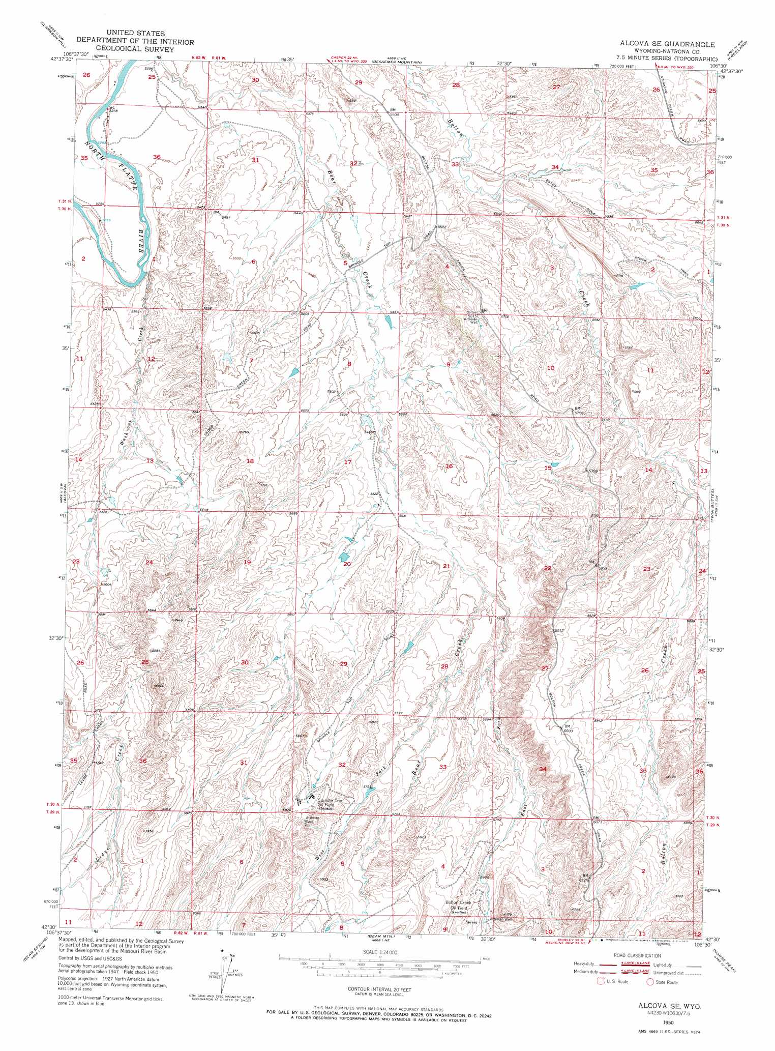
Alcova Se Topo Map Wyoming
To zoom in, hover over the map of Alcova Se
USGS Topo Quad 42106e5 - 1:24,000 scale
| Topo Map Name: | Alcova Se |
| USGS Topo Quad ID: | 42106e5 |
| Print Size: | ca. 21 1/4" wide x 27" high |
| Southeast Coordinates: | 42.5° N latitude / 106.5° W longitude |
| Map Center Coordinates: | 42.5625° N latitude / 106.5625° W longitude |
| U.S. State: | WY |
| Filename: | o42106e5.jpg |
| Download Map JPG Image: | Alcova Se topo map 1:24,000 scale |
| Map Type: | Topographic |
| Topo Series: | 7.5´ |
| Map Scale: | 1:24,000 |
| Source of Map Images: | United States Geological Survey (USGS) |
| Alternate Map Versions: |
Alcova SE WY 1950, updated 1971 Download PDF Buy paper map Alcova SE WY 2012 Download PDF Buy paper map Alcova SE WY 2015 Download PDF Buy paper map |
1:24,000 Topo Quads surrounding Alcova Se
Poison Spider |
Oil Mountain |
Emigrant Gap |
Goose Egg |
Casper |
Benton Basin Ne |
Clarkson Hill |
Bessemer Mountain |
Freeland |
Crimson Dawn |
Benton Basin |
Alcova |
Alcova Se |
Twin Buttes |
Sheep Creek |
Pathfinder Dam |
Bear Spring |
Bear Mountain |
Horse Peak |
Mud Springs |
Leo |
Fourmile Ridge |
Fourmile Point |
Wild Irish Reservoir |
Measel Spring Reservoir |
> Back to 42106e1 at 1:100,000 scale
> Back to 42106a1 at 1:250,000 scale
> Back to U.S. Topo Maps home
Alcova Se topo map: Gazetteer
Alcova Se: Oilfields
Bolton Creek Oil Field elevation 1800m 5905′Spindle Top Oil Field elevation 1812m 5944′
Alcova Se: Streams
East Fork Bear Creek elevation 1697m 5567′Wash-Out Creek elevation 1611m 5285′
West Fork Bear Creek elevation 1711m 5613′
Alcova Se: Trails
Bates Hole Stock Trail elevation 1736m 5695′Alcova Se digital topo map on disk
Buy this Alcova Se topo map showing relief, roads, GPS coordinates and other geographical features, as a high-resolution digital map file on DVD:
Eastern Wyoming & Western South Dakota
Buy digital topo maps: Eastern Wyoming & Western South Dakota