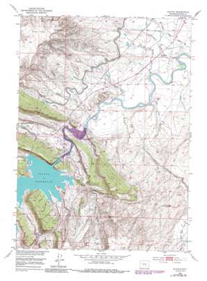
Alcova Topo Map Wyoming
To zoom in, hover over the map of Alcova
USGS Topo Quad 42106e6 - 1:24,000 scale
| Topo Map Name: | Alcova |
| USGS Topo Quad ID: | 42106e6 |
| Print Size: | ca. 21 1/4" wide x 27" high |
| Southeast Coordinates: | 42.5° N latitude / 106.625° W longitude |
| Map Center Coordinates: | 42.5625° N latitude / 106.6875° W longitude |
| U.S. State: | WY |
| Filename: | o42106e6.jpg |
| Download Map JPG Image: | Alcova topo map 1:24,000 scale |
| Map Type: | Topographic |
| Topo Series: | 7.5´ |
| Map Scale: | 1:24,000 |
| Source of Map Images: | United States Geological Survey (USGS) |
| Alternate Map Versions: |
Alcova WY 1950, updated 1985 Download PDF Buy paper map Alcova WY 2012 Download PDF Buy paper map Alcova WY 2015 Download PDF Buy paper map |
1:24,000 Topo Quads surrounding Alcova
> Back to 42106e1 at 1:100,000 scale
> Back to 42106a1 at 1:250,000 scale
> Back to U.S. Topo Maps home
Alcova topo map: Gazetteer
Alcova: Dams
Alcova Dam elevation 1673m 5488′Alcova Dam elevation 1651m 5416′
Gray Reef Dam elevation 1646m 5400′
H C Dam elevation 1659m 5442′
Rollins Dam elevation 1692m 5551′
Alcova: Flats
Schrader Flats elevation 1631m 5351′Alcova: Mines
Alcova Area Mine elevation 1658m 5439′Alcova: Populated Places
Alcova elevation 1637m 5370′Alcova Po elevation 1638m 5374′
Alcova: Reservoirs
Alcova Reservoir elevation 1669m 5475′Gray Reef Reservoir elevation 1646m 5400′
H C Reservoir elevation 1659m 5442′
Rollins Reservoir elevation 1692m 5551′
Alcova: Springs
Alcova Hot Springs elevation 1690m 5544′Alcova: Streams
Bear Spring Creek elevation 1703m 5587′Cottonwood Creek elevation 1679m 5508′
Eagle Creek elevation 1638m 5374′
Ledge Creek elevation 1616m 5301′
Alcova: Summits
Flat Top elevation 1953m 6407′Alcova: Tunnels
Tunnel Number 2 elevation 1773m 5816′Alcova: Valleys
Blue Gulch elevation 1629m 5344′Hogback Draw elevation 1626m 5334′
Lone Tree Gulch elevation 1616m 5301′
Mowry Draw elevation 1622m 5321′
Petes Draw elevation 1628m 5341′
S Gulch elevation 1616m 5301′
Schrader Gulch elevation 1611m 5285′
Alcova digital topo map on disk
Buy this Alcova topo map showing relief, roads, GPS coordinates and other geographical features, as a high-resolution digital map file on DVD:
Eastern Wyoming & Western South Dakota
Buy digital topo maps: Eastern Wyoming & Western South Dakota


