Otter Creek Topo Map Wyoming
To zoom in, hover over the map of Otter Creek
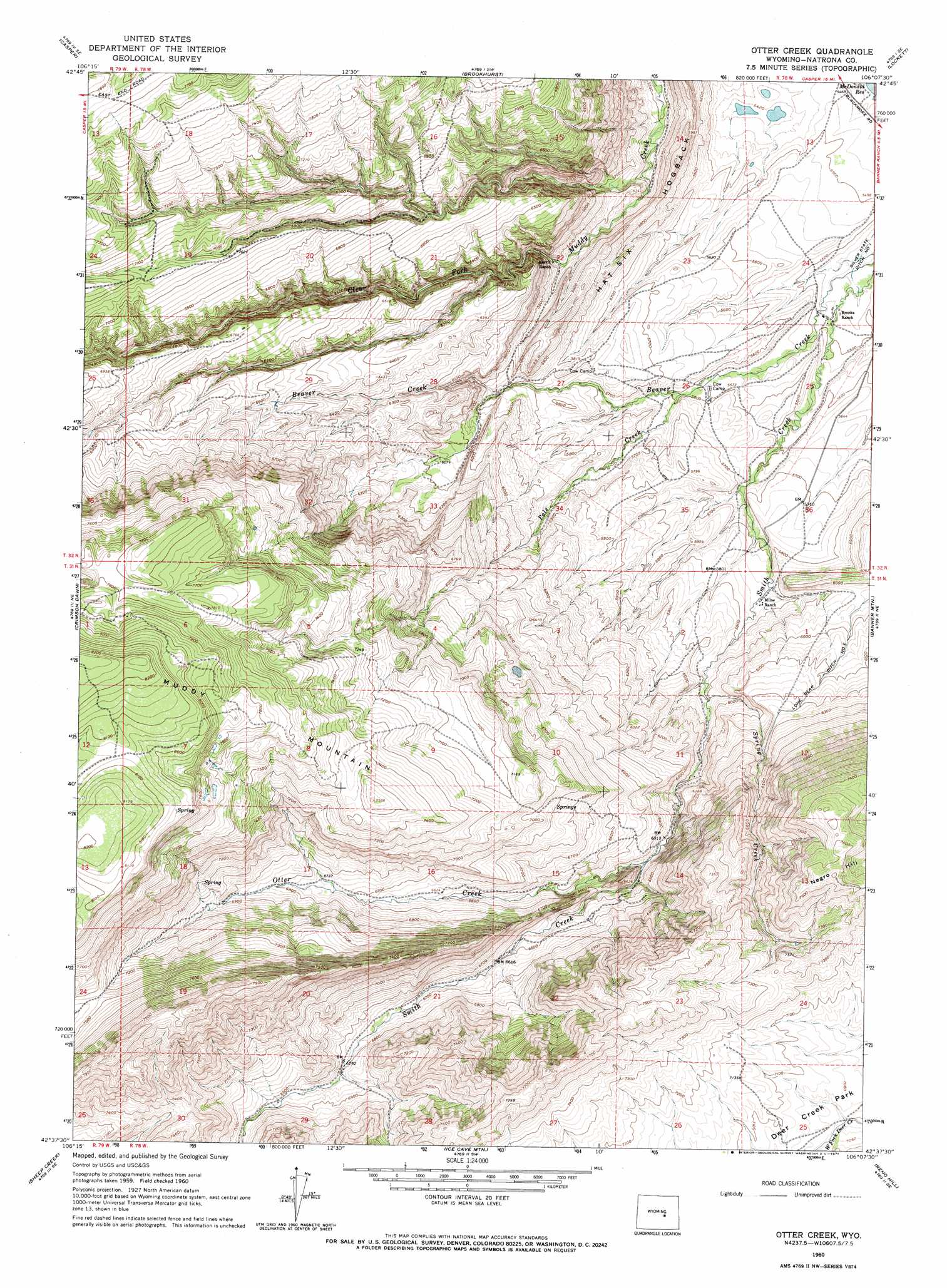
USGS Topo Quad 42106f2 - 1:24,000 scale
| Topo Map Name: | Otter Creek |
| USGS Topo Quad ID: | 42106f2 |
| Print Size: | ca. 21 1/4" wide x 27" high |
| Southeast Coordinates: | 42.625° N latitude / 106.125° W longitude |
| Map Center Coordinates: | 42.6875° N latitude / 106.1875° W longitude |
| U.S. State: | WY |
| Filename: | o42106f2.jpg |
| Download Map JPG Image: | Otter Creek topo map 1:24,000 scale |
| Map Type: | Topographic |
| Topo Series: | 7.5´ |
| Map Scale: | 1:24,000 |
| Source of Map Images: | United States Geological Survey (USGS) |
| Alternate Map Versions: |
Otter Creek WY 1960, updated 1965 Download PDF Buy paper map Otter Creek WY 1960, updated 1971 Download PDF Buy paper map Otter Creek WY 2012 Download PDF Buy paper map Otter Creek WY 2015 Download PDF Buy paper map |
1:24,000 Topo Quads surrounding Otter Creek
Bishop |
The Reefs |
Pratts Soda Lakes |
Campbell Hill |
Glenrock Nw |
Goose Egg |
Casper |
Brookhurst |
Lockett |
Parkerton |
Freeland |
Crimson Dawn |
Otter Creek |
Banner Mountain |
Protsmans Knob |
Twin Buttes |
Sheep Creek |
Ice Cave Mountain |
Reno Hill |
Buck Peak |
Horse Peak |
Mud Springs |
Bates Creek Reservoir |
Squaw Spring |
Rock Creek |
> Back to 42106e1 at 1:100,000 scale
> Back to 42106a1 at 1:250,000 scale
> Back to U.S. Topo Maps home
Otter Creek topo map: Gazetteer
Otter Creek: Canals
Lone Bear Ditch Number 2 elevation 1866m 6122′Otter Creek: Mines
Beaver Creek Mine elevation 1899m 6230′Green Hill Deposit elevation 2294m 7526′
Smith Creek Deposit elevation 2338m 7670′
Otter Creek: Ridges
Hat Six Hogback elevation 1783m 5849′Otter Creek: Streams
Otter Creek elevation 1933m 6341′Pole Creek elevation 1708m 5603′
Spring Creek elevation 1800m 5905′
Otter Creek: Summits
Muddy Mountain elevation 2521m 8270′Otter Creek digital topo map on disk
Buy this Otter Creek topo map showing relief, roads, GPS coordinates and other geographical features, as a high-resolution digital map file on DVD:
Eastern Wyoming & Western South Dakota
Buy digital topo maps: Eastern Wyoming & Western South Dakota