Bessemer Mountain Topo Map Wyoming
To zoom in, hover over the map of Bessemer Mountain
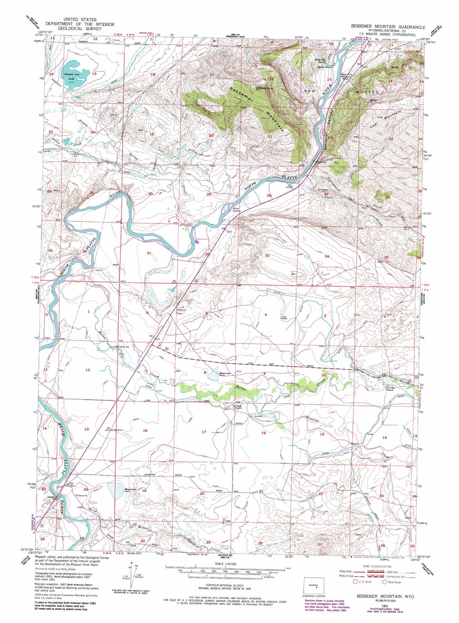
USGS Topo Quad 42106f5 - 1:24,000 scale
| Topo Map Name: | Bessemer Mountain |
| USGS Topo Quad ID: | 42106f5 |
| Print Size: | ca. 21 1/4" wide x 27" high |
| Southeast Coordinates: | 42.625° N latitude / 106.5° W longitude |
| Map Center Coordinates: | 42.6875° N latitude / 106.5625° W longitude |
| U.S. State: | WY |
| Filename: | o42106f5.jpg |
| Download Map JPG Image: | Bessemer Mountain topo map 1:24,000 scale |
| Map Type: | Topographic |
| Topo Series: | 7.5´ |
| Map Scale: | 1:24,000 |
| Source of Map Images: | United States Geological Survey (USGS) |
| Alternate Map Versions: |
Bessemer Mountain WY 1951, updated 1952 Download PDF Buy paper map Bessemer Mountain WY 1951, updated 1958 Download PDF Buy paper map Bessemer Mountain WY 1951, updated 1985 Download PDF Buy paper map Bessemer Mountain WY 2012 Download PDF Buy paper map Bessemer Mountain WY 2015 Download PDF Buy paper map |
1:24,000 Topo Quads surrounding Bessemer Mountain
Reid Canyon |
Emigrant Gap Nw |
Emigrant Gap Ne |
Bishop |
The Reefs |
Poison Spider |
Oil Mountain |
Emigrant Gap |
Goose Egg |
Casper |
Benton Basin Ne |
Clarkson Hill |
Bessemer Mountain |
Freeland |
Crimson Dawn |
Benton Basin |
Alcova |
Alcova Se |
Twin Buttes |
Sheep Creek |
Pathfinder Dam |
Bear Spring |
Bear Mountain |
Horse Peak |
Mud Springs |
> Back to 42106e1 at 1:100,000 scale
> Back to 42106a1 at 1:250,000 scale
> Back to U.S. Topo Maps home
Bessemer Mountain topo map: Gazetteer
Bessemer Mountain: Bridges
Government Bridge elevation 1604m 5262′Bessemer Mountain: Crossings
Winter Crossing elevation 1592m 5223′Bessemer Mountain: Dams
Haygood Dam elevation 1622m 5321′O'Brien Dam elevation 1649m 5410′
Bessemer Mountain: Lakes
Rasmus Lee Lake elevation 1645m 5396′Bessemer Mountain: Mines
Goose Egg Number Two Mine elevation 1593m 5226′Bessemer Mountain: Parks
Oregon Trail Historical Marker elevation 1610m 5282′Bessemer Mountain: Reservoirs
Haygood Reservoir elevation 1622m 5321′O'Brien Reservoir elevation 1649m 5410′
Bessemer Mountain: Springs
Goose Egg Spring elevation 1598m 5242′Bessemer Mountain: Streams
Bates Creek elevation 1598m 5242′Bear Creek elevation 1610m 5282′
Bolton Creek elevation 1604m 5262′
Coal Creek elevation 1586m 5203′
Cottonwood Creek elevation 1586m 5203′
Stinking Creek elevation 1641m 5383′
Willow Creek elevation 1635m 5364′
Bessemer Mountain: Summits
Bessemer Mountain elevation 1905m 6250′Red Buttes elevation 1832m 6010′
Bessemer Mountain: Valleys
Bessemer Narrows elevation 1582m 5190′Bessemer Mountain digital topo map on disk
Buy this Bessemer Mountain topo map showing relief, roads, GPS coordinates and other geographical features, as a high-resolution digital map file on DVD:
Eastern Wyoming & Western South Dakota
Buy digital topo maps: Eastern Wyoming & Western South Dakota