Benton Basin Ne Topo Map Wyoming
To zoom in, hover over the map of Benton Basin Ne
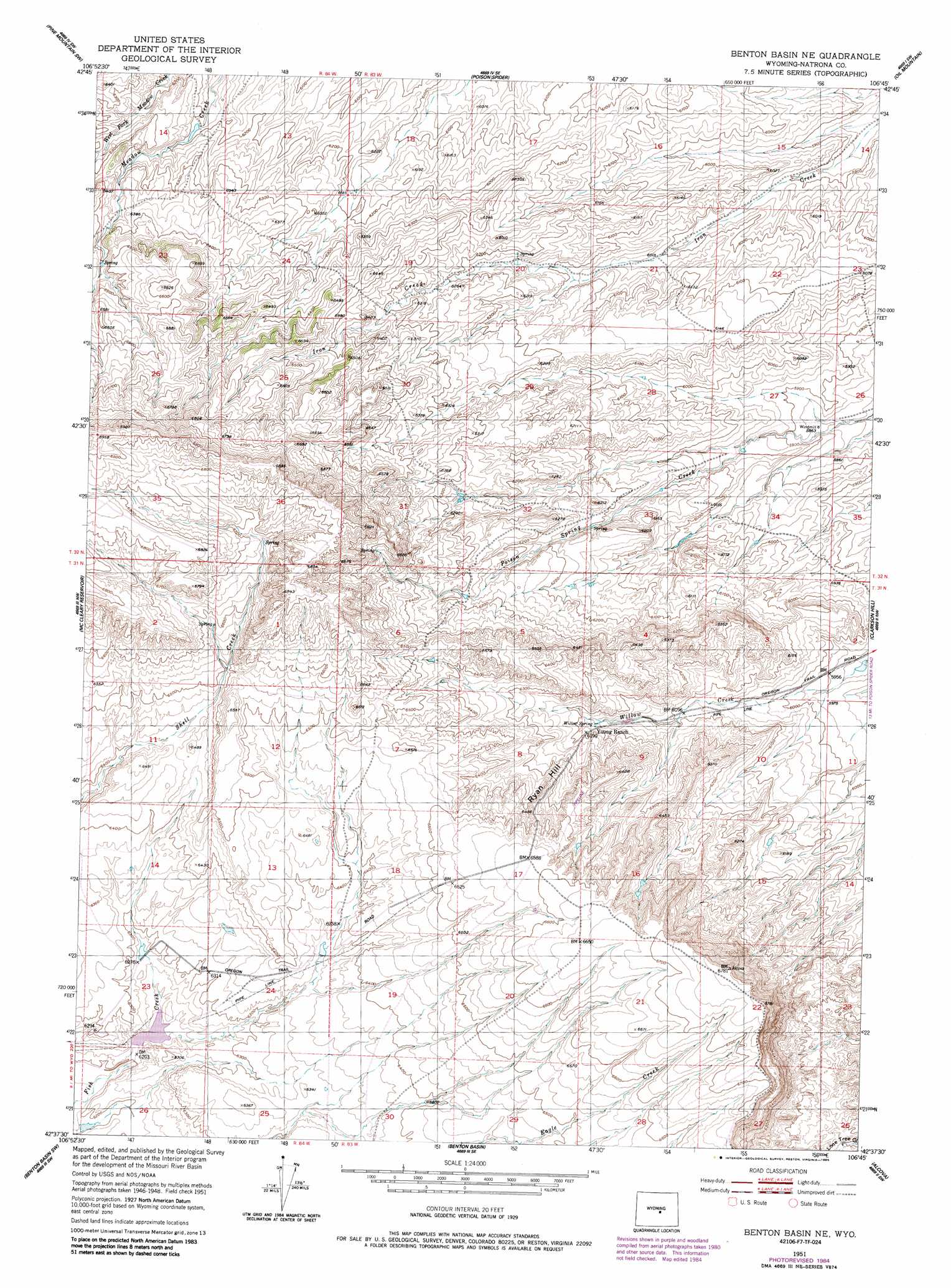
USGS Topo Quad 42106f7 - 1:24,000 scale
| Topo Map Name: | Benton Basin Ne |
| USGS Topo Quad ID: | 42106f7 |
| Print Size: | ca. 21 1/4" wide x 27" high |
| Southeast Coordinates: | 42.625° N latitude / 106.75° W longitude |
| Map Center Coordinates: | 42.6875° N latitude / 106.8125° W longitude |
| U.S. State: | WY |
| Filename: | o42106f7.jpg |
| Download Map JPG Image: | Benton Basin Ne topo map 1:24,000 scale |
| Map Type: | Topographic |
| Topo Series: | 7.5´ |
| Map Scale: | 1:24,000 |
| Source of Map Images: | United States Geological Survey (USGS) |
| Alternate Map Versions: |
Benton Basin NE WY 1951, updated 1953 Download PDF Buy paper map Benton Basin NE WY 1951, updated 1985 Download PDF Buy paper map Benton Basin NE WY 2012 Download PDF Buy paper map Benton Basin NE WY 2015 Download PDF Buy paper map |
1:24,000 Topo Quads surrounding Benton Basin Ne
Gaylord Reservoir |
Square Top Butte |
Reid Canyon |
Emigrant Gap Nw |
Emigrant Gap Ne |
Eightmile Draw |
Pine Mountain Sw |
Poison Spider |
Oil Mountain |
Emigrant Gap |
Horse Creek Springs |
Mccleary Reservoir |
Benton Basin Ne |
Clarkson Hill |
Bessemer Mountain |
Sanford Ranch |
Benton Basin Sw |
Benton Basin |
Alcova |
Alcova Se |
Fort Ridge |
Pathfinder Reservoir Nw |
Pathfinder Dam |
Bear Spring |
Bear Mountain |
> Back to 42106e1 at 1:100,000 scale
> Back to 42106a1 at 1:250,000 scale
> Back to U.S. Topo Maps home
Benton Basin Ne topo map: Gazetteer
Benton Basin Ne: Dams
Shell Creek Dam elevation 1886m 6187′Benton Basin Ne: Mines
Poison Creek Mine elevation 1811m 5941′Benton Basin Ne: Reservoirs
Shell Creek Reservoir elevation 1886m 6187′Benton Basin Ne: Slopes
Ryan Hill elevation 1947m 6387′Benton Basin Ne: Springs
Willow Spring elevation 1878m 6161′Benton Basin Ne digital topo map on disk
Buy this Benton Basin Ne topo map showing relief, roads, GPS coordinates and other geographical features, as a high-resolution digital map file on DVD:
Eastern Wyoming & Western South Dakota
Buy digital topo maps: Eastern Wyoming & Western South Dakota