Wild Horse Mountain Topo Map Wyoming
To zoom in, hover over the map of Wild Horse Mountain
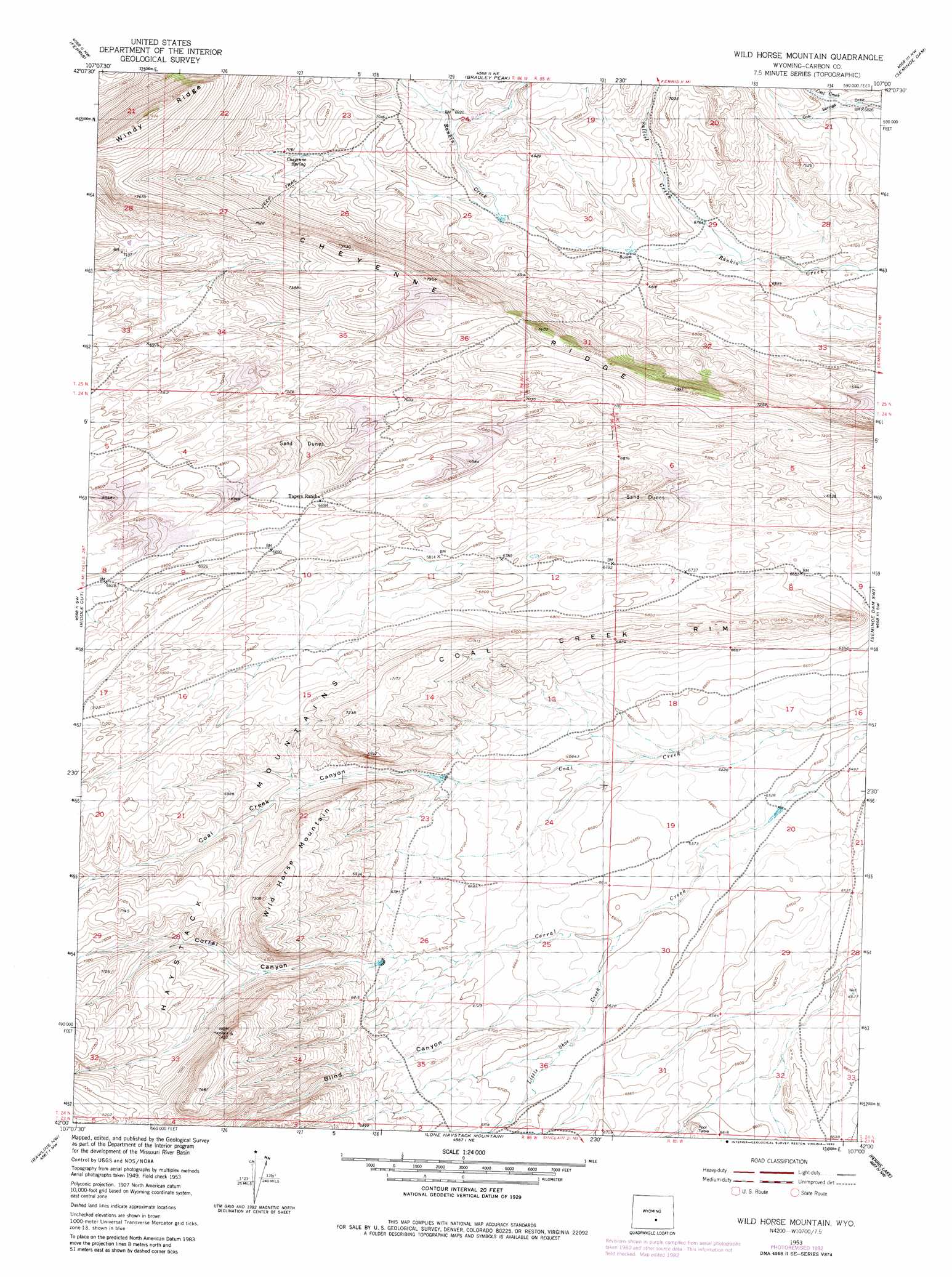
USGS Topo Quad 42107a1 - 1:24,000 scale
| Topo Map Name: | Wild Horse Mountain |
| USGS Topo Quad ID: | 42107a1 |
| Print Size: | ca. 21 1/4" wide x 27" high |
| Southeast Coordinates: | 42° N latitude / 107° W longitude |
| Map Center Coordinates: | 42.0625° N latitude / 107.0625° W longitude |
| U.S. State: | WY |
| Filename: | o42107a1.jpg |
| Download Map JPG Image: | Wild Horse Mountain topo map 1:24,000 scale |
| Map Type: | Topographic |
| Topo Series: | 7.5´ |
| Map Scale: | 1:24,000 |
| Source of Map Images: | United States Geological Survey (USGS) |
| Alternate Map Versions: |
Wild Horse Mountain WY 1953, updated 1955 Download PDF Buy paper map Wild Horse Mountain WY 1953, updated 1971 Download PDF Buy paper map Wild Horse Mountain WY 1953, updated 1983 Download PDF Buy paper map Wild Horse Mountain WY 2012 Download PDF Buy paper map Wild Horse Mountain WY 2015 Download PDF Buy paper map |
1:24,000 Topo Quads surrounding Wild Horse Mountain
Youngs Pass |
Spanish Mine |
Buzzard Ranch |
Pathfinder Reservoir Sw |
Leo |
Lamont Ne |
Ferris |
Bradley Peak |
Seminoe Dam |
Seminoe Dam Ne |
Boggy Meadows |
Riddle Cut |
Wild Horse Mountain |
Seminoe Dam Sw |
Seminoe Dam Se |
Rendle Hill |
Rawlins Nw |
Lone Haystack Mountain |
Ferris Lake |
Pats Bottom |
Rawlins Peak |
Rawlins |
Sinclair |
Fort Steele |
Walcott |
> Back to 42107a1 at 1:100,000 scale
> Back to 42106a1 at 1:250,000 scale
> Back to U.S. Topo Maps home
Wild Horse Mountain topo map: Gazetteer
Wild Horse Mountain: Cliffs
Coal Creek Rim elevation 2109m 6919′Wild Horse Mountain: Ridges
Cheyenne Ridge elevation 2267m 7437′Windy Ridge elevation 2411m 7910′
Wild Horse Mountain: Springs
Cheyenne Spring elevation 2141m 7024′Wild Horse Mountain: Streams
Bothwell Creek elevation 2104m 6902′Little Shoe Creek elevation 2009m 6591′
Saltiel Creek elevation 2049m 6722′
Wild Horse Mountain: Summits
Pool Table elevation 2036m 6679′Wild Horse Mountain elevation 2222m 7290′
Wild Horse Mountain: Valleys
Blind Canyon elevation 2022m 6633′Coal Creek Canyon elevation 2038m 6686′
Corral Canyon elevation 2060m 6758′
Wild Horse Mountain digital topo map on disk
Buy this Wild Horse Mountain topo map showing relief, roads, GPS coordinates and other geographical features, as a high-resolution digital map file on DVD:
Eastern Wyoming & Western South Dakota
Buy digital topo maps: Eastern Wyoming & Western South Dakota