Riddle Cut Topo Map Wyoming
To zoom in, hover over the map of Riddle Cut
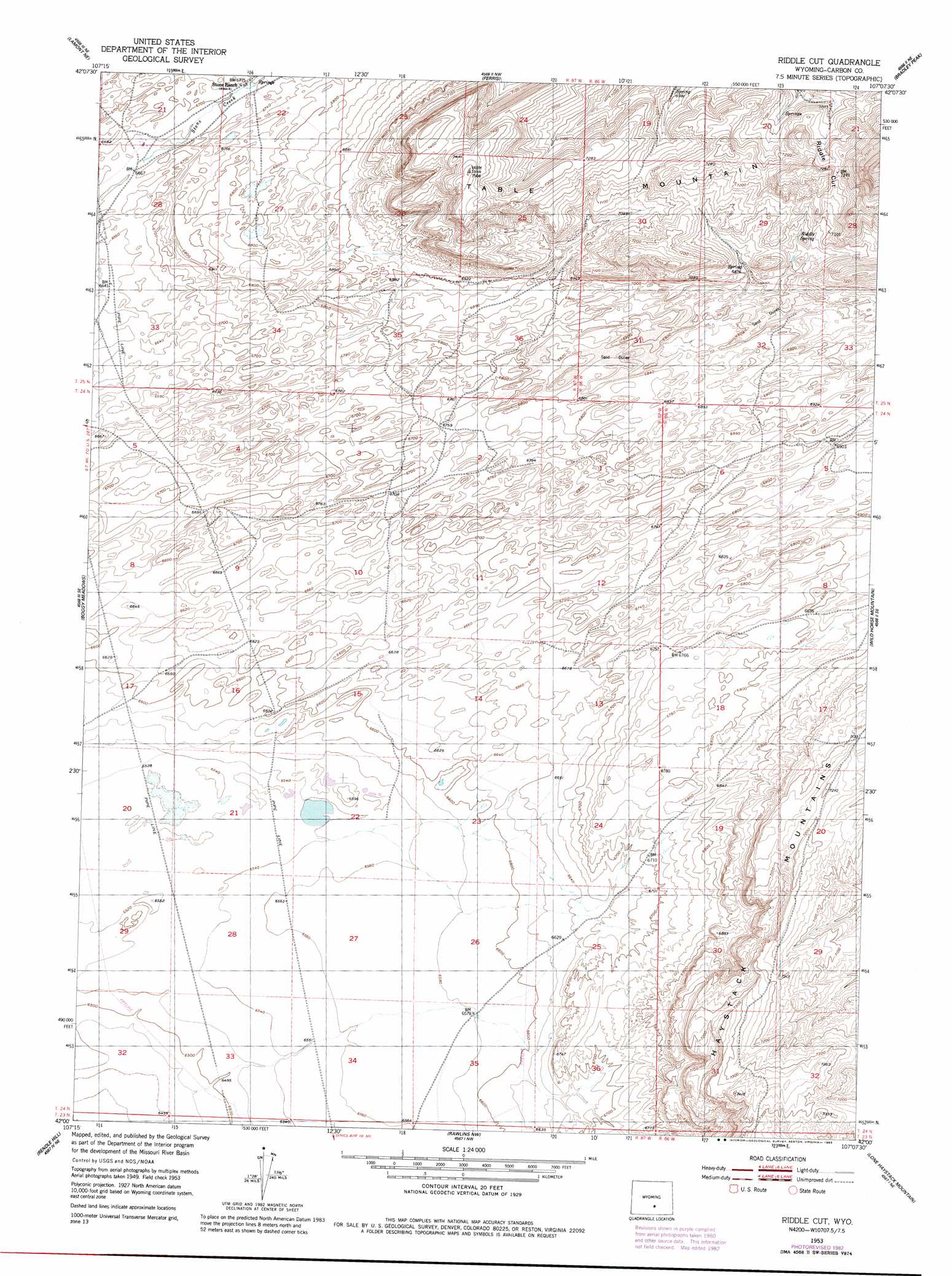
USGS Topo Quad 42107a2 - 1:24,000 scale
| Topo Map Name: | Riddle Cut |
| USGS Topo Quad ID: | 42107a2 |
| Print Size: | ca. 21 1/4" wide x 27" high |
| Southeast Coordinates: | 42° N latitude / 107.125° W longitude |
| Map Center Coordinates: | 42.0625° N latitude / 107.1875° W longitude |
| U.S. State: | WY |
| Filename: | o42107a2.jpg |
| Download Map JPG Image: | Riddle Cut topo map 1:24,000 scale |
| Map Type: | Topographic |
| Topo Series: | 7.5´ |
| Map Scale: | 1:24,000 |
| Source of Map Images: | United States Geological Survey (USGS) |
| Alternate Map Versions: |
Riddle Cut WY 1953, updated 1955 Download PDF Buy paper map Riddle Cut WY 1953, updated 1983 Download PDF Buy paper map Riddle Cut WY 2012 Download PDF Buy paper map Riddle Cut WY 2015 Download PDF Buy paper map |
1:24,000 Topo Quads surrounding Riddle Cut
Muddy Gap |
Youngs Pass |
Spanish Mine |
Buzzard Ranch |
Pathfinder Reservoir Sw |
Lamont |
Lamont Ne |
Ferris |
Bradley Peak |
Seminoe Dam |
Separation Rim |
Boggy Meadows |
Riddle Cut |
Wild Horse Mountain |
Seminoe Dam Sw |
Shamrock Hills |
Rendle Hill |
Rawlins Nw |
Lone Haystack Mountain |
Ferris Lake |
Rawlins Peak Sw |
Rawlins Peak |
Rawlins |
Sinclair |
Fort Steele |
> Back to 42107a1 at 1:100,000 scale
> Back to 42106a1 at 1:250,000 scale
> Back to U.S. Topo Maps home
Riddle Cut topo map: Gazetteer
Riddle Cut: Gaps
Riddle Cut elevation 2217m 7273′Riddle Cut: Springs
Riddle Spring elevation 2152m 7060′Riddle Cut: Summits
Table Mountain elevation 2280m 7480′Riddle Cut digital topo map on disk
Buy this Riddle Cut topo map showing relief, roads, GPS coordinates and other geographical features, as a high-resolution digital map file on DVD:
Eastern Wyoming & Western South Dakota
Buy digital topo maps: Eastern Wyoming & Western South Dakota