Ferris Topo Map Wyoming
To zoom in, hover over the map of Ferris
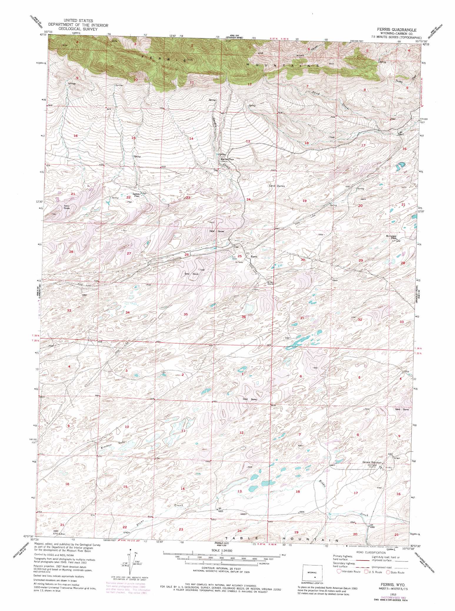
USGS Topo Quad 42107b2 - 1:24,000 scale
| Topo Map Name: | Ferris |
| USGS Topo Quad ID: | 42107b2 |
| Print Size: | ca. 21 1/4" wide x 27" high |
| Southeast Coordinates: | 42.125° N latitude / 107.125° W longitude |
| Map Center Coordinates: | 42.1875° N latitude / 107.1875° W longitude |
| U.S. State: | WY |
| Filename: | o42107b2.jpg |
| Download Map JPG Image: | Ferris topo map 1:24,000 scale |
| Map Type: | Topographic |
| Topo Series: | 7.5´ |
| Map Scale: | 1:24,000 |
| Source of Map Images: | United States Geological Survey (USGS) |
| Alternate Map Versions: |
Ferris WY 1953, updated 1955 Download PDF Buy paper map Ferris WY 1953, updated 1955 Download PDF Buy paper map Ferris WY 1953, updated 1958 Download PDF Buy paper map Ferris WY 1953, updated 1983 Download PDF Buy paper map Ferris WY 2012 Download PDF Buy paper map Ferris WY 2015 Download PDF Buy paper map |
1:24,000 Topo Quads surrounding Ferris
Bucklin Reservoirs |
Savage Peak |
Independence Rock |
Fort Ridge |
Pathfinder Reservoir Nw |
Muddy Gap |
Youngs Pass |
Spanish Mine |
Buzzard Ranch |
Pathfinder Reservoir Sw |
Lamont |
Lamont Ne |
Ferris |
Bradley Peak |
Seminoe Dam |
Separation Rim |
Boggy Meadows |
Riddle Cut |
Wild Horse Mountain |
Seminoe Dam Sw |
Shamrock Hills |
Rendle Hill |
Rawlins Nw |
Lone Haystack Mountain |
Ferris Lake |
> Back to 42107a1 at 1:100,000 scale
> Back to 42106a1 at 1:250,000 scale
> Back to U.S. Topo Maps home
Ferris topo map: Gazetteer
Ferris: Lakes
Rinshaw Lake elevation 2062m 6765′Ferris: Oilfields
General Petroleum Oil Field elevation 2136m 7007′Ferris: Populated Places
Ferris (historical) elevation 2121m 6958′Marvin Place (historical) elevation 2216m 7270′
McCargar Place elevation 2046m 6712′
Ferris: Streams
Garden Creek elevation 2145m 7037′Riddle Creek elevation 2073m 6801′
Ferris digital topo map on disk
Buy this Ferris topo map showing relief, roads, GPS coordinates and other geographical features, as a high-resolution digital map file on DVD:
Eastern Wyoming & Western South Dakota
Buy digital topo maps: Eastern Wyoming & Western South Dakota