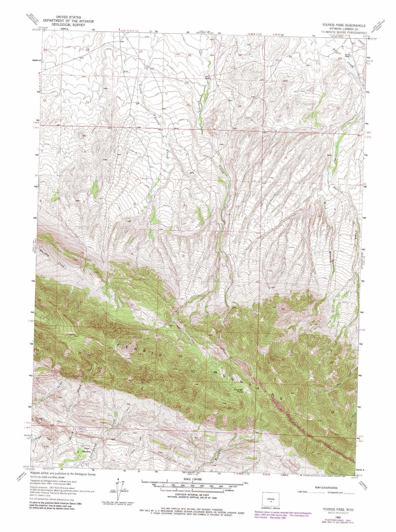
Youngs Pass Topo Map Wyoming
To zoom in, hover over the map of Youngs Pass
USGS Topo Quad 42107c3 - 1:24,000 scale
| Topo Map Name: | Youngs Pass |
| USGS Topo Quad ID: | 42107c3 |
| Print Size: | ca. 21 1/4" wide x 27" high |
| Southeast Coordinates: | 42.25° N latitude / 107.25° W longitude |
| Map Center Coordinates: | 42.3125° N latitude / 107.3125° W longitude |
| U.S. State: | WY |
| Filename: | o42107c3.jpg |
| Download Map JPG Image: | Youngs Pass topo map 1:24,000 scale |
| Map Type: | Topographic |
| Topo Series: | 7.5´ |
| Map Scale: | 1:24,000 |
| Source of Map Images: | United States Geological Survey (USGS) |
| Alternate Map Versions: |
Youngs Pass WY 1962, updated 1964 Download PDF Buy paper map Youngs Pass WY 1962, updated 1982 Download PDF Buy paper map Youngs Pass WY 2012 Download PDF Buy paper map Youngs Pass WY 2015 Download PDF Buy paper map |
1:24,000 Topo Quads surrounding Youngs Pass
Lankin Dome |
Lone Mountain |
Miller Spring |
Beulah Belle Lake |
Sanford Ranch |
Split Rock |
Bucklin Reservoirs |
Savage Peak |
Independence Rock |
Fort Ridge |
Whiskey Peak |
Muddy Gap |
Youngs Pass |
Spanish Mine |
Buzzard Ranch |
Bairoil |
Lamont |
Lamont Ne |
Ferris |
Bradley Peak |
Bull Spring |
Separation Rim |
Boggy Meadows |
Riddle Cut |
Wild Horse Mountain |
> Back to 42107a1 at 1:100,000 scale
> Back to 42106a1 at 1:250,000 scale
> Back to U.S. Topo Maps home
Youngs Pass topo map: Gazetteer
Youngs Pass: Flats
Hays Meadow elevation 2180m 7152′Youngs Pass: Gaps
Youngs Pass elevation 2666m 8746′Youngs Pass: Mines
Babbs Mine elevation 2699m 8854′Cherry Creek Prospect elevation 2494m 8182′
Youngs Pass: Streams
West Branch Pete Creek elevation 2000m 6561′Youngs Pass digital topo map on disk
Buy this Youngs Pass topo map showing relief, roads, GPS coordinates and other geographical features, as a high-resolution digital map file on DVD:
Eastern Wyoming & Western South Dakota
Buy digital topo maps: Eastern Wyoming & Western South Dakota