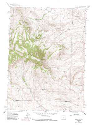
Whiskey Peak Topo Map Wyoming
To zoom in, hover over the map of Whiskey Peak
USGS Topo Quad 42107c5 - 1:24,000 scale
| Topo Map Name: | Whiskey Peak |
| USGS Topo Quad ID: | 42107c5 |
| Print Size: | ca. 21 1/4" wide x 27" high |
| Southeast Coordinates: | 42.25° N latitude / 107.5° W longitude |
| Map Center Coordinates: | 42.3125° N latitude / 107.5625° W longitude |
| U.S. State: | WY |
| Filename: | o42107c5.jpg |
| Download Map JPG Image: | Whiskey Peak topo map 1:24,000 scale |
| Map Type: | Topographic |
| Topo Series: | 7.5´ |
| Map Scale: | 1:24,000 |
| Source of Map Images: | United States Geological Survey (USGS) |
| Alternate Map Versions: |
Whiskey Peak WY 1962, updated 1964 Download PDF Buy paper map Whiskey Peak WY 1962, updated 1985 Download PDF Buy paper map Whiskey Peak WY 2012 Download PDF Buy paper map Whiskey Peak WY 2015 Download PDF Buy paper map |
1:24,000 Topo Quads surrounding Whiskey Peak
> Back to 42107a1 at 1:100,000 scale
> Back to 42106a1 at 1:250,000 scale
> Back to U.S. Topo Maps home
Whiskey Peak topo map: Gazetteer
Whiskey Peak: Dams
Grieves Dam elevation 2056m 6745′Whiskey Peak: Mines
Bebe Claims elevation 2231m 7319′Coors Claims elevation 2440m 8005′
County Line Claims elevation 2060m 6758′
GR Claims elevation 2241m 7352′
Lucky Thirteen Mine elevation 2177m 7142′
Muddy Gap Mine elevation 2019m 6624′
Whiskey Peak: Ranges
Red Hills elevation 2023m 6637′Whiskey Peak: Reservoirs
Camp Creek Reservoir elevation 2249m 7378′Grieves Reservoir elevation 2056m 6745′
Whiskey Peak: Streams
Rabbit Creek elevation 2214m 7263′Whiskey Peak: Summits
Camp Creek Hill elevation 2183m 7162′Green Mountain elevation 2807m 9209′
Whiskey Peak digital topo map on disk
Buy this Whiskey Peak topo map showing relief, roads, GPS coordinates and other geographical features, as a high-resolution digital map file on DVD:
Eastern Wyoming & Western South Dakota
Buy digital topo maps: Eastern Wyoming & Western South Dakota


