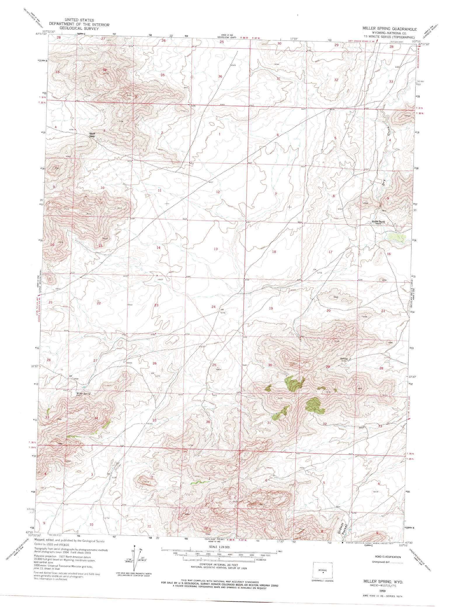
Miller Spring Topo Map Wyoming
To zoom in, hover over the map of Miller Spring
USGS Topo Quad 42107e3 - 1:24,000 scale
| Topo Map Name: | Miller Spring |
| USGS Topo Quad ID: | 42107e3 |
| Print Size: | ca. 21 1/4" wide x 27" high |
| Southeast Coordinates: | 42.5° N latitude / 107.25° W longitude |
| Map Center Coordinates: | 42.5625° N latitude / 107.3125° W longitude |
| U.S. State: | WY |
| Filename: | o42107e3.jpg |
| Download Map JPG Image: | Miller Spring topo map 1:24,000 scale |
| Map Type: | Topographic |
| Topo Series: | 7.5´ |
| Map Scale: | 1:24,000 |
| Source of Map Images: | United States Geological Survey (USGS) |
| Alternate Map Versions: |
Miller Spring WY 1959, updated 1961 Download PDF Buy paper map Miller Spring WY 1959, updated 1977 Download PDF Buy paper map Miller Spring WY 2012 Download PDF Buy paper map Miller Spring WY 2015 Download PDF Buy paper map |
1:24,000 Topo Quads surrounding Miller Spring
Gas Hills |
Ervay Basin Sw |
Garfield Peak |
Stinking Water Creek |
Eightmile Draw |
Mcintosh Meadows |
Blackjack Ranch |
Barlow Gap |
Saddle Rock |
Horse Creek Springs |
Lankin Dome |
Lone Mountain |
Miller Spring |
Beulah Belle Lake |
Sanford Ranch |
Split Rock |
Bucklin Reservoirs |
Savage Peak |
Independence Rock |
Fort Ridge |
Whiskey Peak |
Muddy Gap |
Youngs Pass |
Spanish Mine |
Buzzard Ranch |
> Back to 42107e1 at 1:100,000 scale
> Back to 42106a1 at 1:250,000 scale
> Back to U.S. Topo Maps home
Miller Spring topo map: Gazetteer
Miller Spring: Basins
Ordway Pocket elevation 1981m 6499′Miller Spring: Gaps
Wolf Gap elevation 2084m 6837′Miller Spring: Mines
Vermiculite Sales Corporation Deposit Number One elevation 1918m 6292′Miller Spring: Springs
Miller Spring elevation 1977m 6486′Miller Spring digital topo map on disk
Buy this Miller Spring topo map showing relief, roads, GPS coordinates and other geographical features, as a high-resolution digital map file on DVD:
Eastern Wyoming & Western South Dakota
Buy digital topo maps: Eastern Wyoming & Western South Dakota