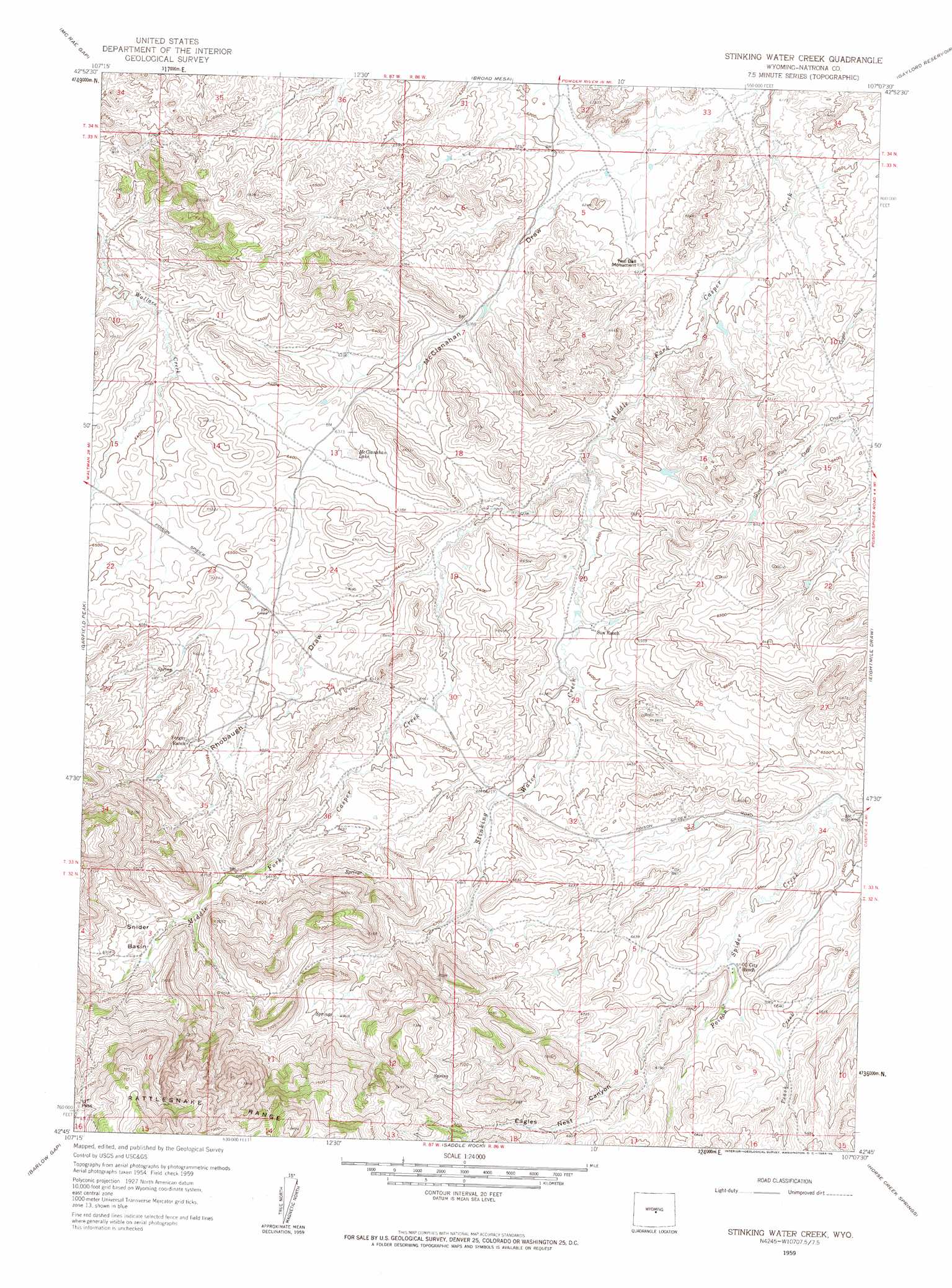
Stinking Water Creek Topo Map Wyoming
To zoom in, hover over the map of Stinking Water Creek
USGS Topo Quad 42107g2 - 1:24,000 scale
| Topo Map Name: | Stinking Water Creek |
| USGS Topo Quad ID: | 42107g2 |
| Print Size: | ca. 21 1/4" wide x 27" high |
| Southeast Coordinates: | 42.75° N latitude / 107.125° W longitude |
| Map Center Coordinates: | 42.8125° N latitude / 107.1875° W longitude |
| U.S. State: | WY |
| Filename: | o42107g2.jpg |
| Download Map JPG Image: | Stinking Water Creek topo map 1:24,000 scale |
| Map Type: | Topographic |
| Topo Series: | 7.5´ |
| Map Scale: | 1:24,000 |
| Source of Map Images: | United States Geological Survey (USGS) |
| Alternate Map Versions: |
Stinking Water Creek WY 1959, updated 1961 Download PDF Buy paper map Stinking Water Creek WY 1959, updated 1964 Download PDF Buy paper map Stinking Water Creek WY 2012 Download PDF Buy paper map Stinking Water Creek WY 2015 Download PDF Buy paper map |
1:24,000 Topo Quads surrounding Stinking Water Creek
Arminto Sw |
Hiland |
Waltman |
Hells Half Acre |
Powder River |
Ervay Basin |
Mcrae Gap |
Broad Mesa |
Gaylord Reservoir |
Square Top Butte |
Ervay Basin Sw |
Garfield Peak |
Stinking Water Creek |
Eightmile Draw |
Pine Mountain Sw |
Blackjack Ranch |
Barlow Gap |
Saddle Rock |
Horse Creek Springs |
Mccleary Reservoir |
Lone Mountain |
Miller Spring |
Beulah Belle Lake |
Sanford Ranch |
Benton Basin Sw |
> Back to 42107e1 at 1:100,000 scale
> Back to 42106a1 at 1:250,000 scale
> Back to U.S. Topo Maps home
Stinking Water Creek topo map: Gazetteer
Stinking Water Creek: Basins
Snider Basin elevation 2086m 6843′Stinking Water Creek: Lakes
McClanahan Lake elevation 1940m 6364′Stinking Water Creek: Pillars
Neil Bell Monument elevation 1900m 6233′Stinking Water Creek: Streams
Stinking Water Creek elevation 1905m 6250′Stinking Water Creek: Valleys
Eagles Nest Canyon elevation 2006m 6581′Rhobaugh Draw elevation 1933m 6341′
Stinking Water Creek digital topo map on disk
Buy this Stinking Water Creek topo map showing relief, roads, GPS coordinates and other geographical features, as a high-resolution digital map file on DVD:
Eastern Wyoming & Western South Dakota
Buy digital topo maps: Eastern Wyoming & Western South Dakota