Gaylord Reservoir Topo Map Wyoming
To zoom in, hover over the map of Gaylord Reservoir
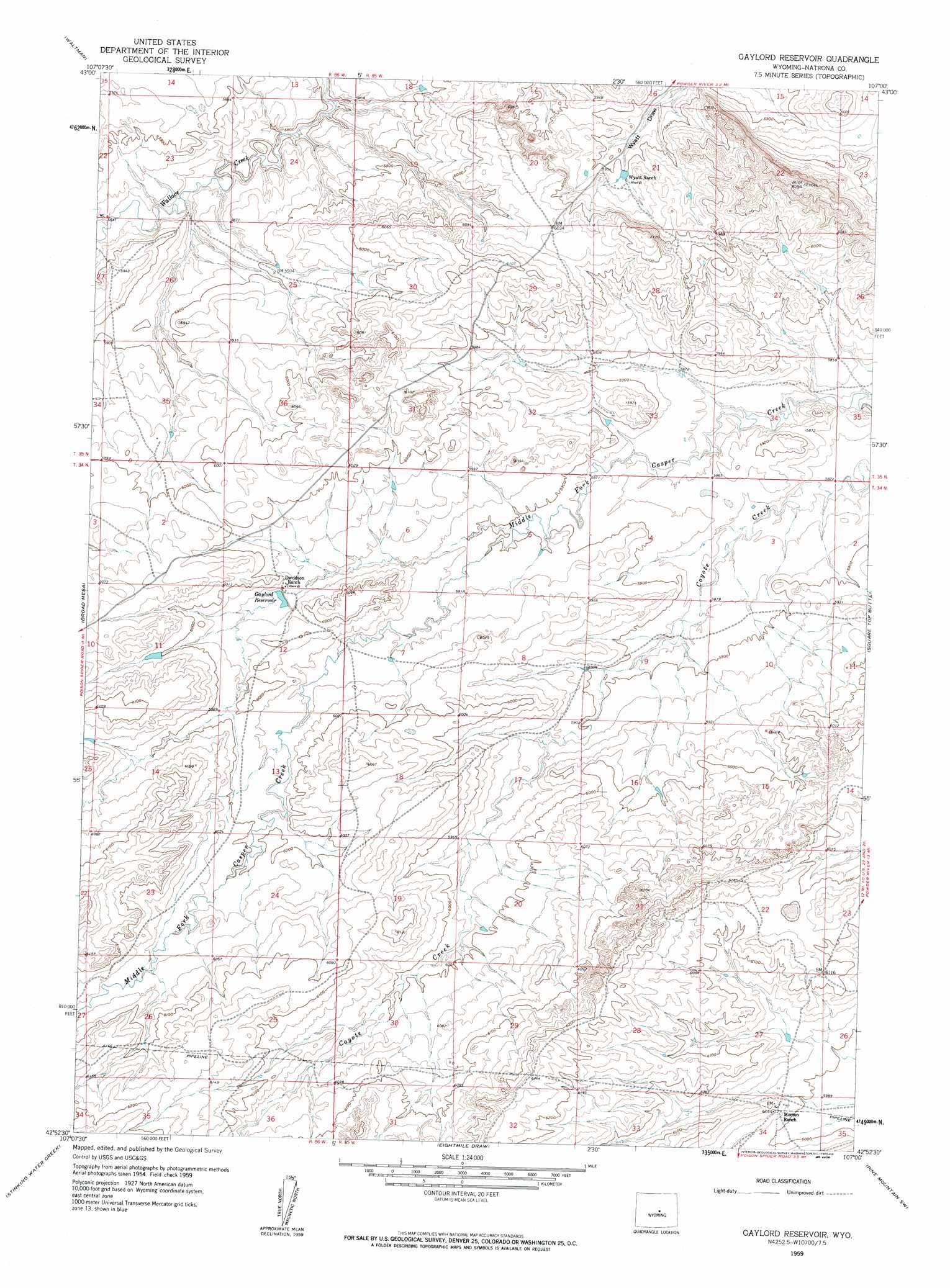
USGS Topo Quad 42107h1 - 1:24,000 scale
| Topo Map Name: | Gaylord Reservoir |
| USGS Topo Quad ID: | 42107h1 |
| Print Size: | ca. 21 1/4" wide x 27" high |
| Southeast Coordinates: | 42.875° N latitude / 107° W longitude |
| Map Center Coordinates: | 42.9375° N latitude / 107.0625° W longitude |
| U.S. State: | WY |
| Filename: | o42107h1.jpg |
| Download Map JPG Image: | Gaylord Reservoir topo map 1:24,000 scale |
| Map Type: | Topographic |
| Topo Series: | 7.5´ |
| Map Scale: | 1:24,000 |
| Source of Map Images: | United States Geological Survey (USGS) |
| Alternate Map Versions: |
Gaylord Reservoir WY 1959, updated 1960 Download PDF Buy paper map Gaylord Reservoir WY 1959, updated 1979 Download PDF Buy paper map Gaylord Reservoir WY 2012 Download PDF Buy paper map Gaylord Reservoir WY 2015 Download PDF Buy paper map |
1:24,000 Topo Quads surrounding Gaylord Reservoir
Arminto |
Waltman Nw |
Notches Dome |
Cave Gulch Reservoir |
Anderson Draw |
Hiland |
Waltman |
Hells Half Acre |
Powder River |
Natrona |
Mcrae Gap |
Broad Mesa |
Gaylord Reservoir |
Square Top Butte |
Reid Canyon |
Garfield Peak |
Stinking Water Creek |
Eightmile Draw |
Pine Mountain Sw |
Poison Spider |
Barlow Gap |
Saddle Rock |
Horse Creek Springs |
Mccleary Reservoir |
Benton Basin Ne |
> Back to 42107e1 at 1:100,000 scale
> Back to 42106a1 at 1:250,000 scale
> Back to U.S. Topo Maps home
Gaylord Reservoir topo map: Gazetteer
Gaylord Reservoir: Dams
Davidson Dam elevation 1823m 5980′Gaylord Reservoir: Reservoirs
Davidson Reservoir elevation 1823m 5980′Gaylord Reservoir elevation 1818m 5964′
Gaylord Reservoir digital topo map on disk
Buy this Gaylord Reservoir topo map showing relief, roads, GPS coordinates and other geographical features, as a high-resolution digital map file on DVD:
Eastern Wyoming & Western South Dakota
Buy digital topo maps: Eastern Wyoming & Western South Dakota