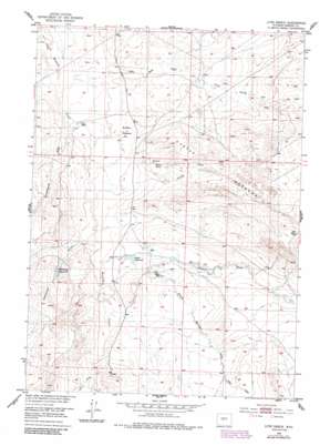
Love Ranch Topo Map Wyoming
To zoom in, hover over the map of Love Ranch
USGS Topo Quad 42107h6 - 1:24,000 scale
| Topo Map Name: | Love Ranch |
| USGS Topo Quad ID: | 42107h6 |
| Print Size: | ca. 21 1/4" wide x 27" high |
| Southeast Coordinates: | 42.875° N latitude / 107.625° W longitude |
| Map Center Coordinates: | 42.9375° N latitude / 107.6875° W longitude |
| U.S. State: | WY |
| Filename: | o42107h6.jpg |
| Download Map JPG Image: | Love Ranch topo map 1:24,000 scale |
| Map Type: | Topographic |
| Topo Series: | 7.5´ |
| Map Scale: | 1:24,000 |
| Source of Map Images: | United States Geological Survey (USGS) |
| Alternate Map Versions: |
Love Ranch WY 1952, updated 1953 Download PDF Buy paper map Love Ranch WY 1952, updated 1985 Download PDF Buy paper map Love Ranch WY 2012 Download PDF Buy paper map Love Ranch WY 2015 Download PDF Buy paper map |
1:24,000 Topo Quads surrounding Love Ranch
> Back to 42107e1 at 1:100,000 scale
> Back to 42106a1 at 1:250,000 scale
> Back to U.S. Topo Maps home
Love Ranch topo map: Gazetteer
Love Ranch: Basins
Buffalo Wallows elevation 1744m 5721′Love Ranch: Dams
Love Dam elevation 1724m 5656′Love Ranch: Ranges
Castle Gardens elevation 1801m 5908′Love Ranch: Reservoirs
Fraser Reservoir elevation 1770m 5807′Love Reservoir elevation 1724m 5656′
Mahoney Reservoir elevation 1764m 5787′
Love Ranch: Valleys
Corral Draw elevation 1738m 5702′Fish Draw elevation 1719m 5639′
Fraser Draw elevation 1763m 5784′
Jumping-off Draw elevation 1725m 5659′
Mahoney Draw elevation 1744m 5721′
Ohio Draw elevation 1788m 5866′
Puddle Springs Draw elevation 1793m 5882′
Reid Draw elevation 1817m 5961′
Willow Springs Draw elevation 1774m 5820′
Love Ranch digital topo map on disk
Buy this Love Ranch topo map showing relief, roads, GPS coordinates and other geographical features, as a high-resolution digital map file on DVD:
Eastern Wyoming & Western South Dakota
Buy digital topo maps: Eastern Wyoming & Western South Dakota


