The Pinnacles Topo Map Wyoming
To zoom in, hover over the map of The Pinnacles
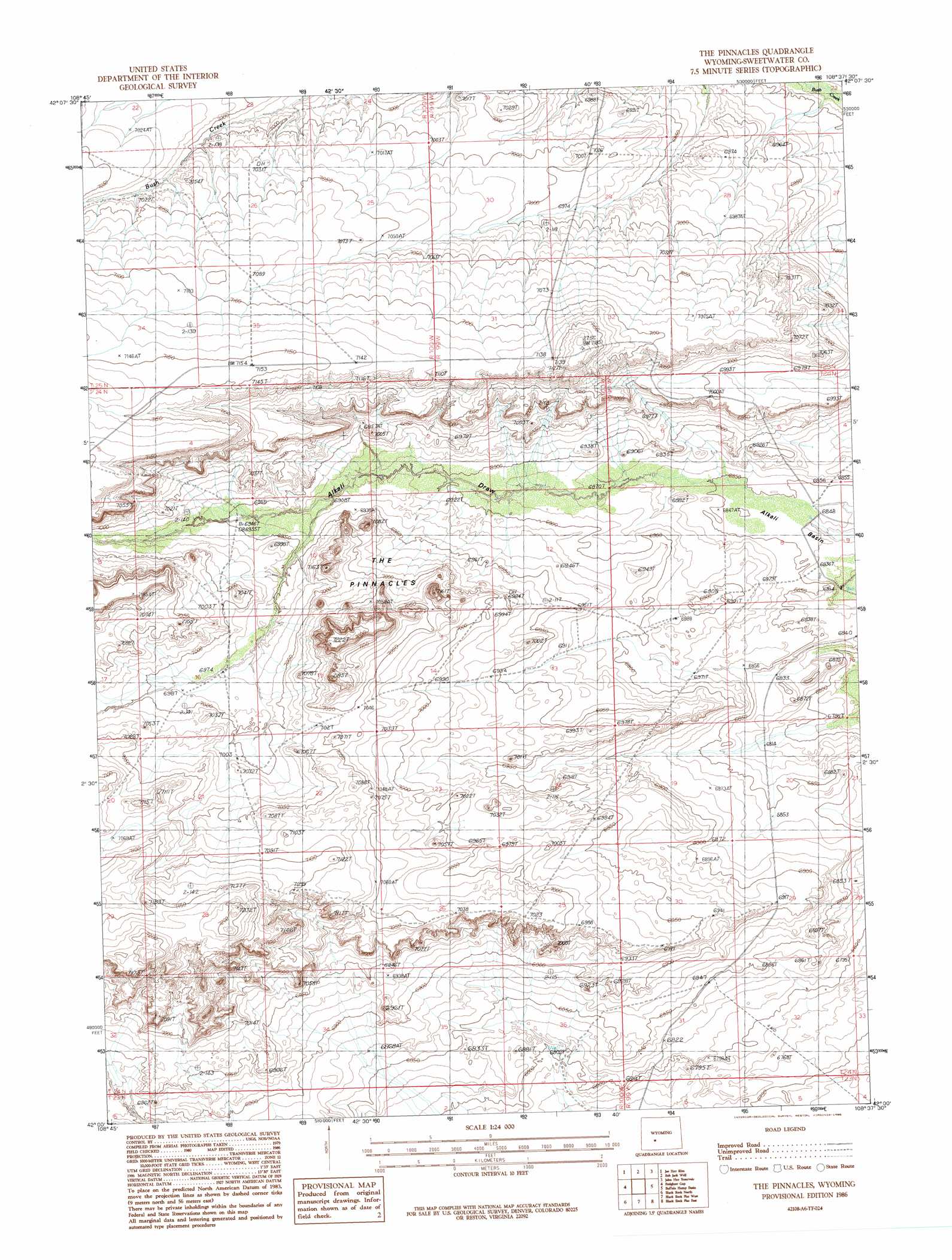
USGS Topo Quad 42108a6 - 1:24,000 scale
| Topo Map Name: | The Pinnacles |
| USGS Topo Quad ID: | 42108a6 |
| Print Size: | ca. 21 1/4" wide x 27" high |
| Southeast Coordinates: | 42° N latitude / 108.625° W longitude |
| Map Center Coordinates: | 42.0625° N latitude / 108.6875° W longitude |
| U.S. State: | WY |
| Filename: | o42108a6.jpg |
| Download Map JPG Image: | The Pinnacles topo map 1:24,000 scale |
| Map Type: | Topographic |
| Topo Series: | 7.5´ |
| Map Scale: | 1:24,000 |
| Source of Map Images: | United States Geological Survey (USGS) |
| Alternate Map Versions: |
The Pinnacles WY 1986, updated 1986 Download PDF Buy paper map The Pinnacles WY 2012 Download PDF Buy paper map The Pinnacles WY 2015 Download PDF Buy paper map |
1:24,000 Topo Quads surrounding The Pinnacles
Pacific Springs |
Dickie Springs |
Continental Peak |
Circle Bar Lake |
Picket Lake |
Rock Cabin Spring |
Joe Hay Rim |
Bob Jack Well |
John Hay Reservoir |
Five Fingers Butte |
Monument Ridge |
Freighter Gap |
The Pinnacles |
Buffalo Hump Basin |
Luman Rim |
Steamboat Mountain |
Black Rock North |
Black Rock Flat West |
Black Rock Flat East |
Red Lake |
South Superior |
Black Rock South |
Tenmile Rim |
Twelvemile Well |
Red Lake Sw |
> Back to 42108a1 at 1:100,000 scale
> Back to 42108a1 at 1:250,000 scale
> Back to U.S. Topo Maps home
The Pinnacles topo map: Gazetteer
The Pinnacles: Dams
Rambaud Number 1 Dam elevation 2083m 6833′The Pinnacles: Pillars
The Pinnacles elevation 2142m 7027′The Pinnacles: Reservoirs
Rambaud Number 1 Reservoir elevation 2083m 6833′The Pinnacles digital topo map on disk
Buy this The Pinnacles topo map showing relief, roads, GPS coordinates and other geographical features, as a high-resolution digital map file on DVD: