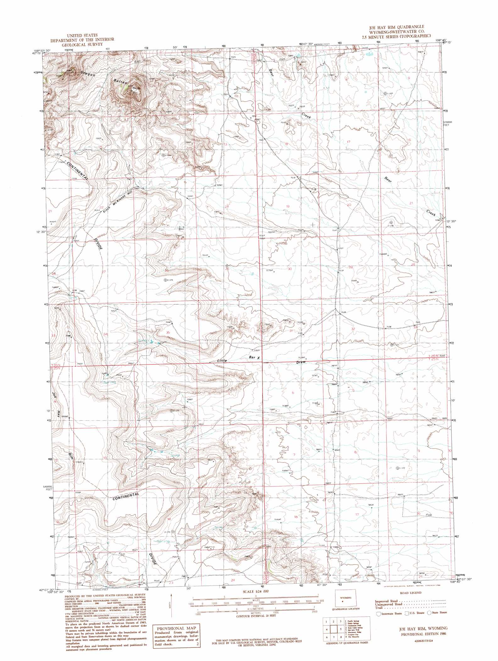
Joe Hay Rim Topo Map Wyoming
To zoom in, hover over the map of Joe Hay Rim
USGS Topo Quad 42108b7 - 1:24,000 scale
| Topo Map Name: | Joe Hay Rim |
| USGS Topo Quad ID: | 42108b7 |
| Print Size: | ca. 21 1/4" wide x 27" high |
| Southeast Coordinates: | 42.125° N latitude / 108.75° W longitude |
| Map Center Coordinates: | 42.1875° N latitude / 108.8125° W longitude |
| U.S. State: | WY |
| Filename: | o42108b7.jpg |
| Download Map JPG Image: | Joe Hay Rim topo map 1:24,000 scale |
| Map Type: | Topographic |
| Topo Series: | 7.5´ |
| Map Scale: | 1:24,000 |
| Source of Map Images: | United States Geological Survey (USGS) |
| Alternate Map Versions: |
Joe Hay Rim WY 1986, updated 1986 Download PDF Buy paper map Joe Hay Rim WY 2012 Download PDF Buy paper map Joe Hay Rim WY 2015 Download PDF Buy paper map |
1:24,000 Topo Quads surrounding Joe Hay Rim
Halls Meadow Spring |
Anderson Ridge |
South Pass City |
Atlantic City |
Radium Springs |
Hay Meadow Reservoir |
Pacific Springs |
Dickie Springs |
Continental Peak |
Circle Bar Lake |
North Packsaddle Canyon |
Rock Cabin Spring |
Joe Hay Rim |
Bob Jack Well |
John Hay Reservoir |
Essex Mountain |
Monument Ridge |
Freighter Gap |
The Pinnacles |
Buffalo Hump Basin |
North Table Mountain |
Steamboat Mountain |
Black Rock North |
Black Rock Flat West |
Black Rock Flat East |
> Back to 42108a1 at 1:100,000 scale
> Back to 42108a1 at 1:250,000 scale
> Back to U.S. Topo Maps home
Joe Hay Rim digital topo map on disk
Buy this Joe Hay Rim topo map showing relief, roads, GPS coordinates and other geographical features, as a high-resolution digital map file on DVD: