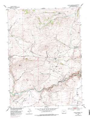
Radium Springs Topo Map Wyoming
To zoom in, hover over the map of Radium Springs
USGS Topo Quad 42108d5 - 1:24,000 scale
| Topo Map Name: | Radium Springs |
| USGS Topo Quad ID: | 42108d5 |
| Print Size: | ca. 21 1/4" wide x 27" high |
| Southeast Coordinates: | 42.375° N latitude / 108.5° W longitude |
| Map Center Coordinates: | 42.4375° N latitude / 108.5625° W longitude |
| U.S. State: | WY |
| Filename: | o42108d5.jpg |
| Download Map JPG Image: | Radium Springs topo map 1:24,000 scale |
| Map Type: | Topographic |
| Topo Series: | 7.5´ |
| Map Scale: | 1:24,000 |
| Source of Map Images: | United States Geological Survey (USGS) |
| Alternate Map Versions: |
Radium Springs WY 1953, updated 1954 Download PDF Buy paper map Radium Springs WY 1953, updated 1970 Download PDF Buy paper map Radium Springs WY 1953, updated 1979 Download PDF Buy paper map Radium Springs WY 2012 Download PDF Buy paper map Radium Springs WY 2015 Download PDF Buy paper map |
1:24,000 Topo Quads surrounding Radium Springs
> Back to 42108a1 at 1:100,000 scale
> Back to 42108a1 at 1:250,000 scale
> Back to U.S. Topo Maps home
Radium Springs topo map: Gazetteer
Radium Springs: Basins
Crows Nest elevation 2335m 7660′Radium Springs: Canals
Harris Ditch elevation 2207m 7240′Radium Springs: Mines
Amanda Mine elevation 2218m 7276′Big Nugget Claim elevation 2283m 7490′
Bullion Mine elevation 2226m 7303′
Burr Mine elevation 2240m 7349′
Hidden Hand Mine elevation 2262m 7421′
Iron Duke Mine elevation 2218m 7276′
Lewiston Area Mine elevation 2266m 7434′
Maxwell Claim elevation 2216m 7270′
Metterling Prospect elevation 2216m 7270′
Radium Springs: Ridges
Antelope Hills elevation 2284m 7493′Radium Springs: Springs
Chicken Springs elevation 2285m 7496′Radium Springs elevation 2244m 7362′
Radium Springs: Streams
Deep Creek elevation 2206m 7237′Harris Slough elevation 2202m 7224′
Long Slough elevation 2202m 7224′
Rock Creek elevation 2205m 7234′
Radium Springs: Valleys
Buffalo Gulch elevation 2196m 7204′Burr Gulch elevation 2191m 7188′
Giblin Gulch elevation 2237m 7339′
Jones Gulch elevation 2313m 7588′
Lame Jack Gulch elevation 2221m 7286′
Wilson Gulch elevation 2233m 7326′
Radium Springs digital topo map on disk
Buy this Radium Springs topo map showing relief, roads, GPS coordinates and other geographical features, as a high-resolution digital map file on DVD:


