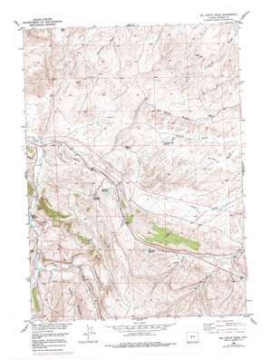
Del Monte Ridge Topo Map Wyoming
To zoom in, hover over the map of Del Monte Ridge
USGS Topo Quad 42108f4 - 1:24,000 scale
| Topo Map Name: | Del Monte Ridge |
| USGS Topo Quad ID: | 42108f4 |
| Print Size: | ca. 21 1/4" wide x 27" high |
| Southeast Coordinates: | 42.625° N latitude / 108.375° W longitude |
| Map Center Coordinates: | 42.6875° N latitude / 108.4375° W longitude |
| U.S. State: | WY |
| Filename: | o42108f4.jpg |
| Download Map JPG Image: | Del Monte Ridge topo map 1:24,000 scale |
| Map Type: | Topographic |
| Topo Series: | 7.5´ |
| Map Scale: | 1:24,000 |
| Source of Map Images: | United States Geological Survey (USGS) |
| Alternate Map Versions: |
Del Monte Ridge WY 1953, updated 1955 Download PDF Buy paper map Del Monte Ridge WY 1958, updated 1960 Download PDF Buy paper map Del Monte Ridge WY 1958, updated 1979 Download PDF Buy paper map Del Monte Ridge WY 2012 Download PDF Buy paper map Del Monte Ridge WY 2015 Download PDF Buy paper map |
1:24,000 Topo Quads surrounding Del Monte Ridge
> Back to 42108e1 at 1:100,000 scale
> Back to 42108a1 at 1:250,000 scale
> Back to U.S. Topo Maps home
Del Monte Ridge topo map: Gazetteer
Del Monte Ridge: Mines
Cinch Claim Number Fourteen Mine elevation 1973m 6473′Noble Ranch Mine elevation 1791m 5875′
Del Monte Ridge: Reservoirs
Del Monte Draw Reservoir elevation 1721m 5646′Dobe Reservoir elevation 1751m 5744′
Rock Draw Reservoir elevation 1849m 6066′
Sandstone Reservoir elevation 1832m 6010′
Sevenmile Reservoir elevation 1818m 5964′
Del Monte Ridge: Ridges
Del Monte Ridge elevation 1783m 5849′Del Monte Ridge: Streams
Dry Twin Creek elevation 1744m 5721′North Fork Hall Creek elevation 1750m 5741′
Red Bluff Creek elevation 1808m 5931′
South Fork Hall Creek elevation 1750m 5741′
Del Monte Ridge digital topo map on disk
Buy this Del Monte Ridge topo map showing relief, roads, GPS coordinates and other geographical features, as a high-resolution digital map file on DVD:


