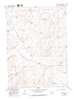
Ninemile Hill Topo Map Wyoming
To zoom in, hover over the map of Ninemile Hill
USGS Topo Quad 42108g4 - 1:24,000 scale
| Topo Map Name: | Ninemile Hill |
| USGS Topo Quad ID: | 42108g4 |
| Print Size: | ca. 21 1/4" wide x 27" high |
| Southeast Coordinates: | 42.75° N latitude / 108.375° W longitude |
| Map Center Coordinates: | 42.8125° N latitude / 108.4375° W longitude |
| U.S. State: | WY |
| Filename: | o42108g4.jpg |
| Download Map JPG Image: | Ninemile Hill topo map 1:24,000 scale |
| Map Type: | Topographic |
| Topo Series: | 7.5´ |
| Map Scale: | 1:24,000 |
| Source of Map Images: | United States Geological Survey (USGS) |
| Alternate Map Versions: |
Ninemile Hill WY 1953, updated 1954 Download PDF Buy paper map Ninemile Hill WY 1958, updated 1960 Download PDF Buy paper map Ninemile Hill WY 1958, updated 1979 Download PDF Buy paper map Ninemile Hill WY 2012 Download PDF Buy paper map Ninemile Hill WY 2015 Download PDF Buy paper map |
1:24,000 Topo Quads surrounding Ninemile Hill
> Back to 42108e1 at 1:100,000 scale
> Back to 42108a1 at 1:250,000 scale
> Back to U.S. Topo Maps home
Ninemile Hill topo map: Gazetteer
Ninemile Hill: Lakes
Red Lake elevation 1763m 5784′Ninemile Hill: Reservoirs
Charlies Reservoir elevation 1742m 5715′Chugwater Reservoir elevation 1720m 5643′
Cottontail Reservoir elevation 1739m 5705′
Deep Pit Reservoir elevation 1799m 5902′
Gustin Reservoir elevation 1678m 5505′
Happy Spring Creek elevation 1689m 5541′
Haynes Reservoir elevation 1672m 5485′
Hopkins Reservoir elevation 1693m 5554′
Lander Valley Reservoir elevation 1665m 5462′
Ninemile Reservoir elevation 1701m 5580′
Rate Reservoir elevation 1684m 5524′
Ninemile Hill: Summits
Ninemile Hill elevation 1812m 5944′Ninemile Hill: Valleys
Haynes Draw elevation 1634m 5360′Ninemile Hill digital topo map on disk
Buy this Ninemile Hill topo map showing relief, roads, GPS coordinates and other geographical features, as a high-resolution digital map file on DVD:


